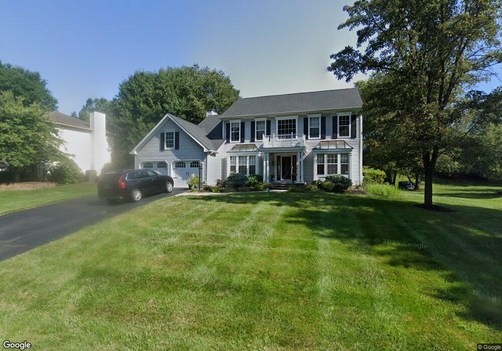
49 Balmoral Dr Chadds Ford, PA 19317
Estimated Value: $775,000 - $848,000
4
Beds
3
Baths
2,868
Sq Ft
$282/Sq Ft
Est. Value
About This Home
This home is located at 49 Balmoral Dr, Chadds Ford, PA 19317 and is currently estimated at $809,865, approximately $282 per square foot. 49 Balmoral Dr is a home located in Chester County with nearby schools including Kennett Middle School, Kennett High School, and Centreville Layton School.
Ownership History
Date
Name
Owned For
Owner Type
Purchase Details
Closed on
Jul 31, 2003
Sold by
Patel Ajay and Patel Snehal A
Bought by
Tsaoussis Panagiotis and Papachristos Jean
Current Estimated Value
Home Financials for this Owner
Home Financials are based on the most recent Mortgage that was taken out on this home.
Original Mortgage
$274,400
Outstanding Balance
$106,434
Interest Rate
3.99%
Mortgage Type
Purchase Money Mortgage
Estimated Equity
$703,431
Purchase Details
Closed on
Apr 5, 1994
Sold by
Ryland Group Inc
Bought by
Patel Ajay and Patel Snehal A
Home Financials for this Owner
Home Financials are based on the most recent Mortgage that was taken out on this home.
Original Mortgage
$182,000
Interest Rate
7.6%
Create a Home Valuation Report for This Property
The Home Valuation Report is an in-depth analysis detailing your home's value as well as a comparison with similar homes in the area
Home Values in the Area
Average Home Value in this Area
Purchase History
| Date | Buyer | Sale Price | Title Company |
|---|---|---|---|
| Tsaoussis Panagiotis | $343,000 | -- | |
| Patel Ajay | $228,210 | Commonwealth Land Title Ins |
Source: Public Records
Mortgage History
| Date | Status | Borrower | Loan Amount |
|---|---|---|---|
| Open | Tsaoussis Panagiotis | $274,400 | |
| Previous Owner | Patel Ajay | $182,000 |
Source: Public Records
Tax History Compared to Growth
Tax History
| Year | Tax Paid | Tax Assessment Tax Assessment Total Assessment is a certain percentage of the fair market value that is determined by local assessors to be the total taxable value of land and additions on the property. | Land | Improvement |
|---|---|---|---|---|
| 2025 | $9,280 | $227,560 | $57,010 | $170,550 |
| 2024 | $9,280 | $227,560 | $57,010 | $170,550 |
| 2023 | $9,099 | $227,560 | $57,010 | $170,550 |
| 2022 | $8,857 | $227,560 | $57,010 | $170,550 |
| 2021 | $8,724 | $227,560 | $57,010 | $170,550 |
| 2020 | $8,561 | $227,560 | $57,010 | $170,550 |
| 2019 | $8,446 | $227,560 | $57,010 | $170,550 |
| 2018 | $8,271 | $227,560 | $57,010 | $170,550 |
| 2017 | $7,694 | $227,560 | $57,010 | $170,550 |
| 2016 | $902 | $227,560 | $57,010 | $170,550 |
| 2015 | $902 | $227,560 | $57,010 | $170,550 |
| 2014 | $902 | $227,560 | $57,010 | $170,550 |
Source: Public Records
Map
Nearby Homes
- 102 Alford Ct
- 336 Edinburgh Rd Unit 89
- 239 S Fairville Rd
- 504 Kennett Pike
- 1540 Fairville Rd
- 101 Burnt Mill Cir
- 101 Burnt Mill Cir Unit 1A
- 101 Burnt Mill Cir Unit 1B
- 821 Burrows Run Rd
- 110 Hannah Ln
- 6410 Kennett Pike
- 1392 Hickory Hill Rd
- 997 Sills Mill Rd
- 993 Sills Mill Rd
- 470 E Hillendale Rd
- 800 Fairville Rd
- 417 Burnt Mill Rd
- 103 Haywood Rd
- 204 Sandy Flash Dr
- 22 Mount Airy Dr