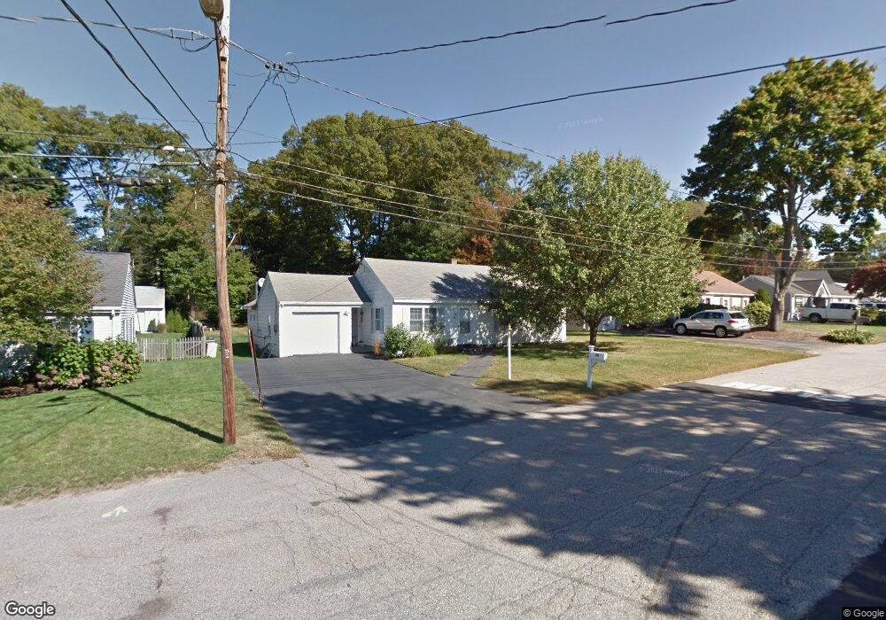
49 Birchcroft Rd Canton, MA 02021
Estimated Value: $592,000 - $653,000
3
Beds
1
Bath
1,315
Sq Ft
$475/Sq Ft
Est. Value
About This Home
This home is located at 49 Birchcroft Rd, Canton, MA 02021 and is currently estimated at $624,345, approximately $474 per square foot. 49 Birchcroft Rd is a home located in Norfolk County with nearby schools including Canton High School, St. John the Evangelist School, and Beacon Scholastic Academy.
Ownership History
Date
Name
Owned For
Owner Type
Purchase Details
Closed on
Aug 7, 2000
Sold by
Stellberger Charles
Bought by
Christopoulos D and Christopoulos Vicki
Current Estimated Value
Home Financials for this Owner
Home Financials are based on the most recent Mortgage that was taken out on this home.
Original Mortgage
$197,900
Outstanding Balance
$65,134
Interest Rate
8.1%
Mortgage Type
Purchase Money Mortgage
Estimated Equity
$559,211
Create a Home Valuation Report for This Property
The Home Valuation Report is an in-depth analysis detailing your home's value as well as a comparison with similar homes in the area
Home Values in the Area
Average Home Value in this Area
Purchase History
| Date | Buyer | Sale Price | Title Company |
|---|---|---|---|
| Christopoulos D | $219,900 | -- |
Source: Public Records
Mortgage History
| Date | Status | Borrower | Loan Amount |
|---|---|---|---|
| Open | Christopoulos D | $197,900 |
Source: Public Records
Tax History
| Year | Tax Paid | Tax Assessment Tax Assessment Total Assessment is a certain percentage of the fair market value that is determined by local assessors to be the total taxable value of land and additions on the property. | Land | Improvement |
|---|---|---|---|---|
| 2025 | $5,325 | $538,400 | $356,900 | $181,500 |
| 2024 | $5,162 | $517,800 | $343,200 | $174,600 |
| 2023 | $5,222 | $494,000 | $343,200 | $150,800 |
| 2022 | $5,176 | $456,000 | $326,900 | $129,100 |
| 2021 | $5,046 | $413,600 | $297,100 | $116,500 |
| 2020 | $4,865 | $397,800 | $283,000 | $114,800 |
| 2019 | $4,536 | $365,800 | $257,200 | $108,600 |
| 2018 | $4,413 | $355,300 | $247,300 | $108,000 |
| 2017 | $4,456 | $348,400 | $242,500 | $105,900 |
| 2016 | $4,391 | $343,300 | $236,600 | $106,700 |
| 2015 | $4,261 | $332,400 | $229,700 | $102,700 |
Source: Public Records
Map
Nearby Homes
- 42 Oakdale Rd
- 22 Oakdale Rd
- 74 Cedarcrest Rd
- 78 Cedarcrest Rd
- 102 Spring Ln
- 15 Draper St
- 33 Algonquin Rd
- 9 Evergreen Cir
- 49 Algonquin Rd
- 22 Lewis St
- 26 Pequit St
- 59 Endicott St Unit 59
- 865 Washington St Unit 6
- 6 Audubon Way Unit 6
- 20 Audubon Way Unit 307
- 20 Audubon Way Unit 205
- 20 Audubon Way Unit 302
- 20 Audubon Way Unit 109
- 20 Audubon Way Unit 410
- 20 Audubon Way Unit 408
- 51 Birchcroft Rd
- 47 Birchcroft Rd
- 53 Birchcroft Rd
- 45 Birchcroft Rd
- 160 Dedham St
- 158 Dedham St
- 55 Birchcroft Rd
- 43 Birchcroft Rd
- 2 Ashdale Rd
- 48 Birchcroft Rd
- 46 Birchcroft Rd
- 3 Ashdale Rd
- 152 Dedham St
- 41 Birchcroft Rd
- 10 Maplecroft Rd
- 44 Birchcroft Rd
- 58 Birchcroft Rd
- 7 Ashdale Rd
- 162 Dedham St
- 156 Dedham St Unit 156
Your Personal Tour Guide
Ask me questions while you tour the home.