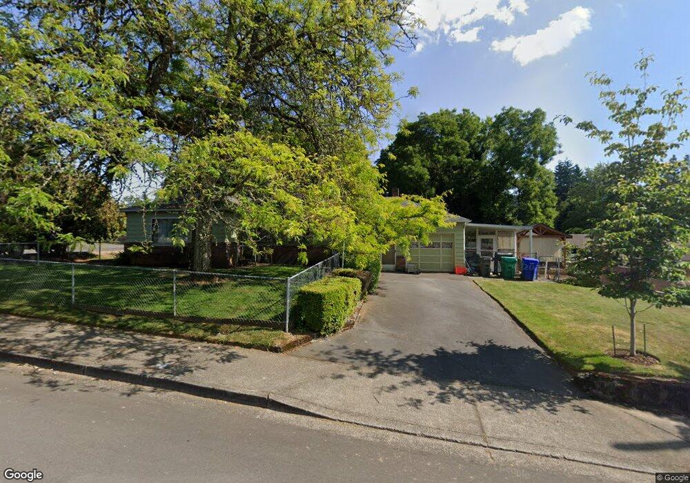
490 SE 2nd St Gresham, OR 97080
Historic Southeast NeighborhoodEstimated Value: $387,000 - $390,000
2
Beds
1
Bath
1,183
Sq Ft
$328/Sq Ft
Est. Value
About This Home
This home is located at 490 SE 2nd St, Gresham, OR 97080 and is currently estimated at $388,322, approximately $328 per square foot. 490 SE 2nd St is a home located in Multnomah County with nearby schools including East Gresham Elementary School, Dexter McCarty Middle School, and Gresham High School.
Ownership History
Date
Name
Owned For
Owner Type
Purchase Details
Closed on
Mar 17, 2005
Sold by
Dickinson Jennie Mae
Bought by
Nims Tom A and Watson Wendi J
Current Estimated Value
Home Financials for this Owner
Home Financials are based on the most recent Mortgage that was taken out on this home.
Original Mortgage
$128,000
Outstanding Balance
$67,188
Interest Rate
6.25%
Mortgage Type
Stand Alone First
Estimated Equity
$321,134
Purchase Details
Closed on
May 25, 1995
Sold by
Dickinson Jennie Mae
Bought by
Dickinson Jennie Mae and Dickinson Donald W
Create a Home Valuation Report for This Property
The Home Valuation Report is an in-depth analysis detailing your home's value as well as a comparison with similar homes in the area
Home Values in the Area
Average Home Value in this Area
Purchase History
| Date | Buyer | Sale Price | Title Company |
|---|---|---|---|
| Nims Tom A | $160,000 | Transnation Title Agency Or | |
| Dickinson Jennie Mae | -- | -- |
Source: Public Records
Mortgage History
| Date | Status | Borrower | Loan Amount |
|---|---|---|---|
| Open | Nims Tom A | $128,000 | |
| Closed | Nims Tom A | $32,000 |
Source: Public Records
Tax History
| Year | Tax Paid | Tax Assessment Tax Assessment Total Assessment is a certain percentage of the fair market value that is determined by local assessors to be the total taxable value of land and additions on the property. | Land | Improvement |
|---|---|---|---|---|
| 2025 | $3,844 | $188,880 | -- | -- |
| 2024 | $3,679 | $183,380 | -- | -- |
| 2023 | $3,352 | $178,040 | $0 | $0 |
| 2022 | $3,258 | $172,860 | $0 | $0 |
| 2021 | $3,176 | $167,830 | $0 | $0 |
| 2020 | $2,989 | $162,950 | $0 | $0 |
| 2019 | $2,911 | $158,210 | $0 | $0 |
| 2018 | $2,775 | $153,610 | $0 | $0 |
| 2017 | $2,663 | $149,140 | $0 | $0 |
| 2016 | $2,348 | $144,800 | $0 | $0 |
Source: Public Records
Map
Nearby Homes
- 415 SE Roberts Ave
- 417 SE Roberts Ave
- 318 NE Roberts Ave Unit 308
- 318 NE Roberts Ave Unit 203
- 491 NE Elliott Ave
- 0 NE 5th St
- 625 SW Miller Ct
- 4740 SE 2nd St
- 4764 SE 2nd St
- 4667 SE 2nd St
- 0 NE 6th St
- 660 NE 9th St
- 894 NE Linden Ave
- 1715 SE 5th St Unit 1725
- 55 SW Lovhar Dr
- 450 SE Hogan Rd
- 645 W Powell Blvd
- 511 SE 15th St
- 638 SW 7th St
- 955 SE Hogan Rd
- 225 SE Kelly Ave Unit 227
- 450 SE 2nd St
- 165 SE Kelly Ave
- 220 SE Beech Ave
- 235 SE Kelly Ave
- 251 SE Kelly Ave Unit 253
- 240 SE Beech Ave
- 206 SE Kelly Ave
- 151 SE Kelly Ave
- 222 SE Kelly Ave
- 405 SE 2nd St
- 164 SE Kelly Ave
- 260 SE Beech Ave
- 250 SE Kelly Ave
- 249 SE Kelly Ave
- 145 SE Kelly Ave
- 152 SE Kelly Ave
- 350 SE 2nd St
- 350 SE 2nd St
- 280 SE Beech Ave
Your Personal Tour Guide
Ask me questions while you tour the home.