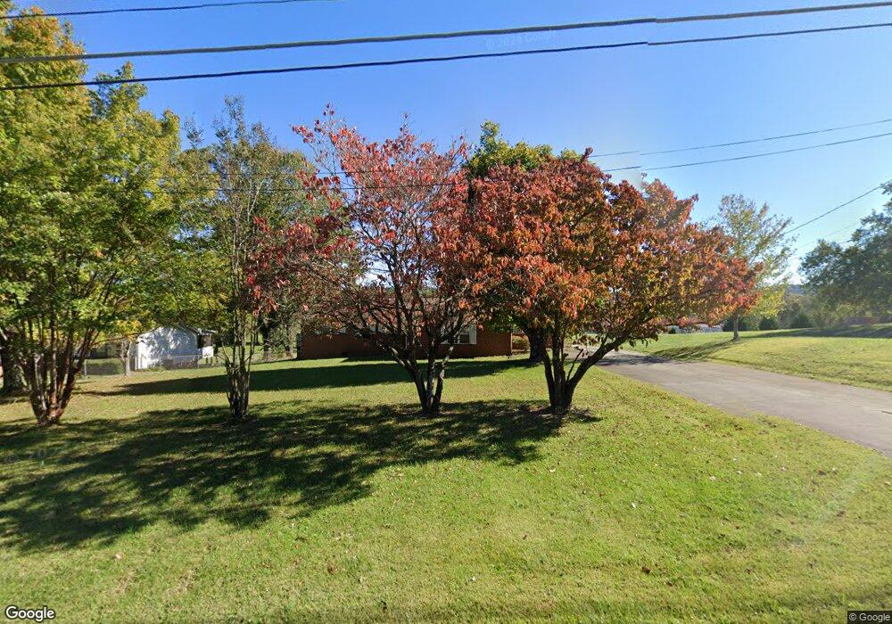
4900 W Emory Rd Powell, TN 37849
Estimated Value: $389,671 - $496,000
3
Beds
2
Baths
1,970
Sq Ft
$213/Sq Ft
Est. Value
About This Home
This home is located at 4900 W Emory Rd, Powell, TN 37849 and is currently estimated at $420,418, approximately $213 per square foot. 4900 W Emory Rd is a home located in Knox County with nearby schools including Powell Elementary School, Powell Middle School, and Karns High School.
Ownership History
Date
Name
Owned For
Owner Type
Purchase Details
Closed on
Oct 1, 2024
Sold by
Watkins Richard T and Watkins Carol J
Bought by
Knox County Tennessee
Current Estimated Value
Purchase Details
Closed on
Sep 29, 1997
Sold by
Broyles Bernice Z
Bought by
Watkins Richard T and Watkins Carol J
Home Financials for this Owner
Home Financials are based on the most recent Mortgage that was taken out on this home.
Original Mortgage
$75,200
Interest Rate
6.99%
Mortgage Type
Purchase Money Mortgage
Create a Home Valuation Report for This Property
The Home Valuation Report is an in-depth analysis detailing your home's value as well as a comparison with similar homes in the area
Home Values in the Area
Average Home Value in this Area
Purchase History
| Date | Buyer | Sale Price | Title Company |
|---|---|---|---|
| Knox County Tennessee | $18,500 | Tennessee Valley Title | |
| Watkins Richard T | $94,000 | Abstract Title Inc |
Source: Public Records
Mortgage History
| Date | Status | Borrower | Loan Amount |
|---|---|---|---|
| Previous Owner | Watkins Richard T | $75,200 |
Source: Public Records
Tax History Compared to Growth
Tax History
| Year | Tax Paid | Tax Assessment Tax Assessment Total Assessment is a certain percentage of the fair market value that is determined by local assessors to be the total taxable value of land and additions on the property. | Land | Improvement |
|---|---|---|---|---|
| 2024 | $999 | $64,300 | $0 | $0 |
| 2023 | $999 | $64,300 | $0 | $0 |
| 2022 | $999 | $64,300 | $0 | $0 |
| 2021 | $806 | $38,025 | $0 | $0 |
| 2020 | $806 | $38,025 | $0 | $0 |
| 2019 | $806 | $38,025 | $0 | $0 |
| 2018 | $806 | $38,025 | $0 | $0 |
| 2017 | $806 | $38,025 | $0 | $0 |
| 2016 | $809 | $0 | $0 | $0 |
| 2015 | $809 | $0 | $0 | $0 |
| 2014 | $809 | $0 | $0 | $0 |
Source: Public Records
Map
Nearby Homes
- 4924 W Emory Rd
- 6003 Sweet Bell Ave Unit Lot 174
- 4908 Montmorency Dr
- 8155 Gold Bell St Unit Lot 23
- 8205 Gold Bell St Unit Lot 25
- 8209 Gold Bell St Unit Lot 26
- 8147 Gold Bell St Unit Lot 21
- 8154 Gold Bell St Unit Lot 172
- 8143 Gold Bell St Unit Lot 20
- 8151 Gold Bell St Unit Lot 22
- 8201 Gold Bell St Unit Lot 24
- 8045 Gold Bell St
- 4345 Honey Bell St Unit Lot 188
- 4320 Honey Bell St Unit Lot 199
- 4525 Unity Bell Ave Unit Lot 171
- 4332 Honey Bell St Unit Lot 201
- 4356 Honey Bell St Unit Lot 204
- 4338 Honey Bell St Unit Lot 202
- 4533 Peace Bell Ave Unit Lot 163
- 4539 Peace Bell Ave Unit Lot 164
- 4734 W Emory Rd
- 4912 W Emory Rd
- 4728 W Emory Rd
- 4700 MacMont Cir
- 4905 W Emory Rd
- 4701 MacMont Cir
- 4914 W Emory Rd
- 4709 MacMont Cir
- 4913 W Emory Rd
- 4710 MacMont Cir
- 4904 Governorwood Dr
- 4908 Governorwood Dr
- 4713 MacMont Cir
- 4912 Governorwood Dr
- 4917 W Emory Rd
- 4921 W Emory Rd
- 4717 MacMont Cir
- 4916 Governorwood Dr
- 4901 Governorwood Dr
- 4909 Governorwood Dr
