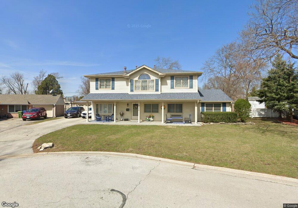
4906 Stone Circle Dr Unit 1 Oak Lawn, IL 60453
Estimated Value: $381,000 - $402,000
5
Beds
3
Baths
2,412
Sq Ft
$161/Sq Ft
Est. Value
About This Home
This home is located at 4906 Stone Circle Dr Unit 1, Oak Lawn, IL 60453 and is currently estimated at $388,214, approximately $160 per square foot. 4906 Stone Circle Dr Unit 1 is a home located in Cook County with nearby schools including Sward Elementary School, Kolmar Avenue Elementary School, and J Covington Elementary School.
Ownership History
Date
Name
Owned For
Owner Type
Purchase Details
Closed on
Jun 2, 1995
Sold by
Casper James C and Casper Marie E
Bought by
Madsen Neil and Madsen Maureen
Current Estimated Value
Home Financials for this Owner
Home Financials are based on the most recent Mortgage that was taken out on this home.
Original Mortgage
$118,600
Interest Rate
8.26%
Create a Home Valuation Report for This Property
The Home Valuation Report is an in-depth analysis detailing your home's value as well as a comparison with similar homes in the area
Home Values in the Area
Average Home Value in this Area
Purchase History
| Date | Buyer | Sale Price | Title Company |
|---|---|---|---|
| Madsen Neil | $125,000 | -- |
Source: Public Records
Mortgage History
| Date | Status | Borrower | Loan Amount |
|---|---|---|---|
| Closed | Madsen Neil | $118,600 |
Source: Public Records
Tax History Compared to Growth
Tax History
| Year | Tax Paid | Tax Assessment Tax Assessment Total Assessment is a certain percentage of the fair market value that is determined by local assessors to be the total taxable value of land and additions on the property. | Land | Improvement |
|---|---|---|---|---|
| 2024 | $8,042 | $31,000 | $5,684 | $25,316 |
| 2023 | $6,741 | $31,000 | $5,684 | $25,316 |
| 2022 | $6,741 | $23,258 | $4,974 | $18,284 |
| 2021 | $6,623 | $23,257 | $4,973 | $18,284 |
| 2020 | $6,714 | $23,257 | $4,973 | $18,284 |
| 2019 | $6,603 | $23,396 | $4,500 | $18,896 |
| 2018 | $6,353 | $23,396 | $4,500 | $18,896 |
| 2017 | $6,473 | $23,396 | $4,500 | $18,896 |
| 2016 | $6,635 | $21,242 | $3,789 | $17,453 |
| 2015 | $6,454 | $21,242 | $3,789 | $17,453 |
| 2014 | $6,397 | $21,242 | $3,789 | $17,453 |
| 2013 | $6,250 | $22,733 | $3,789 | $18,944 |
Source: Public Records
Map
Nearby Homes
- 9953 Elm Circle Dr
- 10109 S Cicero Ave Unit 206
- 9909 Elm Circle Dr
- 9904 S Cicero Ave
- 10010 Harnew Rd W Unit 1
- 5120 W 101st St
- 5125 W 101st St
- 10016 Harnew Rd W
- 9821 S Cicero Ave Unit 8
- 10012 S 52nd Ave
- 10021 Cook Ave
- 5168 W 99th St
- 10403 S Keating Ave Unit 1C
- 4913 W 105th St
- 9711 Tulley Ave
- 5300 Oakdale Dr
- 5009 W 105th St
- 4433 W 100th St
- 9825 S Kilbourn Ave
- 9706 S 52nd Ave
- 4900 Stone Circle Dr
- 4912 Stone Circle Dr Unit 1
- 4935 Spring Rd
- 4929 Spring Rd
- 4939 Spring Rd
- 4925 Spring Rd
- 4943 Spring Rd
- 10036 Harnew Rd E
- 4905 Stone Circle Dr
- 10040 Harnew Rd E
- 10032 Harnew Rd E
- 4919 Spring Rd
- 10100 Harnew Rd E
- 4947 Spring Rd Unit 1
- 10028 Harnew Rd E
- 4920 Stone Circle Dr
- 10104 Harnew Rd E
- 4915 Spring Rd
- 4951 Spring Rd
- 10024 Harnew Rd E