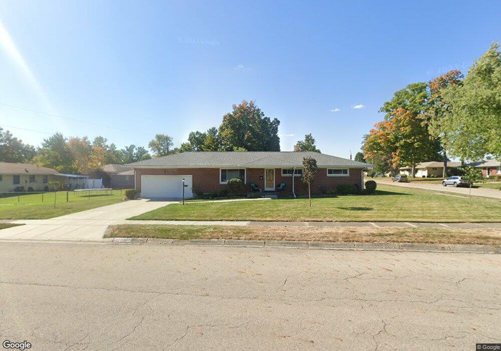
4911 Tulane Rd Springfield, OH 45503
Estimated Value: $218,000 - $243,000
3
Beds
2
Baths
1,225
Sq Ft
$189/Sq Ft
Est. Value
About This Home
This home is located at 4911 Tulane Rd, Springfield, OH 45503 and is currently estimated at $231,189, approximately $188 per square foot. 4911 Tulane Rd is a home located in Clark County with nearby schools including Northridge Elementary School, Kenton Ridge Middle & High School, and Emmanuel Christian Academy.
Ownership History
Date
Name
Owned For
Owner Type
Purchase Details
Closed on
Oct 18, 2024
Sold by
Powell Gregory D and Haddix Pamela J
Bought by
Powell Gregory D and Haddix Pamela J
Current Estimated Value
Purchase Details
Closed on
Jul 7, 2000
Sold by
Shepherd Rodger and Shepherd Tara L
Bought by
Powell Gregory D
Home Financials for this Owner
Home Financials are based on the most recent Mortgage that was taken out on this home.
Original Mortgage
$91,920
Interest Rate
8.55%
Mortgage Type
Purchase Money Mortgage
Purchase Details
Closed on
Jun 1, 1994
Sold by
Stine Thomas J
Bought by
Oneill Rodgers D and Oneill Catherine
Home Financials for this Owner
Home Financials are based on the most recent Mortgage that was taken out on this home.
Original Mortgage
$60,750
Interest Rate
8.48%
Mortgage Type
Purchase Money Mortgage
Create a Home Valuation Report for This Property
The Home Valuation Report is an in-depth analysis detailing your home's value as well as a comparison with similar homes in the area
Home Values in the Area
Average Home Value in this Area
Purchase History
| Date | Buyer | Sale Price | Title Company |
|---|---|---|---|
| Powell Gregory D | -- | None Listed On Document | |
| Powell Gregory D | -- | None Listed On Document | |
| Powell Gregory D | $114,900 | -- | |
| Oneill Rodgers D | $67,500 | -- |
Source: Public Records
Mortgage History
| Date | Status | Borrower | Loan Amount |
|---|---|---|---|
| Previous Owner | Powell Gregory D | $91,920 | |
| Previous Owner | Oneill Rodgers D | $60,750 |
Source: Public Records
Tax History
| Year | Tax Paid | Tax Assessment Tax Assessment Total Assessment is a certain percentage of the fair market value that is determined by local assessors to be the total taxable value of land and additions on the property. | Land | Improvement |
|---|---|---|---|---|
| 2025 | $2,303 | $74,560 | $18,730 | $55,830 |
| 2024 | $2,227 | $52,660 | $12,530 | $40,130 |
| 2023 | $2,227 | $52,660 | $12,530 | $40,130 |
| 2022 | $2,235 | $52,660 | $12,530 | $40,130 |
| 2021 | $2,377 | $47,470 | $9,950 | $37,520 |
| 2020 | $2,380 | $47,470 | $9,950 | $37,520 |
| 2019 | $2,425 | $47,470 | $9,950 | $37,520 |
| 2018 | $2,096 | $39,390 | $8,920 | $30,470 |
| 2017 | $1,796 | $40,936 | $8,918 | $32,018 |
| 2016 | $1,784 | $40,936 | $8,918 | $32,018 |
| 2015 | $1,740 | $38,773 | $8,575 | $30,198 |
| 2014 | $1,740 | $38,773 | $8,575 | $30,198 |
| 2013 | $1,700 | $38,773 | $8,575 | $30,198 |
Source: Public Records
Map
Nearby Homes
- 1709 Thomas Dr
- 4652 Reno Ln Unit 15
- 5033 Ridgewood Rd E
- 4577 Reno Ln Unit 2
- 1521 Erika Dr
- 4446 Ridgewood Rd E Unit 3
- 4802 Willowbrook Dr
- 4741 Cullen Ave
- 1341 Student Ave
- 5564 Ridgewood Rd E Unit 7
- 4256 Midfield St Unit 9
- 1495 Victorian Way
- 1836 Dunseth Ln
- 1469 Victorian Way
- 5564 Ridgewood Rd W
- 4500 Bosart Rd
- 1977 Willoughby Ave
- 4343 Burchill St
- 1812 Willow Lakes Dr
- 3942 Harris Ln
- 1733 Thomas Dr
- 1740 Merrydale Rd
- 1732 Merrydale Rd
- 4910 Tulane Rd
- 4931 Tulane Rd
- 1725 Thomas Dr
- 4920 Tulane Rd
- 1734 Thomas Dr
- 4900 Tulane Rd
- 1724 Merrydale Rd
- 4930 Tulane Rd
- 1726 Thomas Dr
- 1717 Thomas Dr
- 1739 Merrydale Rd
- 1716 Merrydale Rd
- 1731 Merrydale Rd
- 1718 Thomas Dr
- 4834 Tulane Rd
- 4827 Tulane Rd
- 1708 Merrydale Rd
Your Personal Tour Guide
Ask me questions while you tour the home.