
Seller's Agent in 2017
Gary Swallows
Swallows & Associates Realty
(623) 780-8000
9 in this area
39 Total Sales
Estimated Value: $777,000 - $877,000
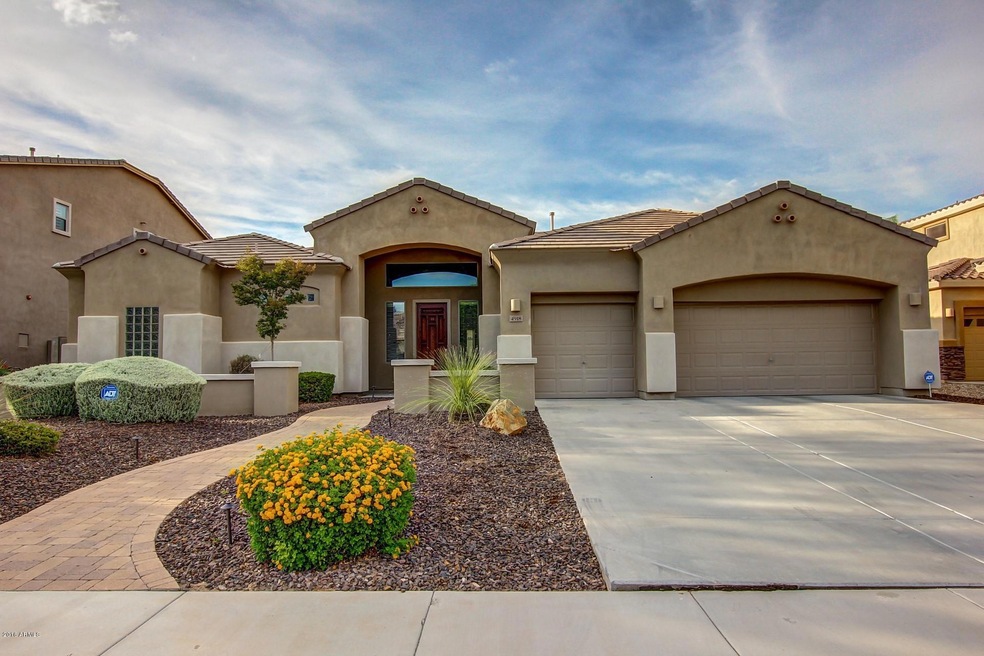
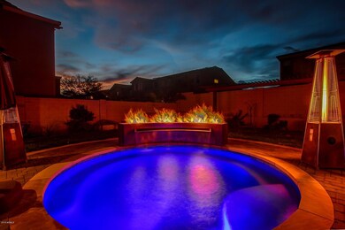
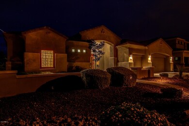
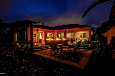
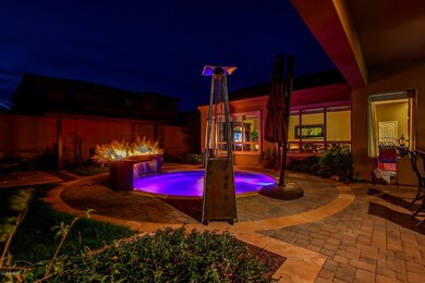
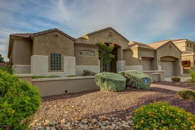
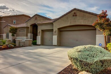
REDUCED & VOTED BEST HOME ON AGENT TOUR! OWNER bought & closed on new home, wants SOLD now! Split floorplan/high ceilings/open & light, 20'' diagonal laid tile thru out. Kitchen is a culinary delight w/breakfast bar seating for 6/granite counters/cherry cabinets w/roll outs/ss appliance pkg/dual ovens/pantry & opens to lrg family room. Sep. forml living & dining rooms. Master w/exit to patio/dual vanities/lrg snail shower/dual w-in closets. 2nd & 3rd bedrooms w/Jack & Jill bath w/dual sinks. 4th Bedrm adjacent to full bath & private entry. (Currently used as den but seller will add closet). Lovely backyd w/htd cocktail pool w/unique fire feature, extended cov patio w/pavers/lush grass/shrubs.
Awesome Stetson Valley neighborhood w/hiking/biking/playgrounds/close to everything.
Last Agent to Sell the Property
Swallows & Associates Realty Brokerage Phone: 623-780-8000 License #BR008787000 Listed on: 07/22/2016
Co-Listed By
Swallows & Associates Realty Brokerage Phone: 623-780-8000 License #SA037448000
| Date | Buyer | Sale Price | Title Company |
|---|---|---|---|
| Gerads William T | -- | First American Title Insuran | |
| Wambolt Jason G | $443,990 | North American Title Co | |
| U S Home Corp | $9,416,487 | Magnus Title Agency |
| Date | Status | Borrower | Loan Amount |
|---|---|---|---|
| Previous Owner | Gerads William T | $424,100 | |
| Previous Owner | Wambolt Jason G | $288,950 |
| Date | Event | Price | List to Sale | Price per Sq Ft |
|---|---|---|---|---|
| 06/25/2025 06/25/25 | Off Market | $469,000 | -- | -- |
| 05/01/2017 05/01/17 | Sold | $469,000 | -3.3% | $154 / Sq Ft |
| 03/14/2017 03/14/17 | Pending | -- | -- | -- |
| 01/09/2017 01/09/17 | Price Changed | $484,900 | -1.5% | $160 / Sq Ft |
| 12/12/2016 12/12/16 | Price Changed | $492,500 | -0.5% | $162 / Sq Ft |
| 09/16/2016 09/16/16 | For Sale | $495,000 | +5.5% | $163 / Sq Ft |
| 09/13/2016 09/13/16 | Off Market | $469,000 | -- | -- |
| 07/22/2016 07/22/16 | For Sale | $495,000 | -- | $163 / Sq Ft |
| Year | Tax Paid | Tax Assessment Tax Assessment Total Assessment is a certain percentage of the fair market value that is determined by local assessors to be the total taxable value of land and additions on the property. | Land | Improvement |
|---|---|---|---|---|
| 2025 | $3,833 | $43,215 | -- | -- |
| 2024 | $3,706 | $41,157 | -- | -- |
| 2023 | $3,706 | $55,510 | $11,100 | $44,410 |
| 2022 | $3,561 | $42,960 | $8,590 | $34,370 |
| 2021 | $3,678 | $40,300 | $8,060 | $32,240 |
| 2020 | $3,610 | $38,410 | $7,680 | $30,730 |
| 2019 | $3,499 | $37,280 | $7,450 | $29,830 |
| 2018 | $3,378 | $36,500 | $7,300 | $29,200 |
| 2017 | $3,261 | $34,930 | $6,980 | $27,950 |
| 2016 | $3,078 | $39,420 | $7,880 | $31,540 |
| 2015 | $2,747 | $40,470 | $8,090 | $32,380 |
Seller's Agent in 2017
Gary Swallows
Swallows & Associates Realty
(623) 780-8000
9 in this area
39 Total Sales
Seller Co-Listing Agent in 2017
Carolyn Swallows
Swallows & Associates Realty
(602) 616-8000
11 in this area
49 Total Sales
Buyer's Agent in 2017
David Oesterle
RE/MAX
(602) 920-2558
98 Total Sales
Source: Arizona Regional Multiple Listing Service (ARMLS)
MLS Number: 5474616
APN: 201-38-279
Disclaimer: Certain information contained herein is derived from information provided by parties other than Homes.com. All information provided is deemed reliable, but is not guaranteed to be accurate and should be independently verified.
![]() All information should be verified by the recipient and none is guaranteed as accurate by ARMLS
All information should be verified by the recipient and none is guaranteed as accurate by ARMLS
Listing Information presented by local MLS brokerage: Ten-X, local REALTOR®- Arlene Richardson - (888)-952-6393