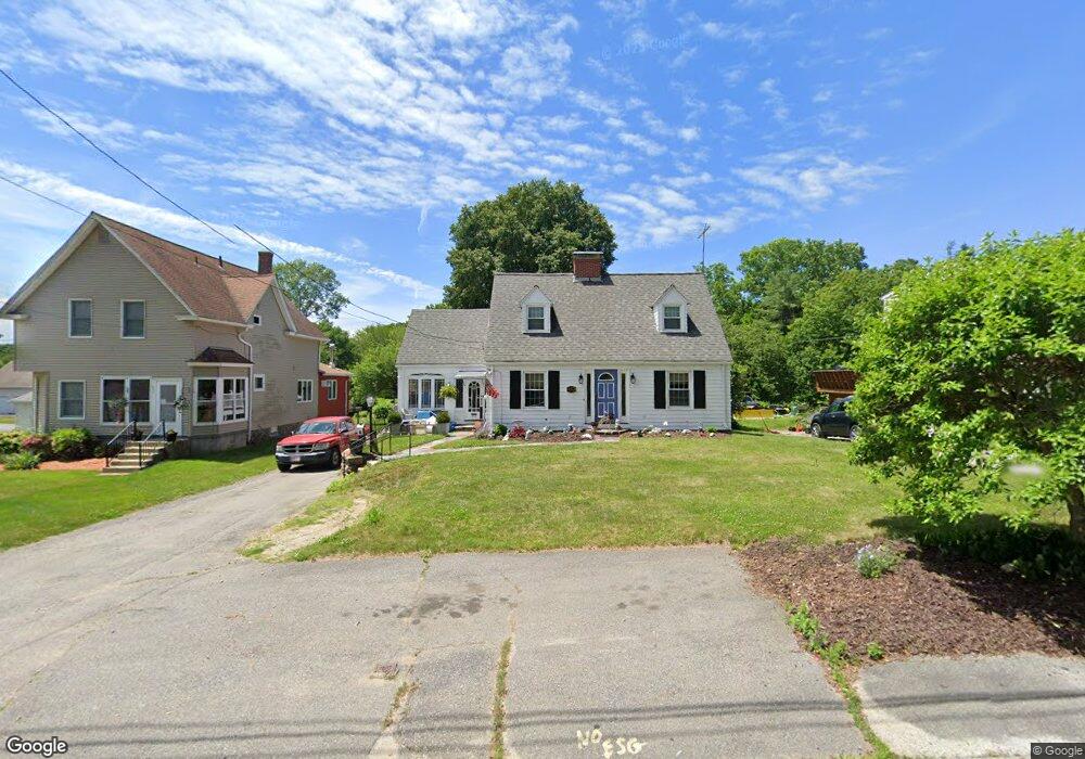
492 Massasoit Rd Worcester, MA 01604
Broadmeadow Brook NeighborhoodEstimated Value: $414,000 - $477,000
3
Beds
2
Baths
1,680
Sq Ft
$265/Sq Ft
Est. Value
About This Home
This home is located at 492 Massasoit Rd, Worcester, MA 01604 and is currently estimated at $445,911, approximately $265 per square foot. 492 Massasoit Rd is a home located in Worcester County with nearby schools including Jacob Hiatt Magnet School, Chandler Magnet, and Rice Square Elementary School.
Ownership History
Date
Name
Owned For
Owner Type
Purchase Details
Closed on
Aug 1, 2017
Sold by
Plante Rt and Miller
Bought by
Gelinas Pierre and Gelinas Tiphanie A
Current Estimated Value
Home Financials for this Owner
Home Financials are based on the most recent Mortgage that was taken out on this home.
Original Mortgage
$160,000
Outstanding Balance
$131,057
Interest Rate
3.91%
Mortgage Type
New Conventional
Estimated Equity
$314,854
Purchase Details
Closed on
Dec 21, 2004
Sold by
Carlson Arlene and Miller Diane I
Bought by
Carlson Arlene and Miller Diane I
Create a Home Valuation Report for This Property
The Home Valuation Report is an in-depth analysis detailing your home's value as well as a comparison with similar homes in the area
Home Values in the Area
Average Home Value in this Area
Purchase History
| Date | Buyer | Sale Price | Title Company |
|---|---|---|---|
| Gelinas Pierre | $200,000 | -- | |
| Carlson Arlene | -- | -- | |
| Carlson Arlene | -- | -- |
Source: Public Records
Mortgage History
| Date | Status | Borrower | Loan Amount |
|---|---|---|---|
| Open | Gelinas Pierre | $160,000 |
Source: Public Records
Tax History
| Year | Tax Paid | Tax Assessment Tax Assessment Total Assessment is a certain percentage of the fair market value that is determined by local assessors to be the total taxable value of land and additions on the property. | Land | Improvement |
|---|---|---|---|---|
| 2025 | $4,944 | $374,800 | $119,600 | $255,200 |
| 2024 | $4,858 | $353,300 | $119,600 | $233,700 |
| 2023 | $4,656 | $324,700 | $104,000 | $220,700 |
| 2022 | $4,251 | $279,500 | $83,200 | $196,300 |
| 2021 | $4,133 | $253,900 | $66,600 | $187,300 |
| 2020 | $4,029 | $237,000 | $66,500 | $170,500 |
| 2019 | $3,839 | $213,300 | $60,200 | $153,100 |
| 2018 | $3,854 | $203,800 | $60,200 | $143,600 |
| 2017 | $3,692 | $192,100 | $60,200 | $131,900 |
| 2016 | $3,660 | $177,600 | $45,700 | $131,900 |
| 2015 | $3,564 | $177,600 | $45,700 | $131,900 |
| 2014 | $3,470 | $177,600 | $45,700 | $131,900 |
Source: Public Records
Map
Nearby Homes
- 3 Julien Ave
- 266 Massasoit Rd
- 1260 Grafton St
- 12 Irene Ct
- 330 Sunderland Rd Unit 80
- 330 Sunderland Rd Unit 69
- 16 Vincent Cir
- 1257 Grafton St
- 259 Massasoit Rd
- 7 Clarissa St
- 256 Massasoit Rd
- 340 Sunderland Rd Unit 28
- 2 Diane St
- 25 Upton St
- 25 Stoneham Rd
- 1195 Grafton St Unit 19
- 1195 Grafton St Unit 39
- 1205 Grafton St Unit 31
- 38 Garnet St
- 270 Sunderland Rd Unit 2
- 496 Massasoit Rd
- 490 Massasoit Rd
- 488 Massasoit Rd
- 500 Massasoit Rd
- 489 Massasoit Rd
- 474 Massasoit Rd
- 483 Massasoit Rd
- 502 Massasoit Rd
- 3 Sprague Ln
- 3 Sprague Ln Unit Bmt
- 3 Sprague Ln Unit 3
- 3 Sprague Ln Unit Lower
- 5 Sprague Ln
- 506 Massasoit Rd
- 7 Sprague Ln
- 505 Massasoit Rd
- 479 Massasoit Rd
- 470 Massasoit Rd
- 1 Sprague Ln
- 511 Massasoit Rd
Your Personal Tour Guide
Ask me questions while you tour the home.