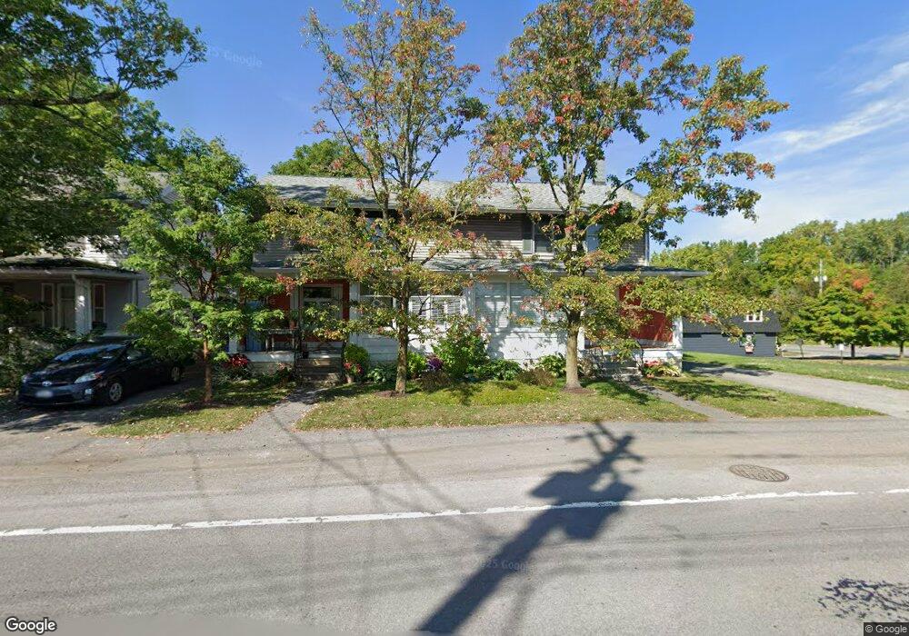
4920 Ransom Rd Clarence, NY 14031
Estimated Value: $373,000 - $450,711
6
Beds
3
Baths
2,784
Sq Ft
$143/Sq Ft
Est. Value
About This Home
This home is located at 4920 Ransom Rd, Clarence, NY 14031 and is currently estimated at $397,428, approximately $142 per square foot. 4920 Ransom Rd is a home located in Erie County with nearby schools including Harris Hill Elementary School, Clarence Middle School, and Clarence Senior High School.
Ownership History
Date
Name
Owned For
Owner Type
Purchase Details
Closed on
Aug 21, 2025
Sold by
Massaro Rosemary
Bought by
Massaro Rosemary and Schaaf Gregory J
Current Estimated Value
Purchase Details
Closed on
Feb 1, 2010
Sold by
Sheldon Gary M and Massaro Rosemary
Bought by
Massaro Rosemary and Sheldon Rosemary
Purchase Details
Closed on
Oct 5, 1995
Sold by
Blum Debra A
Bought by
Sheldon Gary M and Sheldon Rosemary
Create a Home Valuation Report for This Property
The Home Valuation Report is an in-depth analysis detailing your home's value as well as a comparison with similar homes in the area
Home Values in the Area
Average Home Value in this Area
Purchase History
| Date | Buyer | Sale Price | Title Company |
|---|---|---|---|
| Massaro Rosemary | -- | None Available | |
| Massaro Rosemary | -- | None Available | |
| Massaro Rosemary | -- | None Available | |
| Sheldon Gary M | $83,500 | -- | |
| Sheldon Gary M | $83,500 | -- |
Source: Public Records
Tax History Compared to Growth
Tax History
| Year | Tax Paid | Tax Assessment Tax Assessment Total Assessment is a certain percentage of the fair market value that is determined by local assessors to be the total taxable value of land and additions on the property. | Land | Improvement |
|---|---|---|---|---|
| 2024 | -- | $364,000 | $20,400 | $343,600 |
| 2023 | $4,931 | $200,000 | $20,400 | $179,600 |
| 2022 | $4,868 | $200,000 | $20,400 | $179,600 |
| 2021 | $4,853 | $200,000 | $20,400 | $179,600 |
| 2020 | $3,962 | $185,000 | $13,600 | $171,400 |
| 2019 | $4,359 | $185,000 | $13,600 | $171,400 |
| 2018 | $3,871 | $185,000 | $13,600 | $171,400 |
| 2017 | $2,261 | $175,000 | $13,600 | $161,400 |
| 2016 | $4,356 | $175,000 | $13,600 | $161,400 |
| 2015 | -- | $175,000 | $13,600 | $161,400 |
| 2014 | -- | $165,000 | $13,600 | $151,400 |
Source: Public Records
Map
Nearby Homes
- 5201 Kandefer's Trail
- v/l Sorellina Ln S
- 6265 Salt Rd
- 5095 Salt Rd
- 10912 Main St
- 4619 Pine Manor
- 4535 Ransom Rd
- 4765 Shisler Rd
- 4883 Winding Ln
- 4455 Shisler Rd
- 4505 Timberlake Dr
- 10121 Greiner Rd
- 0 Jones Rd Unit B1637455
- 5140 Kraus Rd
- 11310 Stage Rd
- 9808 Tottenham Ave
- 4100 Ransom Rd
- 9875 Hollingson Rd
- 0 Strickler Rd E Unit B1434481
- 9800 Hollingson Rd
- 4910 Ransom Rd
- 4900 Ransom Rd
- 10611 Main St Unit . A
- 4890 Ransom Rd
- 6 Laurel St
- Sorellina Layne Sorellina Ln S
- 4884 Ransom Rd
- 4885 Ransom Rd
- 10622 Main St
- 10593 Main St
- 10632 Main St Unit Upper Front 1
- 10647 Main St
- 10594 Main St
- 4888 Sawmill Rd
- 0 Ransom Tillman Unit B421782
- 4984 Bank St
- 4880 Sawmill Rd
- 4975 Bank St
- 10580 Main St
- 10660 Main St