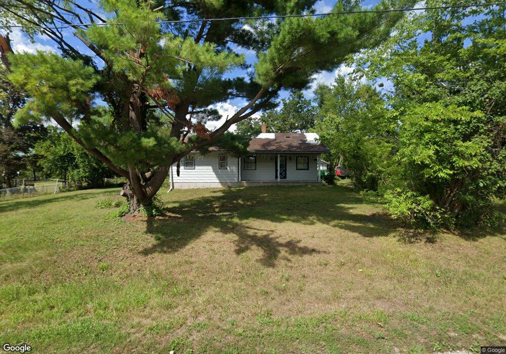
4921 Mcgowan Dr Cedar Rapids, IA 52403
Estimated Value: $161,000 - $203,588
2
Beds
1
Bath
914
Sq Ft
$198/Sq Ft
Est. Value
About This Home
This home is located at 4921 Mcgowan Dr, Cedar Rapids, IA 52403 and is currently estimated at $180,647, approximately $197 per square foot. 4921 Mcgowan Dr is a home located in Linn County with nearby schools including Summit Elementary School, Erskine Elementary School, and McKinley STEAM Academy.
Ownership History
Date
Name
Owned For
Owner Type
Purchase Details
Closed on
May 6, 2020
Sold by
The Estate Of Shirley J Mudd
Bought by
Mudd John L
Current Estimated Value
Purchase Details
Closed on
Sep 18, 2012
Sold by
Mudd Laurn Renee
Bought by
Mudd Junn Lineuln
Create a Home Valuation Report for This Property
The Home Valuation Report is an in-depth analysis detailing your home's value as well as a comparison with similar homes in the area
Home Values in the Area
Average Home Value in this Area
Purchase History
| Date | Buyer | Sale Price | Title Company |
|---|---|---|---|
| Mudd John L | -- | None Available | |
| Mudd Junn Lineuln | -- | None Available |
Source: Public Records
Tax History Compared to Growth
Tax History
| Year | Tax Paid | Tax Assessment Tax Assessment Total Assessment is a certain percentage of the fair market value that is determined by local assessors to be the total taxable value of land and additions on the property. | Land | Improvement |
|---|---|---|---|---|
| 2025 | $1,868 | $179,200 | $47,900 | $131,300 |
| 2024 | $1,598 | $170,600 | $47,900 | $122,700 |
| 2023 | $1,598 | $170,600 | $47,900 | $122,700 |
| 2022 | $1,400 | $122,100 | $47,900 | $74,200 |
| 2021 | $1,326 | $109,800 | $47,900 | $61,900 |
| 2020 | $1,326 | $96,800 | $33,600 | $63,200 |
| 2019 | $1,376 | $93,500 | $33,600 | $59,900 |
| 2018 | $1,346 | $93,500 | $33,600 | $59,900 |
| 2017 | $1,400 | $95,300 | $33,600 | $61,700 |
| 2016 | $1,400 | $95,300 | $33,600 | $61,700 |
| 2015 | $1,406 | $95,300 | $33,600 | $61,700 |
| 2014 | $1,448 | $95,300 | $33,600 | $61,700 |
| 2013 | $1,297 | $95,300 | $33,600 | $61,700 |
Source: Public Records
Map
Nearby Homes
- 4809 Mcgowan Dr
- 6936 Hackberry Loop
- 6932 Hackberry Loop
- 6849 Pumpkin Patch Blvd
- 6485 Cabbage Patch Place
- 6876 Bottom Land Ln
- 6859 Pumpkin Patch Blvd
- 6934 Hackberry Loop
- 5029 Broadlawn Dr SE
- 5658 Meadow Grass Cir SE
- 5750 Meadow Grass Cir SE
- 5638 Meadow Grass Cir SE
- 819 Tumble Grass Ct SE
- 827 Tumble Grass Ct SE
- 4725 Green Valley Dr SE
- 808 Green Valley Terrace SE
- 921 Rosedale Rd SE
- 725 E Post Ct SE Unit 725C
- 717 E Post Ct SE Unit 717C
- 701 E Post Ct SE Unit 701E
- 4925 Mcgowan Dr
- 4810 Mcgowan Dr
- 4920 Mcgowan Dr
- 4918 Mcgowan Dr
- 500 Wilder Dr
- 4808 Mcgowan Dr
- 480 Wilder Dr
- 0 Wilder Dr SE
- 508 Valley View Dr
- 4790 Mcgowan Dr
- 4802 Mcgowan Dr
- 510 Valley View Dr
- 600 Carlton Rd
- 470 Wilder Dr
- 601 Wilder Dr
- 505 Valley View Dr
- 4800 Mcgowan Dr
- 502 Wilder Dr
- 4700 Korff Rd SE
- 4700 Korff Rd