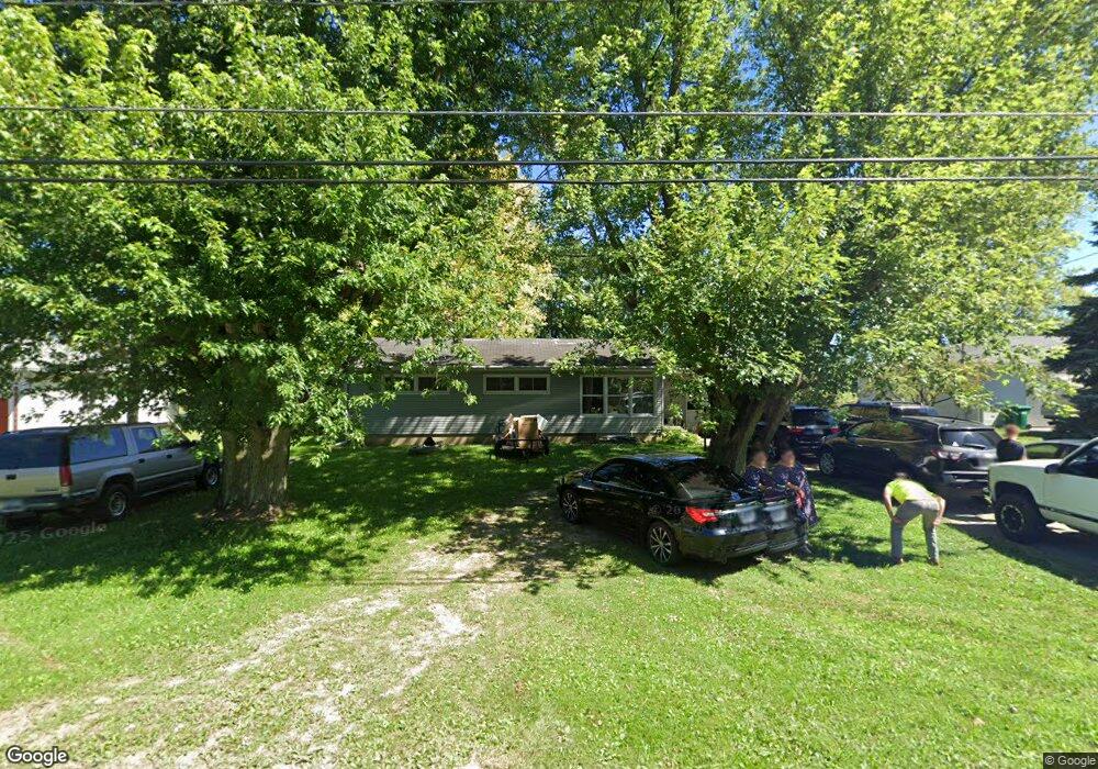
4922 Bosart Rd Springfield, OH 45503
Estimated Value: $198,490 - $266,000
3
Beds
1
Bath
1,242
Sq Ft
$178/Sq Ft
Est. Value
About This Home
This home is located at 4922 Bosart Rd, Springfield, OH 45503 and is currently estimated at $220,623, approximately $177 per square foot. 4922 Bosart Rd is a home located in Clark County with nearby schools including Northridge Elementary School, Kenton Ridge Middle & High School, and Emmanuel Christian Academy.
Ownership History
Date
Name
Owned For
Owner Type
Purchase Details
Closed on
Jul 14, 2006
Sold by
Reynolds Carton F and Reynolds Donna
Bought by
Bannister Denise A
Current Estimated Value
Home Financials for this Owner
Home Financials are based on the most recent Mortgage that was taken out on this home.
Original Mortgage
$128,981
Outstanding Balance
$75,651
Interest Rate
6.72%
Mortgage Type
FHA
Estimated Equity
$144,972
Purchase Details
Closed on
Jun 27, 2002
Sold by
Reynolds David B and Reynolds Tina
Bought by
Reynolds Carton F and Reynolds Donna
Purchase Details
Closed on
Jun 7, 1999
Sold by
Reynolds Carton F and Reynolds Donna
Bought by
Reynolds Carton F and Reynolds Donna
Home Financials for this Owner
Home Financials are based on the most recent Mortgage that was taken out on this home.
Original Mortgage
$81,750
Interest Rate
8%
Mortgage Type
Purchase Money Mortgage
Create a Home Valuation Report for This Property
The Home Valuation Report is an in-depth analysis detailing your home's value as well as a comparison with similar homes in the area
Home Values in the Area
Average Home Value in this Area
Purchase History
| Date | Buyer | Sale Price | Title Company |
|---|---|---|---|
| Bannister Denise A | $130,000 | None Available | |
| Reynolds Carton F | -- | -- | |
| Reynolds Carton F | -- | -- |
Source: Public Records
Mortgage History
| Date | Status | Borrower | Loan Amount |
|---|---|---|---|
| Open | Bannister Denise A | $128,981 | |
| Previous Owner | Reynolds Carton F | $81,750 |
Source: Public Records
Tax History
| Year | Tax Paid | Tax Assessment Tax Assessment Total Assessment is a certain percentage of the fair market value that is determined by local assessors to be the total taxable value of land and additions on the property. | Land | Improvement |
|---|---|---|---|---|
| 2025 | $1,933 | $59,040 | $15,540 | $43,500 |
| 2024 | $1,870 | $44,210 | $12,920 | $31,290 |
| 2023 | $1,870 | $44,210 | $12,920 | $31,290 |
| 2022 | $1,876 | $44,210 | $12,920 | $31,290 |
| 2021 | $1,830 | $36,540 | $10,680 | $25,860 |
| 2020 | $1,831 | $36,540 | $10,680 | $25,860 |
| 2019 | $1,866 | $36,540 | $10,680 | $25,860 |
| 2018 | $1,624 | $30,510 | $9,820 | $20,690 |
| 2017 | $1,391 | $35,340 | $9,821 | $25,519 |
| 2016 | $1,382 | $35,340 | $9,821 | $25,519 |
| 2015 | $1,531 | $36,194 | $10,675 | $25,519 |
| 2014 | $1,531 | $36,194 | $10,675 | $25,519 |
| 2013 | $1,496 | $36,194 | $10,675 | $25,519 |
Source: Public Records
Map
Nearby Homes
- 4500 Bosart Rd
- 4652 Reno Ln Unit 15
- 1709 Thomas Dr
- 4577 Reno Ln Unit 2
- 1977 Willoughby Ave
- 5033 Ridgewood Rd E
- 1836 Dunseth Ln
- 1521 Erika Dr
- 4028 Ryland Dr Unit 4028
- 4446 Ridgewood Rd E Unit 3
- 5060 Morris Rd
- 5564 Ridgewood Rd E Unit 7
- 1921 Elaina Dr
- 1812 Willow Lakes Dr
- 4256 Midfield St Unit 9
- 1495 Victorian Way
- 1469 Victorian Way
- 1341 Student Ave
- 4802 Willowbrook Dr
- 3942 Harris Ln
- 4928 Bosart Rd
- 4914 Bosart Rd
- 4906 Bosart Rd
- 4960 Bosart Rd
- 4931 Bosart Rd
- 4911 Bosart Rd
- 4953 Bosart Rd
- 4880 Bosart Rd
- 2497 Moorefield Rd
- 4885 Bosart Rd
- 4830 Bosart Rd
- 2536 Moorefield Rd
- 4820 Bosart Rd
- 2433 Moorefield Rd
- 2494 Moorefield Rd
- 4845 Bosart Rd
- 4810 Bosart Rd
- 2411 Moorefield Rd
- 4801 Bosart Rd
- 4754 Bosart Rd
Your Personal Tour Guide
Ask me questions while you tour the home.