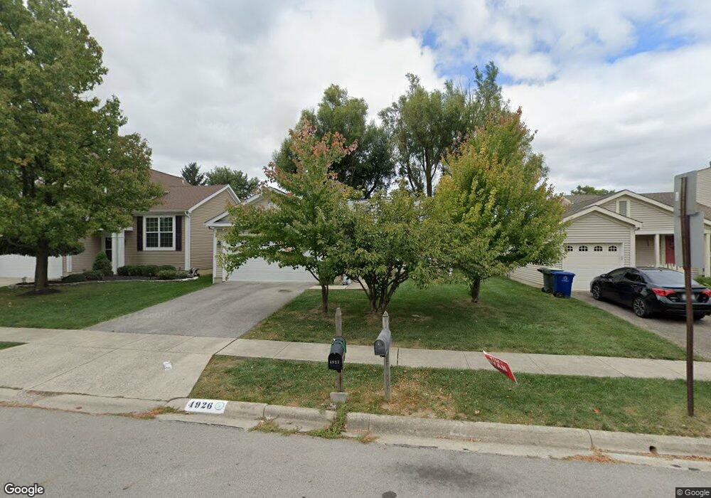
4926 Calhoon Dr Hilliard, OH 43026
Cross Creek NeighborhoodEstimated Value: $275,000 - $349,000
3
Beds
2
Baths
1,176
Sq Ft
$275/Sq Ft
Est. Value
About This Home
This home is located at 4926 Calhoon Dr, Hilliard, OH 43026 and is currently estimated at $323,310, approximately $274 per square foot. 4926 Calhoon Dr is a home located in Franklin County with nearby schools including J W Reason Elementary School, Hilliard Station Sixth Grade Elementary School, and Hilliard Heritage Middle School.
Ownership History
Date
Name
Owned For
Owner Type
Purchase Details
Closed on
May 5, 1999
Sold by
Crandall Louis E
Bought by
Saunders Joseph D and Saunders Susan R
Current Estimated Value
Home Financials for this Owner
Home Financials are based on the most recent Mortgage that was taken out on this home.
Original Mortgage
$119,950
Outstanding Balance
$30,993
Interest Rate
7.04%
Mortgage Type
VA
Estimated Equity
$292,317
Purchase Details
Closed on
Aug 21, 1990
Bought by
Crandall Louis E
Create a Home Valuation Report for This Property
The Home Valuation Report is an in-depth analysis detailing your home's value as well as a comparison with similar homes in the area
Home Values in the Area
Average Home Value in this Area
Purchase History
| Date | Buyer | Sale Price | Title Company |
|---|---|---|---|
| Saunders Joseph D | $116,500 | Esquire Title | |
| Crandall Louis E | $84,200 | -- |
Source: Public Records
Mortgage History
| Date | Status | Borrower | Loan Amount |
|---|---|---|---|
| Open | Saunders Joseph D | $119,950 |
Source: Public Records
Tax History Compared to Growth
Tax History
| Year | Tax Paid | Tax Assessment Tax Assessment Total Assessment is a certain percentage of the fair market value that is determined by local assessors to be the total taxable value of land and additions on the property. | Land | Improvement |
|---|---|---|---|---|
| 2024 | $5,227 | $92,550 | $29,860 | $62,690 |
| 2023 | $4,528 | $92,540 | $29,855 | $62,685 |
| 2022 | $3,816 | $62,450 | $12,360 | $50,090 |
| 2021 | $3,918 | $62,450 | $12,360 | $50,090 |
| 2020 | $3,951 | $62,450 | $12,360 | $50,090 |
| 2019 | $3,568 | $50,050 | $9,870 | $40,180 |
| 2018 | $3,527 | $50,050 | $9,870 | $40,180 |
| 2017 | $3,644 | $50,050 | $9,870 | $40,180 |
| 2016 | $3,735 | $48,730 | $11,450 | $37,280 |
| 2015 | $3,501 | $48,730 | $11,450 | $37,280 |
| 2014 | $3,507 | $48,730 | $11,450 | $37,280 |
| 2013 | $1,756 | $48,160 | $10,885 | $37,275 |
Source: Public Records
Map
Nearby Homes
- 4976 Shady Oak Dr
- 4945 Singleton Dr Unit 13C
- 2756 Shelton Cir
- 4995 Singleton Dr
- 4995 Singleton Dr Unit 18c
- 2759 Lyndley Ct
- 5052 Bressler Dr
- 5112 Bressler Dr
- 5188 Calhoon Ct
- 3012 Papin St Unit 39
- 2967 Castlebrook Ave
- 5215 Bressler Dr
- 5258 Skytrail Dr
- 4843 Stoneybrook Blvd Unit 30E
- 4857 Stoneybrook Blvd Unit 29E
- 2477 Crystal Springs Dr
- 4862 Stoneybrook Blvd Unit 24E
- 5285 Redlands Dr
- 5041 Stoneybrook Blvd Unit 9E
- 2401 Featherwood Dr
- 4932 Calhoon Dr
- 4938 Calhoon Dr
- 4914 Calhoon Dr
- 4944 Calhoon Dr
- 4921 Calhoon Dr
- 4933 Calhoon Dr
- 4941 Calhoon Dr
- 4952 Calhoon Dr
- 4915 Calhoon Dr
- 4949 Calhoon Dr
- 4957 Calhoon Dr
- 4881 Singleton Dr
- 4881 Singleton Dr Unit 3A
- 2764 Toms Trace Ct
- 4877 Singleton Dr
- 4917 Singleton Dr Unit 8D
- 4915 Singleton Dr
- 4915 Singleton Dr Unit 8C
- 4883 Singleton Dr Unit 3B
- 4963 Calhoon Dr