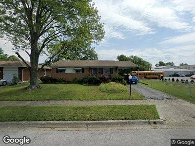
4928 Andrew Rd Columbus, OH 43227
Shady Lane NeighborhoodEstimated Value: $188,686 - $255,000
3
Beds
2
Baths
1,053
Sq Ft
$212/Sq Ft
Est. Value
About This Home
This home is located at 4928 Andrew Rd, Columbus, OH 43227 and is currently estimated at $223,422, approximately $212 per square foot. 4928 Andrew Rd is a home located in Franklin County with nearby schools including Shady Lane Elementary School, Sherwood Middle School, and Walnut Ridge High School.
Ownership History
Date
Name
Owned For
Owner Type
Purchase Details
Closed on
Jan 12, 2020
Sold by
Bigony Tammy Sue
Bought by
Bigony Harold Lee
Current Estimated Value
Purchase Details
Closed on
Jan 7, 2020
Sold by
Palmore James Timothy
Bought by
Bigony Harold Lee
Purchase Details
Closed on
Jan 6, 2020
Sold by
Palmore Joseph Michael
Bought by
Bigony Harold Lee
Purchase Details
Closed on
Dec 23, 2019
Sold by
Estate Of Margie Bell Bigony
Bought by
Palmore Joseph Michael and Palmore Ricky Ray
Purchase Details
Closed on
Jun 12, 1978
Bought by
Bird Marge B
Create a Home Valuation Report for This Property
The Home Valuation Report is an in-depth analysis detailing your home's value as well as a comparison with similar homes in the area
Home Values in the Area
Average Home Value in this Area
Purchase History
| Date | Buyer | Sale Price | Title Company |
|---|---|---|---|
| Bigony Harold Lee | -- | None Available | |
| Bigony Harold Lee | -- | None Available | |
| Bigony Harold Lee | -- | None Available | |
| Palmore Joseph Michael | -- | None Available | |
| Bird Marge B | -- | -- |
Source: Public Records
Mortgage History
| Date | Status | Borrower | Loan Amount |
|---|---|---|---|
| Previous Owner | Bigony Marge | $97,850 | |
| Previous Owner | Bird Marge B | $66,000 |
Source: Public Records
Tax History Compared to Growth
Tax History
| Year | Tax Paid | Tax Assessment Tax Assessment Total Assessment is a certain percentage of the fair market value that is determined by local assessors to be the total taxable value of land and additions on the property. | Land | Improvement |
|---|---|---|---|---|
| 2024 | $3,095 | $61,080 | $16,140 | $44,940 |
| 2023 | $2,810 | $61,075 | $16,135 | $44,940 |
| 2022 | $1,905 | $34,270 | $6,060 | $28,210 |
| 2021 | $1,781 | $34,270 | $6,060 | $28,210 |
| 2020 | $1,827 | $34,270 | $6,060 | $28,210 |
| 2019 | $1,833 | $27,060 | $4,830 | $22,230 |
| 2018 | $1,440 | $27,060 | $4,830 | $22,230 |
| 2017 | $1,134 | $27,060 | $4,830 | $22,230 |
| 2016 | $1,157 | $26,220 | $5,010 | $21,210 |
| 2015 | $1,051 | $26,220 | $5,010 | $21,210 |
| 2014 | $1,053 | $26,220 | $5,010 | $21,210 |
| 2013 | $657 | $30,835 | $5,880 | $24,955 |
Source: Public Records
Map
Nearby Homes
- 5072 Teddy Dr
- 1294 Lancelot Rd
- 1308 Lancelot Rd
- 4838 Calvin Dr
- 4991 Justin Rd
- 1359 Gertrude Dr
- 1086 Billie Dr
- 1494 Country Club Rd
- 4814 E Livingston Ave
- 1519 Country Club Rd
- 4620 Boynton Place
- 1477 Shady Lane Rd
- 4685 E Livingston Ave
- 4538 Grimsby Rd
- 0 E Main St
- 1290 Maetzel Dr
- 1660 Shady Lane Rd
- 4467 Grimsby Rd
- 4656 Dundee Ave
- 4502 Aragon Ave