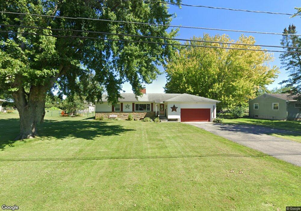
4928 Bosart Rd Springfield, OH 45503
Estimated Value: $204,000 - $218,000
2
Beds
2
Baths
1,180
Sq Ft
$178/Sq Ft
Est. Value
About This Home
This home is located at 4928 Bosart Rd, Springfield, OH 45503 and is currently estimated at $209,934, approximately $177 per square foot. 4928 Bosart Rd is a home located in Clark County with nearby schools including Rolling Hills Elementary School, Northridge Middle School, and Kenton Ridge Middle & High School.
Ownership History
Date
Name
Owned For
Owner Type
Purchase Details
Closed on
Dec 11, 2014
Sold by
Urley Waylan Glenn and Chacom Danielle Elizabeth
Bought by
Lambert Lloyd Heath and Lambert Julie M
Current Estimated Value
Home Financials for this Owner
Home Financials are based on the most recent Mortgage that was taken out on this home.
Original Mortgage
$80,000
Outstanding Balance
$61,392
Interest Rate
3.97%
Mortgage Type
Future Advance Clause Open End Mortgage
Estimated Equity
$148,542
Purchase Details
Closed on
Sep 6, 2007
Sold by
Ulrey Elza G and Ulrey Debora R
Bought by
Ulrey Waylan Glenn
Create a Home Valuation Report for This Property
The Home Valuation Report is an in-depth analysis detailing your home's value as well as a comparison with similar homes in the area
Home Values in the Area
Average Home Value in this Area
Purchase History
| Date | Buyer | Sale Price | Title Company |
|---|---|---|---|
| Lambert Lloyd Heath | $70,000 | Attorney | |
| Ulrey Waylan Glenn | -- | Attorney |
Source: Public Records
Mortgage History
| Date | Status | Borrower | Loan Amount |
|---|---|---|---|
| Open | Lambert Lloyd Heath | $80,000 |
Source: Public Records
Tax History Compared to Growth
Tax History
| Year | Tax Paid | Tax Assessment Tax Assessment Total Assessment is a certain percentage of the fair market value that is determined by local assessors to be the total taxable value of land and additions on the property. | Land | Improvement |
|---|---|---|---|---|
| 2024 | $1,776 | $41,060 | $12,920 | $28,140 |
| 2023 | $1,776 | $41,060 | $12,920 | $28,140 |
| 2022 | $1,782 | $41,060 | $12,920 | $28,140 |
| 2021 | $1,873 | $36,560 | $10,680 | $25,880 |
| 2020 | $1,874 | $36,560 | $10,680 | $25,880 |
| 2019 | $1,910 | $36,560 | $10,680 | $25,880 |
| 2018 | $1,849 | $33,950 | $9,820 | $24,130 |
| 2017 | $1,591 | $36,960 | $9,821 | $27,139 |
| 2016 | $1,581 | $36,960 | $9,821 | $27,139 |
| 2015 | $2,686 | $37,814 | $10,675 | $27,139 |
| 2014 | $637 | $37,814 | $10,675 | $27,139 |
| 2013 | $622 | $37,814 | $10,675 | $27,139 |
Source: Public Records
Map
Nearby Homes
- 4849 Ashley Dr
- 4644 Middle Urbana Rd
- 1709 Thomas Dr
- 4740 Merrimont Ave
- 4321 Tulane Rd
- 4249 Reno Rd
- 5220 Ridgewood Rd E
- 4512 Ridgewood Rd E
- 4438 Tacoma St
- 5127 Stoneridge Dr
- 3963 Covington Dr Unit 3963
- 4446 Ridgewood Rd E Unit 3
- 1902 Willow Lakes Dr Unit 71
- 1888 Birchwood Ct
- 5249 Taywell Dr
- 1640 Montego Dr
- 1461 Student Ave
- 4050 Tacoma St
- 4622 W Ridgewood Rd
- 4922 Bosart Rd
- 4960 Bosart Rd
- 4914 Bosart Rd
- 2497 Moorefield Rd
- 4953 Bosart Rd
- 4931 Bosart Rd
- 4906 Bosart Rd
- 4911 Bosart Rd
- 2536 Moorefield Rd
- 4880 Bosart Rd
- 4885 Bosart Rd
- 2494 Moorefield Rd
- 2433 Moorefield Rd
- 4830 Bosart Rd
- 4820 Bosart Rd
- 4845 Bosart Rd
- 2411 Moorefield Rd
- 4810 Bosart Rd
- 2399 Moorefield Rd
- 4801 Bosart Rd