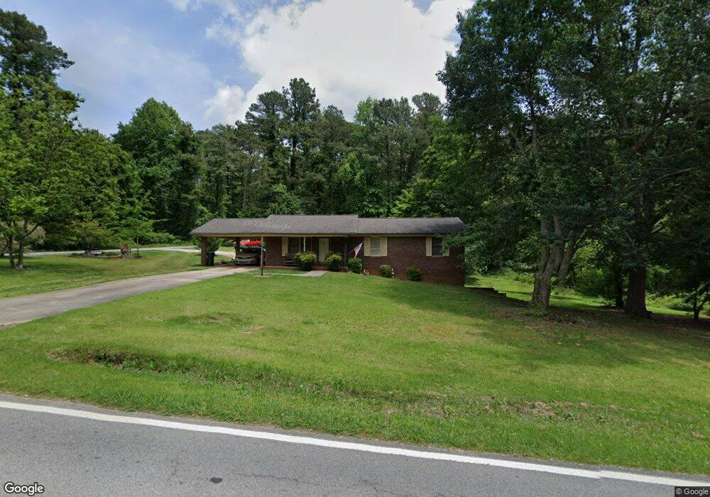
495 Fernside Dr Toccoa, GA 30577
Estimated Value: $193,649 - $239,000
3
Beds
2
Baths
1,104
Sq Ft
$203/Sq Ft
Est. Value
About This Home
This home is located at 495 Fernside Dr, Toccoa, GA 30577 and is currently estimated at $224,662, approximately $203 per square foot. 495 Fernside Dr is a home located in Stephens County with nearby schools including Stephens County High School.
Ownership History
Date
Name
Owned For
Owner Type
Purchase Details
Closed on
Jul 13, 2009
Sold by
Pruitt Adam W
Bought by
Kirk-Hess Mary Ann
Current Estimated Value
Home Financials for this Owner
Home Financials are based on the most recent Mortgage that was taken out on this home.
Original Mortgage
$112,244
Outstanding Balance
$73,475
Interest Rate
5.53%
Mortgage Type
New Conventional
Estimated Equity
$151,187
Purchase Details
Closed on
Oct 31, 2007
Sold by
Not Provided
Bought by
Kirk Hess Mary Ann
Home Financials for this Owner
Home Financials are based on the most recent Mortgage that was taken out on this home.
Original Mortgage
$103,000
Interest Rate
6.26%
Mortgage Type
New Conventional
Purchase Details
Closed on
Sep 1, 1993
Bought by
<Buyer Info Not Present>
Purchase Details
Closed on
Apr 1, 1992
Bought by
<Buyer Info Not Present>
Create a Home Valuation Report for This Property
The Home Valuation Report is an in-depth analysis detailing your home's value as well as a comparison with similar homes in the area
Purchase History
| Date | Buyer | Sale Price | Title Company |
|---|---|---|---|
| Kirk-Hess Mary Ann | $110,000 | -- | |
| Kirk Hess Mary Ann | $103,000 | -- | |
| <Buyer Info Not Present> | -- | -- | |
| <Buyer Info Not Present> | -- | -- |
Source: Public Records
Mortgage History
| Date | Status | Borrower | Loan Amount |
|---|---|---|---|
| Open | Kirk-Hess Mary Ann | $112,244 | |
| Previous Owner | Kirk Hess Mary Ann | $103,000 |
Source: Public Records
Tax History Compared to Growth
Tax History
| Year | Tax Paid | Tax Assessment Tax Assessment Total Assessment is a certain percentage of the fair market value that is determined by local assessors to be the total taxable value of land and additions on the property. | Land | Improvement |
|---|---|---|---|---|
| 2025 | $1,902 | $64,047 | $2,929 | $61,118 |
| 2024 | $1,545 | $43,347 | $2,929 | $40,418 |
| 2023 | $1,442 | $40,758 | $2,929 | $37,829 |
| 2022 | $1,159 | $38,924 | $2,929 | $35,995 |
| 2021 | $1,066 | $34,076 | $2,929 | $31,147 |
| 2020 | $1,072 | $33,953 | $2,929 | $31,024 |
| 2019 | $1,072 | $33,813 | $2,789 | $31,024 |
| 2018 | $1,072 | $33,813 | $2,789 | $31,024 |
| 2017 | $1,089 | $33,813 | $2,789 | $31,024 |
| 2016 | $1,072 | $33,813 | $2,789 | $31,024 |
| 2015 | $1,116 | $33,609 | $2,789 | $30,820 |
| 2014 | $991 | $29,349 | $2,789 | $26,560 |
| 2013 | -- | $30,046 | $3,486 | $26,560 |
Source: Public Records
Map
Nearby Homes
- 17 Collier Mill Rd
- 0 E Currahee St Unit 10544607
- 668 Brookdale Rd
- 297 Ayers Creek Dr
- 327 Ayers Creek Dr
- 405 Ayers Creek Dr
- 110 Valley Rd
- 139 Myrtle St
- 148 Moreland Dr
- 0 Moreland Dr Unit 10565201
- 593 Cross Creek Dr
- 1222 E Tugalo St
- 151 Rock Creek Rd
- 0 Hillendale Dr Unit 7660500
- 0 Hillendale Dr Unit 10618602
- 281 Line Rd
- 0 Brookhaven Cir Unit 10616964
- 43 Mountain View Dr
- 117 Glencrest Dr
- 45 Hayes St
- 33 Wesley Cir
- 38 Collier Mill Rd
- 486 Fernside Dr
- 63 Wesley Cir
- 54 Collier Mill Rd
- 63 Collier Mill Rd
- 18 Wesley Cir
- 0 Collier Mill Rd Unit LOT7 7296376
- 0 Collier Mill Rd Unit LOT5 7296384
- 0 Collier Mill Rd Unit LOT8 7296375
- 0 Collier Mill Rd Unit 7,8 8168439
- 0 Collier Mill Rd Unit 5 8168403
- 192 Shangri la Dr
- 592 Fernside Dr
- 725 Wesley Cir
- 5682 Fernside Dr
- 133 Shangri la Dr
- 111 Wesley Cir
- 78 Collier Mill Rd
- 112 Brookdale Rd