Estimated Value: $226,000 - $313,000
2
Beds
2
Baths
1,008
Sq Ft
$270/Sq Ft
Est. Value
About This Home
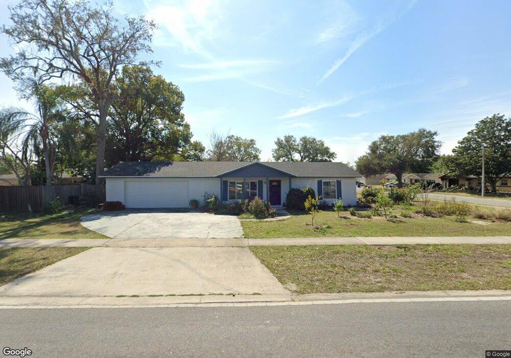
This home is located at 495 Wurst Rd, Ocoee, FL 34761 and is currently estimated at $272,571, approximately $270 per square foot. 495 Wurst Rd is a home located in Orange County with nearby schools including Spring Lake Elementary School, Ocoee Middle School, and Ocoee High School.
Ownership History
Date
Name
Owned For
Owner Type
Purchase Details
Closed on
Oct 31, 2001
Sold by
Durie S Vindich M and Vindich M Brenda E
Bought by
Vindich Brenda E
Current Estimated Value
Purchase Details
Closed on
Apr 20, 2000
Sold by
Lott John C and Lott Sharon I
Bought by
Viudich Brenda E
Home Financials for this Owner
Home Financials are based on the most recent Mortgage that was taken out on this home.
Original Mortgage
$60,000
Interest Rate
8.27%
Create a Home Valuation Report for This Property
The Home Valuation Report is an in-depth analysis detailing your home's value as well as a comparison with similar homes in the area
Home Values in the Area
Average Home Value in this Area
Purchase History
| Date | Buyer | Sale Price | Title Company |
|---|---|---|---|
| Vindich Brenda E | -- | -- | |
| Viudich Brenda E | $65,000 | -- |
Source: Public Records
Mortgage History
| Date | Status | Borrower | Loan Amount |
|---|---|---|---|
| Previous Owner | Viudich Brenda E | $60,000 |
Source: Public Records
Tax History
| Year | Tax Paid | Tax Assessment Tax Assessment Total Assessment is a certain percentage of the fair market value that is determined by local assessors to be the total taxable value of land and additions on the property. | Land | Improvement |
|---|---|---|---|---|
| 2025 | $1,156 | $66,932 | -- | -- |
| 2024 | $976 | $65,046 | -- | -- |
| 2023 | $976 | $61,372 | $0 | $0 |
| 2022 | $948 | $59,584 | $0 | $0 |
| 2021 | $945 | $57,849 | $0 | $0 |
| 2020 | $905 | $57,050 | $0 | $0 |
| 2019 | $941 | $55,767 | $0 | $0 |
| 2018 | $933 | $54,727 | $0 | $0 |
| 2017 | $934 | $105,809 | $30,000 | $75,809 |
| 2016 | $940 | $83,234 | $15,000 | $68,234 |
| 2015 | $951 | $73,944 | $15,000 | $58,944 |
| 2014 | $948 | $60,145 | $15,000 | $45,145 |
Source: Public Records
Map
Nearby Homes
- 601 Catwood Dr
- 1213 Baranova Rd
- 1500 Adair St
- 1602 Starfire Ln
- 905 Spring Creek Dr
- 1514 Lady Ave
- 1236 Russell Dr
- 1102 Bellini Ln
- 1614 Maureen Ave Unit 4
- 314 Wurst Rd
- 314 15th Ave
- 1100 Malcom Rd
- 702 Carmen Dr
- 212 Audrey St
- 1103 Malcom Rd Unit 2
- 632 Cardinal St
- 2009 Adair St
- 800 Nicole Blvd
- 1079 N Lakewood Ave
- 902 Nicole Blvd
- 1305 Baranova Rd
- 497 Wurst Rd
- 1305 Willow Creek Rd
- 1303 Baranova Rd
- 493 Wurst Rd
- 496 Wurst Rd
- 1303 Willow Creek Rd
- 1304 Baranova Rd
- 494 Wurst Rd
- 498 Wurst Rd
- 1301 Baranova Rd
- 1302 Baranova Rd
- 492 Wurst Rd
- 1301 Willow Creek Rd
- 497 Noelwood Ct
- 1300 Baranova Rd
- 501 Wurst Rd
- 486 Noelwood Ct
- 1490 Foxfire Dr
- 1225 Baranova Rd
Your Personal Tour Guide
Ask me questions while you tour the home.