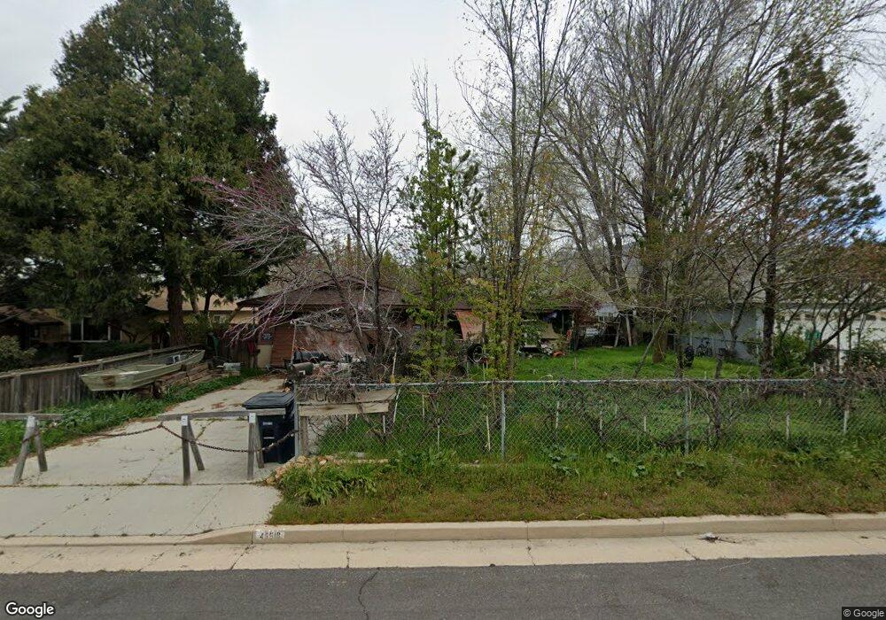
49518 Michael Ave Tehachapi, CA 93561
Estimated Value: $251,000 - $295,108
3
Beds
2
Baths
1,148
Sq Ft
$237/Sq Ft
Est. Value
About This Home
This home is located at 49518 Michael Ave, Tehachapi, CA 93561 and is currently estimated at $272,527, approximately $237 per square foot. 49518 Michael Ave is a home located in Kern County with nearby schools including Cummings Valley Elementary School, Jacobsen Middle School, and Tehachapi High School.
Ownership History
Date
Name
Owned For
Owner Type
Purchase Details
Closed on
Jul 19, 2006
Sold by
Va
Bought by
Chatos Andrew Edward
Current Estimated Value
Purchase Details
Closed on
Jun 12, 2006
Sold by
Bates Michael and Bates Evelyn
Bought by
Va
Purchase Details
Closed on
Apr 24, 2000
Sold by
Hud
Bought by
Bates Michael and Bates Evelyn
Purchase Details
Closed on
Dec 23, 1999
Sold by
Nationsbanc Mtg Corp
Bought by
Hud
Purchase Details
Closed on
Aug 18, 1999
Sold by
Keeton David W and Keeton Kathleen R
Bought by
Nationsbanc Mtg Corp
Purchase Details
Closed on
Mar 7, 1994
Sold by
Brown Kathleen R
Bought by
Keeton David W and Brown Kathleen R
Home Financials for this Owner
Home Financials are based on the most recent Mortgage that was taken out on this home.
Original Mortgage
$52,211
Interest Rate
7.79%
Mortgage Type
FHA
Create a Home Valuation Report for This Property
The Home Valuation Report is an in-depth analysis detailing your home's value as well as a comparison with similar homes in the area
Home Values in the Area
Average Home Value in this Area
Purchase History
| Date | Buyer | Sale Price | Title Company |
|---|---|---|---|
| Chatos Andrew Edward | -- | First American Title | |
| Va | $192,000 | First American Title Company | |
| Bates Michael | $45,000 | Commonwealth Land Title Ins | |
| Hud | -- | First American Title Ins Co | |
| Nationsbanc Mtg Corp | $54,786 | First American Title Co | |
| Keeton David W | -- | First American Title Ins Co |
Source: Public Records
Mortgage History
| Date | Status | Borrower | Loan Amount |
|---|---|---|---|
| Previous Owner | Keeton David W | $52,211 |
Source: Public Records
Tax History
| Year | Tax Paid | Tax Assessment Tax Assessment Total Assessment is a certain percentage of the fair market value that is determined by local assessors to be the total taxable value of land and additions on the property. | Land | Improvement |
|---|---|---|---|---|
| 2025 | $1,155 | $257,220 | $53,582 | $203,638 |
| 2024 | $1,174 | $252,178 | $52,532 | $199,646 |
| 2023 | $1,174 | $247,234 | $51,502 | $195,732 |
| 2022 | $1,248 | $242,388 | $50,493 | $191,895 |
| 2021 | $759 | $201,000 | $50,000 | $151,000 |
| 2020 | $644 | $188,000 | $47,000 | $141,000 |
| 2019 | $368 | $161,000 | $40,000 | $121,000 |
| 2018 | $311 | $152,000 | $38,000 | $114,000 |
| 2017 | $186 | $138,000 | $35,000 | $103,000 |
| 2016 | $100 | $116,000 | $29,000 | $87,000 |
| 2015 | $155 | $131,000 | $33,000 | $98,000 |
| 2014 | $100 | $113,000 | $28,000 | $85,000 |
Source: Public Records
Map
Nearby Homes
- 49517 Michael Ave
- 333 S Dennison Rd Unit 63
- 333 S Dennison Rd Unit 53
- 1165 Arabian Dr
- 600 S Dennison Rd Unit 1
- 600 S Dennison Rd Unit 27
- 600 S Dennison Rd
- 600 S Dennison Rd Unit 65
- 600 S Dennison Rd Unit 13
- 600 S Dennison Rd Unit 120
- 600 S Dennison Rd Unit 4
- 600 S Dennison Rd Unit 35
- 600 S Dennison Rd Unit 65
- 0 Goodrick Dr
- 321 E I St
- 8 Challenger Dr
- 907 Valerie Ln
- 413 Apple Way
- 211 E Tehachapi Blvd
- 321 Holly Dr
- 49520 Michael Ave
- 49516 Michael Ave
- 49519 Brett Ave
- 49517 Brett Ave
- 49521 Brett Ave
- 49522 Michael Ave
- 49514 Michael Ave
- 49515 Brett Ave
- 49519 Michael Ave
- 49523 Brett Ave
- 49512 Michael Ave
- 49523 Michael Ave
- 49515 Michael Ave
- 49513 Brett Ave
- 49513 Michael Ave
- 49510 Michael Ave
- 49518 Brett Ave
- 49516 Brett Ave
- 49511 Brett Ave
- 49520 Brett Ave
Your Personal Tour Guide
Ask me questions while you tour the home.
