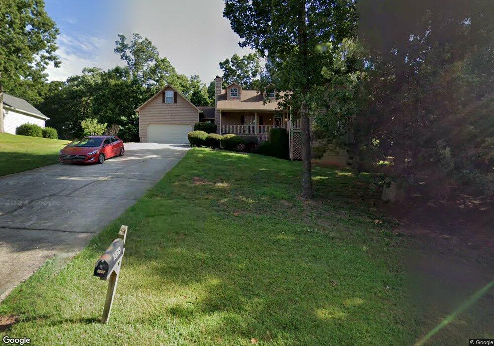
496 Mckenzie Ave Stockbridge, GA 30281
Estimated Value: $331,000 - $362,000
4
Beds
3
Baths
2,084
Sq Ft
$166/Sq Ft
Est. Value
About This Home
This home is located at 496 Mckenzie Ave, Stockbridge, GA 30281 and is currently estimated at $345,293, approximately $165 per square foot. 496 Mckenzie Ave is a home located in Henry County with nearby schools including Woodland Elementary School, Woodland Middle School, and Woodland High School.
Ownership History
Date
Name
Owned For
Owner Type
Purchase Details
Closed on
Jun 29, 2007
Sold by
Carnaggio John T
Bought by
Terry Tracy S and Daniels Terry Tracy
Current Estimated Value
Home Financials for this Owner
Home Financials are based on the most recent Mortgage that was taken out on this home.
Original Mortgage
$187,956
Outstanding Balance
$116,002
Interest Rate
6.35%
Mortgage Type
VA
Estimated Equity
$229,291
Purchase Details
Closed on
Oct 31, 1995
Sold by
Homesinc Georgia
Bought by
Carnaggio John Alisa
Create a Home Valuation Report for This Property
The Home Valuation Report is an in-depth analysis detailing your home's value as well as a comparison with similar homes in the area
Home Values in the Area
Average Home Value in this Area
Purchase History
| Date | Buyer | Sale Price | Title Company |
|---|---|---|---|
| Terry Tracy S | $184,000 | -- | |
| Carnaggio John Alisa | $124,500 | -- |
Source: Public Records
Mortgage History
| Date | Status | Borrower | Loan Amount |
|---|---|---|---|
| Open | Terry Tracy S | $187,956 | |
| Closed | Carnaggio John Alisa | $0 |
Source: Public Records
Tax History Compared to Growth
Tax History
| Year | Tax Paid | Tax Assessment Tax Assessment Total Assessment is a certain percentage of the fair market value that is determined by local assessors to be the total taxable value of land and additions on the property. | Land | Improvement |
|---|---|---|---|---|
| 2025 | $4,180 | $149,868 | $18,000 | $131,868 |
| 2024 | $4,180 | $135,480 | $18,000 | $117,480 |
| 2023 | $3,472 | $136,120 | $16,000 | $120,120 |
| 2022 | $3,301 | $107,520 | $12,000 | $95,520 |
| 2021 | $2,898 | $90,440 | $12,000 | $78,440 |
| 2020 | $2,763 | $84,760 | $10,800 | $73,960 |
| 2019 | $2,706 | $82,320 | $10,800 | $71,520 |
| 2018 | $2,552 | $75,800 | $10,000 | $65,800 |
| 2016 | $2,151 | $61,440 | $10,000 | $51,440 |
| 2015 | $1,897 | $53,600 | $7,200 | $46,400 |
| 2014 | $1,778 | $50,160 | $7,200 | $42,960 |
Source: Public Records
Map
Nearby Homes
- 0 Mckenzie Ave Unit 10593345
- 564 Mckenzie Ave
- 320 Mckenzie Dr
- 164 Mckenzie Ct
- 719 Erin Dr
- 1720 Highway 138 E
- 805 Anna Kathryn Dr
- 825 Anna Kathryn Dr
- 809 Anna Kathryn Dr
- 807 Anna Kathryn Dr
- 829 Anna Kathryn Dr
- 830 Anna Kathryn Dr
- 811 Anna Kathryn Dr
- 831 Anna Kathryn Dr
- 813 Anna Kathryn Dr
- 551 Hood Rd
- 1810 Highway 138 E
- 95 Fern Ct
- 65 Wynfield Dr
- 100 Kim Trail
- 488 Mckenzie Ave
- 504 Mckenzie Ave
- 325 Mckenzie Dr
- 495 Mckenzie Ave
- 480 Mckenzie Ave
- 333 Mckenzie Dr
- 512 Mckenzie Ave
- 317 Mckenzie Dr
- 481 Mckenzie Ave
- 503 Mckenzie Ave
- 341 Mckenzie Dr
- 341 Mckenzie Dr Unit 40
- 309 Mckenzie Dr Unit 26
- 309 Mckenzie Dr
- 472 Mckenzie Ave
- 520 Mckenzie Ave
- 1 Room McKenzie Subdivision
- 1 Room In McKenzie Subdivision
- 1 Mckenzie Ave
- 625 Mckenzie Cir