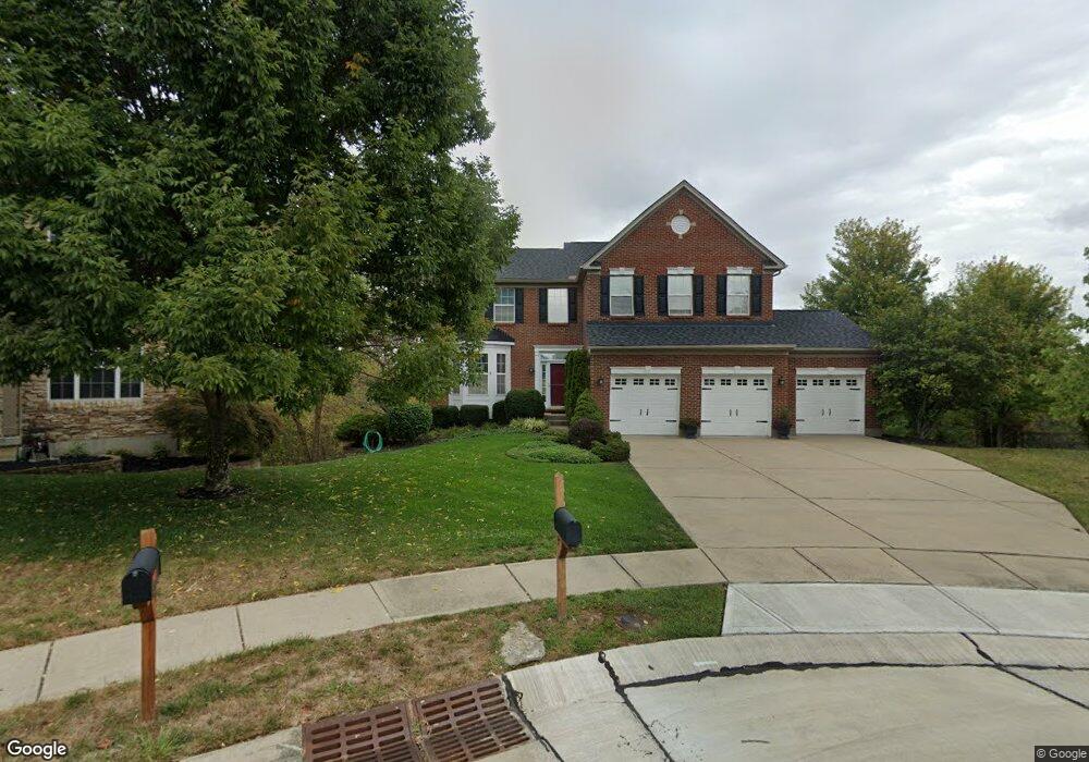
4967 Sundance Dr Independence, KY 41051
Estimated Value: $386,000 - $486,000
4
Beds
3
Baths
3,032
Sq Ft
$149/Sq Ft
Est. Value
About This Home
This home is located at 4967 Sundance Dr, Independence, KY 41051 and is currently estimated at $450,359, approximately $148 per square foot. 4967 Sundance Dr is a home located in Kenton County with nearby schools including Simon Kenton High School, St. Cecilia Catholic School, and Calvary Christian School.
Ownership History
Date
Name
Owned For
Owner Type
Purchase Details
Closed on
May 12, 2023
Sold by
Acuff Tracy A and Acuff Tammy S
Bought by
Rober And Virginia Ferrell Family Trust
Current Estimated Value
Purchase Details
Closed on
Jan 24, 2007
Sold by
Ferrel Robert Murray and Ferrell Virginia Ohara
Bought by
Ferrell Robert Murray and Ferrell Virginia Ohara
Purchase Details
Closed on
Feb 16, 2006
Sold by
The Ryland Group Inc
Bought by
Ferrell Robert and Ferrell Virginia
Home Financials for this Owner
Home Financials are based on the most recent Mortgage that was taken out on this home.
Original Mortgage
$234,600
Interest Rate
6.08%
Mortgage Type
Fannie Mae Freddie Mac
Purchase Details
Closed on
Feb 22, 2005
Sold by
Great Development Properties Inc
Bought by
The Ryland Group Inc
Create a Home Valuation Report for This Property
The Home Valuation Report is an in-depth analysis detailing your home's value as well as a comparison with similar homes in the area
Home Values in the Area
Average Home Value in this Area
Purchase History
| Date | Buyer | Sale Price | Title Company |
|---|---|---|---|
| Rober And Virginia Ferrell Family Trust | -- | None Listed On Document | |
| Rober And Virginia Ferrell Family Trust | -- | None Listed On Document | |
| Acuff Tracy A | -- | None Listed On Document | |
| Acuff Tracy A | -- | None Listed On Document | |
| Ferrell Robert Murray | -- | None Available | |
| Ferrell Robert | $335,172 | Ryland Title Company | |
| The Ryland Group Inc | $1,215,375 | Ryland Title Company |
Source: Public Records
Mortgage History
| Date | Status | Borrower | Loan Amount |
|---|---|---|---|
| Previous Owner | Ferrell Robert | $234,600 |
Source: Public Records
Tax History
| Year | Tax Paid | Tax Assessment Tax Assessment Total Assessment is a certain percentage of the fair market value that is determined by local assessors to be the total taxable value of land and additions on the property. | Land | Improvement |
|---|---|---|---|---|
| 2025 | $4,003 | $393,300 | $45,000 | $348,300 |
| 2024 | $3,324 | $317,700 | $35,500 | $282,200 |
| 2023 | $3,417 | $317,200 | $35,000 | $282,200 |
| 2022 | $3,546 | $317,200 | $35,000 | $282,200 |
| 2021 | $3,599 | $317,200 | $35,000 | $282,200 |
| 2020 | $3,076 | $270,000 | $30,000 | $240,000 |
| 2019 | $3,085 | $270,000 | $30,000 | $240,000 |
| 2018 | $3,124 | $270,000 | $30,000 | $240,000 |
| 2017 | $3,038 | $270,000 | $30,000 | $240,000 |
| 2015 | $3,422 | $270,000 | $35,000 | $235,000 |
| 2014 | $3,374 | $270,000 | $35,000 | $235,000 |
Source: Public Records
Map
Nearby Homes
- 4828 Far Hills Dr
- 4758 Fowler Creek Rd
- 2072 Crown Vetch Dr
- 1884 Bridle Path
- 4358 Siffel Ct
- 3852 Sherbourne Dr
- 46 Waterside Way
- 10444 Canberra Dr
- SHELBURN Plan at Sherbourne - Sherbourne Summits
- QUENTIN Plan at Sherbourne - Sherbourne Summits
- 1346 Brisbane Ct
- 3981 Sherbourne Dr
- 64 Sherwood Dr
- 10363 Canberra Dr
- 1443 Shirepeak Way
- 83 Pitman Ct
- 1192 Hands Pike
- 1 Ridgeport Dr
- 10 Ridgeport Dr
- 3929 Crestside Ct Unit 126H
- 4964 Sundance Dr
- 4961 Sundance Dr
- 4960 Sundance Dr
- 4957 Sundance Dr
- 4963 Sundance Dr
- 4956 Sundance Dr
- 4953 Sundance Dr
- 4952 Sundance Dr
- 2161 Golden Valley Dr
- 2157 Golden Valley Dr
- 4949 Sundance Dr
- 4949 Sundance Dr Unit 229
- 4944 Sundance Dr
- 2153 Golden Valley Dr
- 2162 Golden Valley Dr
- 2162 Golden Valley Dr Unit 248
- 4945 Sundance Dr
- 2149 Golden Valley Dr
- 4934 Sundance Dr
- 4941 Sundance Dr
Your Personal Tour Guide
Ask me questions while you tour the home.