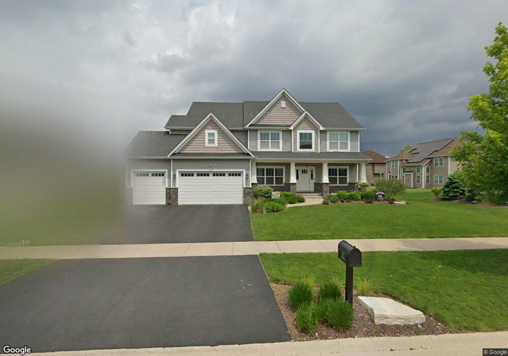
497 Bloomfield Cir W Oswego, IL 60543
South Oswego NeighborhoodEstimated Value: $637,000 - $674,000
3
Beds
4
Baths
3,568
Sq Ft
$183/Sq Ft
Est. Value
About This Home
This home is located at 497 Bloomfield Cir W, Oswego, IL 60543 and is currently estimated at $654,137, approximately $183 per square foot. 497 Bloomfield Cir W is a home with nearby schools including Southbury Elementary School, Traughber Junior High School, and Oswego High School.
Ownership History
Date
Name
Owned For
Owner Type
Purchase Details
Closed on
Dec 28, 2015
Sold by
Mccue Builders Inc
Bought by
Dietz Robert W and Dietz Heather M
Current Estimated Value
Home Financials for this Owner
Home Financials are based on the most recent Mortgage that was taken out on this home.
Original Mortgage
$352,400
Outstanding Balance
$282,900
Interest Rate
4.25%
Mortgage Type
New Conventional
Estimated Equity
$371,237
Purchase Details
Closed on
Jun 9, 2006
Sold by
Faganel Const Mgmt Banbury Ridge Inc
Bought by
Mc Cue Builders Inc
Create a Home Valuation Report for This Property
The Home Valuation Report is an in-depth analysis detailing your home's value as well as a comparison with similar homes in the area
Home Values in the Area
Average Home Value in this Area
Purchase History
| Date | Buyer | Sale Price | Title Company |
|---|---|---|---|
| Dietz Robert W | $441,000 | Wheatland Title Guaranty | |
| Mc Cue Builders Inc | $1,087,000 | Chicago Title Insurance Co |
Source: Public Records
Mortgage History
| Date | Status | Borrower | Loan Amount |
|---|---|---|---|
| Open | Dietz Robert W | $352,400 |
Source: Public Records
Tax History Compared to Growth
Tax History
| Year | Tax Paid | Tax Assessment Tax Assessment Total Assessment is a certain percentage of the fair market value that is determined by local assessors to be the total taxable value of land and additions on the property. | Land | Improvement |
|---|---|---|---|---|
| 2024 | $15,231 | $195,264 | $33,210 | $162,054 |
| 2023 | $14,304 | $175,914 | $29,919 | $145,995 |
| 2022 | $14,304 | $164,406 | $27,962 | $136,444 |
| 2021 | $13,815 | $153,651 | $26,133 | $127,518 |
| 2020 | $13,130 | $144,954 | $24,654 | $120,300 |
| 2019 | $13,111 | $142,583 | $24,654 | $117,929 |
| 2018 | $12,888 | $136,915 | $23,674 | $113,241 |
| 2017 | $13,146 | $134,231 | $23,210 | $111,021 |
| 2016 | $13,513 | $135,918 | $30,483 | $105,435 |
| 2015 | -- | $16 | $16 | $0 |
| 2014 | -- | $16 | $16 | $0 |
| 2013 | -- | $16 | $16 | $0 |
Source: Public Records
Map
Nearby Homes
- 80 Stonehill Rd
- 94 Templeton Dr
- 809 Canton Dr
- 706 Springside Ct
- 748 Juniper St
- 210 Dorset Ave
- 521 Litchfield Way
- 747 Fairfield Dr
- 749 Fairfield Dr
- 230 Piper Glen Ave
- 555 Litchfield Way
- 621 Mansfield Way
- 633 Mansfield Way
- 318 Monica Ln
- 2489 Semillon St
- 2486 Semillon St
- 2319 Hirsch Dr
- 612 Murdock Place
- 2492 Semillon St
- 2259 Riesling Rd
- 495 Bloomfield Cir W
- 595 Colchester Dr
- 597 Colchester Dr
- 493 Bloomfield Cir W
- 599 Colchester Dr
- 494 Bloomfield Cir W
- 496 Bloomfield Cir W
- 498 Bloomfield Cir W
- 500 Bloomfield Cir W
- 492 Bloomfield Cir W
- 489 Bloomfield Cir W
- 589 Colchester Dr
- 490 Bloomfield Cir W
- 600 Colchester Dr
- 596 Colchester Dr
- 598 Colchester Dr
- 205 Redding Ct
- 488 Bloomfield Cir W
- 487 Bloomfield Cir W
- 207 Redding Ct