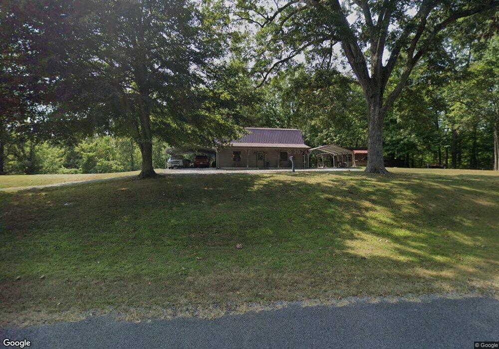
4971 Rogers Marshall Rd Union City, TN 38261
Estimated Value: $147,513 - $190,000
--
Bed
2
Baths
1,123
Sq Ft
$147/Sq Ft
Est. Value
About This Home
This home is located at 4971 Rogers Marshall Rd, Union City, TN 38261 and is currently estimated at $164,628, approximately $146 per square foot. 4971 Rogers Marshall Rd is a home located in Obion County.
Ownership History
Date
Name
Owned For
Owner Type
Purchase Details
Closed on
Apr 4, 2003
Bought by
Michael Lawson
Current Estimated Value
Purchase Details
Closed on
Jan 8, 2003
Sold by
Calhoun Joey E
Bought by
Steve Calhoun
Purchase Details
Closed on
Nov 26, 2002
Bought by
Calhoun Joey E
Purchase Details
Closed on
Jul 12, 1999
Sold by
Danny Pruitt
Bought by
Sammy Driver
Purchase Details
Closed on
Jul 19, 1994
Bought by
Pruitt Danny and Pruitt Teresa
Purchase Details
Closed on
Feb 10, 1993
Bought by
Williams Larry G and Williams Joyce C
Create a Home Valuation Report for This Property
The Home Valuation Report is an in-depth analysis detailing your home's value as well as a comparison with similar homes in the area
Home Values in the Area
Average Home Value in this Area
Purchase History
| Date | Buyer | Sale Price | Title Company |
|---|---|---|---|
| Michael Lawson | $7,500 | -- | |
| Steve Calhoun | $6,633 | -- | |
| Calhoun Joey E | $8,000 | -- | |
| Sammy Driver | $5,000 | -- | |
| Pruitt Danny | $22,000 | -- | |
| Williams Larry G | -- | -- |
Source: Public Records
Tax History Compared to Growth
Tax History
| Year | Tax Paid | Tax Assessment Tax Assessment Total Assessment is a certain percentage of the fair market value that is determined by local assessors to be the total taxable value of land and additions on the property. | Land | Improvement |
|---|---|---|---|---|
| 2025 | $393 | $28,450 | $0 | $0 |
| 2024 | $393 | $28,450 | $1,500 | $26,950 |
| 2023 | $393 | $28,450 | $1,500 | $26,950 |
| 2022 | $355 | $18,675 | $1,625 | $17,050 |
| 2021 | $355 | $18,675 | $1,625 | $17,050 |
| 2020 | $342 | $18,675 | $1,625 | $17,050 |
| 2019 | $342 | $18,025 | $1,625 | $16,400 |
| 2018 | $343 | $18,025 | $1,625 | $16,400 |
| 2017 | $375 | $18,700 | $1,625 | $17,075 |
| 2016 | $375 | $18,700 | $1,625 | $17,075 |
| 2015 | $375 | $18,700 | $1,625 | $17,075 |
| 2014 | $375 | $18,700 | $1,625 | $17,075 |
Source: Public Records
Map
Nearby Homes
- 5030 Rogers Marshall Rd
- 4744 N Clayton Antioch Rd
- 3272 St Rt 925
- 1559 Ella Groom Rd
- 0 Bogus Hollow Rd
- 3454 Treece Rd
- 0 Walnut Logging Rd
- 0 Denson Rd
- 1127 W Shawtown Rd
- Tract 1 Walter Whipple Rd
- 4478 Crystal Rd
- 3216 W Shawtown Rd
- 317 W Highway 22
- 3232 W Shawtown Rd
- 72 W Highway 22
- 4310 Old Samburg Rd
- 560 Todd Thomas Rd
- 848 Bethel Church Rd
- 0 Burrus Rd
- 3105 Rock Springs Extended Rd
- 4949 Rogers Marshall Rd
- 5083 Rogers Marshall Rd
- 5115 Rogers Marshall Rd
- 4820 Rogers Marshall Rd
- 4740 Rogers Marshall Rd
- 2715 W Highway 22
- 2798 W Highway 22
- 2681 W Highway 22
- 2651 W Highway 22
- 5276 Rogers Marshall Rd
- 5159 Morris Rd
- 2898 W Highway 22
- 2298 W Main St
- 5140 N Clayton Antioch Rd
- 5140 N Clayton Antioch Rd
- 2948 W Highway 22
- 5319 Morris Rd
- 5459 Morris Rd
- 3008 W Highway 22