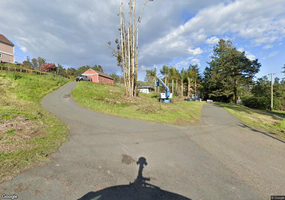
4993 Canfield Hill Ln Petaluma, CA 94952
Estimated Value: $1,726,079 - $1,831,000
4
Beds
3
Baths
2,080
Sq Ft
$855/Sq Ft
Est. Value
About This Home
This home is located at 4993 Canfield Hill Ln, Petaluma, CA 94952 and is currently estimated at $1,778,540, approximately $855 per square foot. 4993 Canfield Hill Ln is a home located in Sonoma County with nearby schools including Dunham Elementary School, Petaluma Junior High School, and Petaluma High School.
Ownership History
Date
Name
Owned For
Owner Type
Purchase Details
Closed on
Sep 14, 2015
Sold by
Hammer James B and Hammer Linda L
Bought by
Morse Daren and Le Vy
Current Estimated Value
Home Financials for this Owner
Home Financials are based on the most recent Mortgage that was taken out on this home.
Original Mortgage
$839,960
Outstanding Balance
$656,108
Interest Rate
3.75%
Mortgage Type
New Conventional
Estimated Equity
$1,122,432
Purchase Details
Closed on
Jan 6, 1995
Sold by
Hammer James B and Hammer Linda L
Bought by
The Hammer Family 1994 Living Trust
Create a Home Valuation Report for This Property
The Home Valuation Report is an in-depth analysis detailing your home's value as well as a comparison with similar homes in the area
Home Values in the Area
Average Home Value in this Area
Purchase History
| Date | Buyer | Sale Price | Title Company |
|---|---|---|---|
| Morse Daren | $1,050,000 | Stewart Title Of Ca Inc | |
| Hammer James B | -- | Stewart Title Of Ca Inc | |
| The Hammer Family 1994 Living Trust | -- | -- |
Source: Public Records
Mortgage History
| Date | Status | Borrower | Loan Amount |
|---|---|---|---|
| Open | Morse Daren | $839,960 |
Source: Public Records
Tax History Compared to Growth
Tax History
| Year | Tax Paid | Tax Assessment Tax Assessment Total Assessment is a certain percentage of the fair market value that is determined by local assessors to be the total taxable value of land and additions on the property. | Land | Improvement |
|---|---|---|---|---|
| 2025 | $14,298 | $1,242,920 | $497,191 | $745,729 |
| 2024 | $14,298 | $1,218,550 | $487,443 | $731,107 |
| 2023 | $14,298 | $1,194,658 | $477,886 | $716,772 |
| 2022 | $13,579 | $1,171,234 | $468,516 | $702,718 |
| 2021 | $13,293 | $1,148,270 | $459,330 | $688,940 |
| 2020 | $13,306 | $1,136,497 | $454,621 | $681,876 |
| 2019 | $12,758 | $1,114,213 | $445,707 | $668,506 |
| 2018 | $12,547 | $1,092,367 | $436,968 | $655,399 |
| 2017 | $11,986 | $1,070,949 | $428,400 | $642,549 |
| 2016 | $11,796 | $1,049,950 | $420,000 | $629,950 |
| 2015 | $4,257 | $372,740 | $100,248 | $272,492 |
| 2014 | -- | $365,440 | $98,285 | $267,155 |
Source: Public Records
Map
Nearby Homes
- 5611 Blank Rd
- 6000 Petersen Rd
- 6675 Petersen Rd
- 5301 Hutchinson Rd
- 5227 Wendell Ln
- 4201 Bloomfield Rd
- 5300 Gravenstein Hwy S
- 5601 S Gravenstein Hwy
- 3765 Twig Ave
- 1415 Schaeffer Rd
- 3920 Gravenstein Hwy S
- 3790 Gravenstein Hwy S
- 3370 Pharoahs Ln
- 6700 Moro St
- 5111 Todd Rd
- 6067 Gilmore Ave
- 2705 Roblar Rd
- 1850 Blucher Valley Rd
- 6140 Gilmore Ave
- 5816 Lowell Ct
- 4983 Canfield Rd
- 4995 Canfield Rd
- 4981 Canfield Hill Ln
- 200 Vlaardingen Ln
- 4963 Canfield Hill Ln
- 5000 Canfield Rd
- 300 Vlaardingen Ln
- 500 Vlaardingen Ln
- 400 Vlaardingen Ln
- 6245 Roblar Rd
- 6220 Roblar Rd
- 4205 Canfield Rd
- 6221 Roblar Rd
- 6030 Roblar Rd
- 4200 Canfield Rd
- 6025 Roblar Rd
- 5881 Roblar Rd
- 5900 Roblar Rd
- 6010 Roblar Rd
- 5990 Roblar Rd
