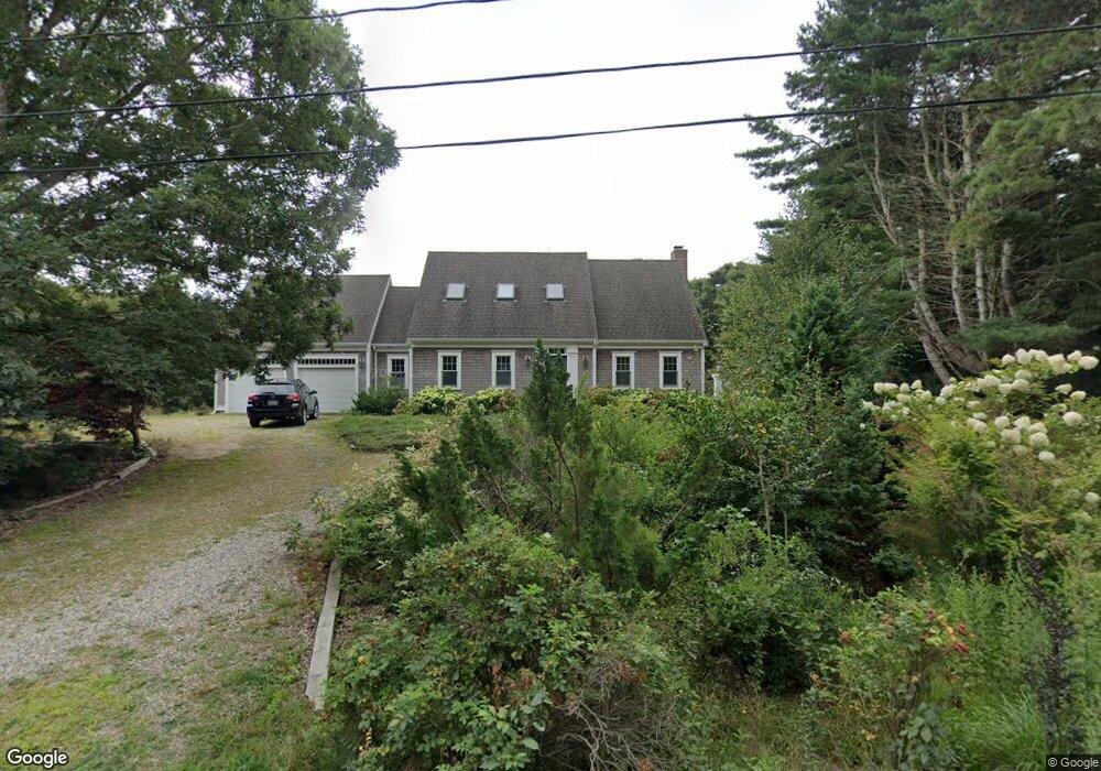
5 Bridge Pond Dr Eastham, MA 2642
Estimated Value: $1,007,000 - $1,498,000
3
Beds
3
Baths
2,026
Sq Ft
$638/Sq Ft
Est. Value
About This Home
This home is located at 5 Bridge Pond Dr, Eastham, MA 2642 and is currently estimated at $1,292,014, approximately $637 per square foot. 5 Bridge Pond Dr is a home located in Barnstable County with nearby schools including Eastham Elementary School, Nauset Regional Middle School, and Nauset Regional High School.
Ownership History
Date
Name
Owned For
Owner Type
Purchase Details
Closed on
Oct 30, 2017
Sold by
Reynolds Eileen W and Meade Reynolds F
Bought by
E & M Reynols Ft
Current Estimated Value
Purchase Details
Closed on
Oct 26, 2017
Sold by
Reynolds Eileen W and Meade Reynolds F
Bought by
E & M Reynols Ft
Purchase Details
Closed on
May 30, 1975
Bought by
Reynolds F Meade and Reynolds Eileen W
Create a Home Valuation Report for This Property
The Home Valuation Report is an in-depth analysis detailing your home's value as well as a comparison with similar homes in the area
Home Values in the Area
Average Home Value in this Area
Purchase History
| Date | Buyer | Sale Price | Title Company |
|---|---|---|---|
| E & M Reynols Ft | -- | -- | |
| E & M Reynols Ft | -- | -- | |
| Reynolds F Meade | -- | -- |
Source: Public Records
Tax History Compared to Growth
Tax History
| Year | Tax Paid | Tax Assessment Tax Assessment Total Assessment is a certain percentage of the fair market value that is determined by local assessors to be the total taxable value of land and additions on the property. | Land | Improvement |
|---|---|---|---|---|
| 2025 | $10,378 | $1,346,000 | $571,300 | $774,700 |
| 2024 | $9,215 | $1,314,500 | $554,600 | $759,900 |
| 2023 | $8,561 | $1,182,400 | $513,600 | $668,800 |
| 2022 | $8,072 | $940,800 | $458,500 | $482,300 |
| 2021 | $4,703 | $859,600 | $416,800 | $442,800 |
| 2020 | $7,360 | $844,000 | $425,400 | $418,600 |
| 2019 | $6,797 | $823,900 | $413,000 | $410,900 |
| 2018 | $2,350 | $784,100 | $380,900 | $403,200 |
| 2017 | $6,104 | $772,700 | $373,400 | $399,300 |
| 2016 | $5,151 | $692,300 | $314,500 | $377,800 |
| 2015 | $4,821 | $679,000 | $308,300 | $370,700 |
Source: Public Records
Map
Nearby Homes
- 1295 Herring Brook Rd
- 645 Samoset Rd
- 45 Cranberry Cir
- 4 Wood Duck Ln
- 10 Cartway N
- 10 Field Rd
- 60 Briggs Field Rd
- 45 Starlight Ln
- 10 Alston Ct
- 85 Huckleberry Ln
- 180 Country Ln
- 255 Massasoit Rd
- 20 Redberry Ln
- 1975 State Hwy Unit 3
- 1975 State Hwy Unit 5
- 10 Surrey Dr
- 1875 State Hwy
- 100 Orchard Dr
- 125 Bay Rd
- 330 Hay Rd
- 1325 Herring Brook Rd
- 15 Bridge Pond Dr
- 10 Bridge Pond Dr
- 25 Bridge Pond Dr
- 20 Bridge Pond Dr
- 1205 Herring Brook Rd
- 45 Bowline Ln
- 5 Billingsgate Ave
- 1200 Herring Brook Rd
- 30 Bridge Pond Dr
- 35 Bridge Pond Dr
- 15 Billingsgate Ave
- 1175 Herring Brook Rd
- 40 Bridge Pond Dr
- 35 Bowline Ln
- 45 Bridge Pond Dr
- 25 Billingsgate Ave
- 1180 Herring Brook Rd
- 10 Billingsgate Ave
- 100 Cole Rd