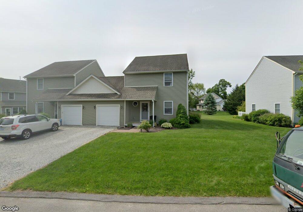
5 Captains Dr Westerly, RI 02891
Estimated Value: $584,245 - $672,000
3
Beds
3
Baths
1,540
Sq Ft
$411/Sq Ft
Est. Value
About This Home
This home is located at 5 Captains Dr, Westerly, RI 02891 and is currently estimated at $632,811, approximately $410 per square foot. 5 Captains Dr is a home located in Washington County with nearby schools including Westerly High School and St. Michael School.
Ownership History
Date
Name
Owned For
Owner Type
Purchase Details
Closed on
Jan 30, 2009
Sold by
Future Homes Llc
Bought by
Angelone Joanne M
Current Estimated Value
Home Financials for this Owner
Home Financials are based on the most recent Mortgage that was taken out on this home.
Original Mortgage
$209,000
Interest Rate
5.28%
Mortgage Type
Purchase Money Mortgage
Create a Home Valuation Report for This Property
The Home Valuation Report is an in-depth analysis detailing your home's value as well as a comparison with similar homes in the area
Home Values in the Area
Average Home Value in this Area
Purchase History
| Date | Buyer | Sale Price | Title Company |
|---|---|---|---|
| Angelone Joanne M | $295,000 | -- |
Source: Public Records
Mortgage History
| Date | Status | Borrower | Loan Amount |
|---|---|---|---|
| Open | Angelone Joanne M | $202,000 | |
| Closed | Angelone Joanne M | $209,000 |
Source: Public Records
Tax History
| Year | Tax Paid | Tax Assessment Tax Assessment Total Assessment is a certain percentage of the fair market value that is determined by local assessors to be the total taxable value of land and additions on the property. | Land | Improvement |
|---|---|---|---|---|
| 2025 | $3,299 | $424,100 | $0 | $424,100 |
| 2024 | $3,900 | $373,200 | $0 | $373,200 |
| 2023 | $3,792 | $373,200 | $0 | $373,200 |
| 2022 | $3,316 | $328,300 | $0 | $328,300 |
| 2021 | $3,677 | $304,900 | $0 | $304,900 |
| 2020 | $3,613 | $304,900 | $0 | $304,900 |
| 2019 | $3,580 | $304,900 | $0 | $304,900 |
| 2018 | $3,453 | $279,600 | $0 | $279,600 |
| 2017 | $3,355 | $279,600 | $0 | $279,600 |
| 2016 | $3,355 | $279,600 | $0 | $279,600 |
| 2015 | $3,242 | $288,700 | $0 | $288,700 |
| 2014 | $3,190 | $288,700 | $0 | $288,700 |
Source: Public Records
Map
Nearby Homes
- 18 Timothy Dr
- 24 Abbey Ln Unit 13
- 23 Abbey Ln Unit 12
- 19 Crestview Dr Unit C
- 22 Summertime Cir
- 23 Summertime Cir
- 21 North Dr
- 38 Summertime Cir
- 45 Summertime Cir
- 39 Summertime Cir
- 25 Summertime Cir
- 33 Whipple Ave
- 16 Green Ave
- 0 Green Ave
- 417 River Rd
- 10 Tristam St
- 16 Spring St
- 25 School St Unit 2
- 8 Kettle Close
- 4 Shore Rd
- 5 Captains Dr Unit 5B
- 3 Captains Dr
- 7 Captains Dr
- 7 Captains Dr Unit 20A
- 1 Captains Dr
- 1 Captains Dr Unit 1A
- 1 Captains Dr Unit 1B
- 6 Captains Dr
- 2 Captains Dr
- 2 Captains Dr Unit 2
- 2 Captain's Watch Unit 23A
- 8 Captains Dr
- 6 Captain's Watch Unit 1A
- 8 Captain's Watch Unit 1B
- 3 Gull Terrace
- 3 Gull Terrace Unit 19B
- 160 Beach St
- 0 Captains Dr Unit 19 B
- 0 Captains Dr Unit 19 B
- 0 Captains Dr Unit 19A
Your Personal Tour Guide
Ask me questions while you tour the home.