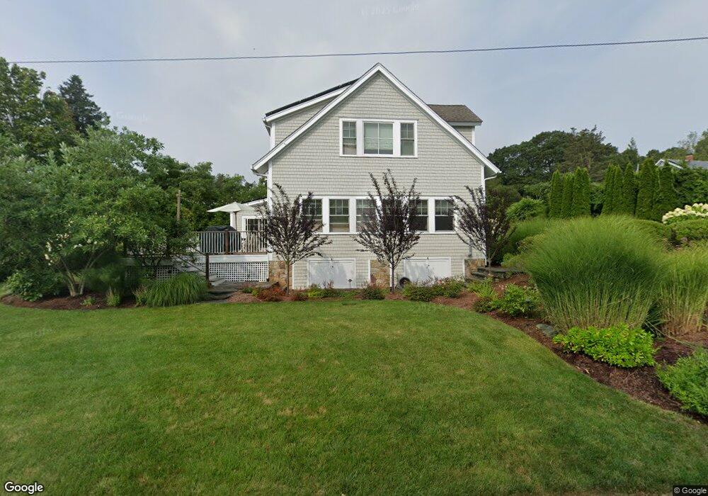
5 Curtis Rd Saunderstown, RI 02874
Saunderstown NeighborhoodEstimated Value: $986,000 - $1,581,000
3
Beds
2
Baths
1,741
Sq Ft
$752/Sq Ft
Est. Value
About This Home
This home is located at 5 Curtis Rd, Saunderstown, RI 02874 and is currently estimated at $1,309,714, approximately $752 per square foot. 5 Curtis Rd is a home located in Washington County with nearby schools including Hamilton Elementary School, Wickford Middle School, and North Kingstown Sr. High School.
Ownership History
Date
Name
Owned For
Owner Type
Purchase Details
Closed on
Oct 18, 2017
Sold by
Mccall Donald S and Mccall Lynn A
Bought by
Donald S Mccall Ret
Current Estimated Value
Purchase Details
Closed on
Feb 9, 2011
Sold by
Sweenor Brian
Bought by
Mccall Donald S and Mccall Lynn A
Purchase Details
Closed on
Mar 28, 2006
Sold by
Gustafson Frank N and Gustafson Linda
Bought by
Sweenor Brian
Create a Home Valuation Report for This Property
The Home Valuation Report is an in-depth analysis detailing your home's value as well as a comparison with similar homes in the area
Home Values in the Area
Average Home Value in this Area
Purchase History
| Date | Buyer | Sale Price | Title Company |
|---|---|---|---|
| Donald S Mccall Ret | -- | -- | |
| Mccall Donald S | $352,000 | -- | |
| Sweenor Brian | $620,000 | -- |
Source: Public Records
Mortgage History
| Date | Status | Borrower | Loan Amount |
|---|---|---|---|
| Previous Owner | Sweenor Brian | $750,000 | |
| Previous Owner | Sweenor Brian | $600,000 | |
| Previous Owner | Sweenor Brian | $600,000 |
Source: Public Records
Tax History Compared to Growth
Tax History
| Year | Tax Paid | Tax Assessment Tax Assessment Total Assessment is a certain percentage of the fair market value that is determined by local assessors to be the total taxable value of land and additions on the property. | Land | Improvement |
|---|---|---|---|---|
| 2025 | $11,358 | $1,028,800 | $507,200 | $521,600 |
| 2024 | $11,580 | $807,500 | $355,100 | $452,400 |
| 2023 | $11,580 | $807,500 | $355,100 | $452,400 |
| 2022 | $11,353 | $807,500 | $355,100 | $452,400 |
| 2021 | $10,624 | $607,100 | $225,500 | $381,600 |
| 2020 | $10,375 | $607,100 | $225,500 | $381,600 |
| 2019 | $10,375 | $607,100 | $225,500 | $381,600 |
| 2018 | $10,418 | $549,200 | $246,700 | $302,500 |
| 2017 | $10,210 | $549,200 | $246,700 | $302,500 |
| 2016 | $9,919 | $549,200 | $246,700 | $302,500 |
| 2015 | $10,013 | $518,800 | $229,100 | $289,700 |
| 2014 | $9,811 | $518,800 | $229,100 | $289,700 |
Source: Public Records
Map
Nearby Homes
- 10 Highland Rd
- 121 Seaside Dr
- 73 Oceanwoods Dr
- 94 Spindrift St
- 127 Oceanwoods Dr
- 174 Seaside Dr
- 21 Helm St
- 31 Stanchion St
- 2180 Tower Hill Rd
- 2424 Tower Hill Rd
- 51 Salisbury Ave
- 86 Spanker St
- 49 Meadow Sweet Trail
- 58 Dolphin St
- 47 Wake Robin Trail
- 625 N Main Rd
- 65 Village Hill Ln
- 46 Hillside Ct
- 229 Earle Dr
- 297 Walmsley Ln
- 15 Curtis Rd
- 18 Curtis Rd
- 20 Curtis Rd
- 121 Harbor View Ave
- 23 Curtis Rd
- 110 Hillside St
- 110 Hill Side St
- 30 Curtis Rd
- 98 Hill Side St
- 101 Tefft St
- 35 Curtis Rd
- 101 Hill Side St
- 114 Spring St
- 55 Wilbur Hazard Rd
- 100 Top Hill Rd
- 80 Hillside St
- 80 Hill Side St
- 170 Champlin Rd
- 73 Wilbur Hazard Rd
- 0 Meadow Terrace