Estimated Value: $548,792 - $643,000
3
Beds
3
Baths
2,256
Sq Ft
$262/Sq Ft
Est. Value
About This Home
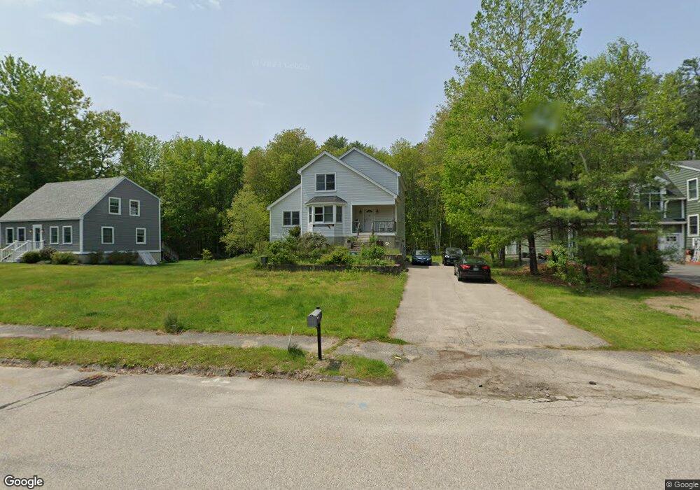
This home is located at 5 Dean Dr, Dover, NH 03820 and is currently estimated at $591,698, approximately $262 per square foot. 5 Dean Dr is a home located in Strafford County with nearby schools including Woodman Park School, Dover Middle School, and Dover Senior High School.
Ownership History
Date
Name
Owned For
Owner Type
Purchase Details
Closed on
Mar 1, 2021
Sold by
Bent Ft
Bought by
Bent Taylr F and Mason Kelsey M
Current Estimated Value
Home Financials for this Owner
Home Financials are based on the most recent Mortgage that was taken out on this home.
Original Mortgage
$284,900
Outstanding Balance
$255,393
Interest Rate
2.7%
Mortgage Type
FHA
Estimated Equity
$336,305
Purchase Details
Closed on
Apr 20, 2016
Sold by
Bent James C and Bent Emma L
Bought by
Bent Ft
Purchase Details
Closed on
Jun 28, 1995
Bought by
Bent Ft
Create a Home Valuation Report for This Property
The Home Valuation Report is an in-depth analysis detailing your home's value as well as a comparison with similar homes in the area
Home Values in the Area
Average Home Value in this Area
Purchase History
| Date | Buyer | Sale Price | Title Company |
|---|---|---|---|
| Bent Taylr F | $315,000 | None Available | |
| Bent Ft | -- | -- | |
| Bent Ft | -- | -- |
Source: Public Records
Mortgage History
| Date | Status | Borrower | Loan Amount |
|---|---|---|---|
| Open | Bent Taylr F | $284,900 |
Source: Public Records
Tax History Compared to Growth
Tax History
| Year | Tax Paid | Tax Assessment Tax Assessment Total Assessment is a certain percentage of the fair market value that is determined by local assessors to be the total taxable value of land and additions on the property. | Land | Improvement |
|---|---|---|---|---|
| 2024 | $10,291 | $566,400 | $165,300 | $401,100 |
| 2023 | $9,541 | $510,200 | $147,900 | $362,300 |
| 2022 | $8,970 | $452,100 | $139,200 | $312,900 |
| 2021 | $8,428 | $388,400 | $121,800 | $266,600 |
| 2020 | $8,521 | $342,900 | $121,800 | $221,100 |
| 2019 | $8,421 | $334,300 | $117,500 | $216,800 |
| 2018 | $7,964 | $319,600 | $104,400 | $215,200 |
| 2017 | $7,774 | $300,500 | $91,400 | $209,100 |
| 2016 | $7,330 | $278,800 | $80,600 | $198,200 |
| 2015 | $7,294 | $274,100 | $80,600 | $193,500 |
| 2014 | $7,129 | $274,100 | $80,600 | $193,500 |
| 2011 | $6,451 | $256,800 | $72,400 | $184,400 |
Source: Public Records
Map
Nearby Homes
- 134 Emerald Ln
- 18 Huckins Rd
- 5 Charlotte Dr
- 7 Fancy Hill
- 52 Pumpkin Hollow Rd
- 24 Wildcat Dr
- 231 Long Hill Rd
- 80 Glenwood Ave
- 0 Nute Rd Unit 19B 5060365
- 13 Sullivan Dr
- 0 Indian Brook Rd Unit C
- Lot 4 Emerson Ridge Unit 4
- 5 Cedarbrook Dr
- 5 Prospect St
- 92 Old Rochester Rd
- 1 Prospect Ct
- 0 4th St Unit 2
- 7B the Crossings at Village Center Dr
- 7A the Crossings at Village Center Dr
- 8A the Crossings at Village Center Dr