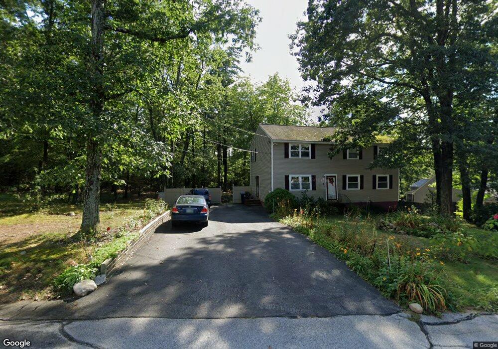
5 Highridge Trail Allenstown, NH 03275
Suncook NeighborhoodEstimated Value: $461,000 - $539,422
4
Beds
2
Baths
2,472
Sq Ft
$201/Sq Ft
Est. Value
About This Home
This home is located at 5 Highridge Trail, Allenstown, NH 03275 and is currently estimated at $497,356, approximately $201 per square foot. 5 Highridge Trail is a home located in Merrimack County with nearby schools including Allenstown Elementary School, Armand R. Dupont School, and Tender Years Child Care & Learning Center.
Ownership History
Date
Name
Owned For
Owner Type
Purchase Details
Closed on
Jun 10, 2004
Sold by
Sanuth Matthew L and Sanuth Amanda J
Bought by
Tarigan Andreas P
Current Estimated Value
Home Financials for this Owner
Home Financials are based on the most recent Mortgage that was taken out on this home.
Original Mortgage
$22,300
Outstanding Balance
$10,894
Interest Rate
5.99%
Mortgage Type
Purchase Money Mortgage
Estimated Equity
$486,462
Purchase Details
Closed on
Nov 15, 2002
Sold by
Ruth Jacqueline A
Bought by
Sanuth Matthew L and Sanuth Amanda J
Home Financials for this Owner
Home Financials are based on the most recent Mortgage that was taken out on this home.
Original Mortgage
$172,000
Interest Rate
6.03%
Purchase Details
Closed on
Mar 25, 2002
Sold by
Letourneau Kim S and Letourneau Denise M
Bought by
Ruth Jacqueline A
Home Financials for this Owner
Home Financials are based on the most recent Mortgage that was taken out on this home.
Original Mortgage
$144,500
Interest Rate
6.91%
Create a Home Valuation Report for This Property
The Home Valuation Report is an in-depth analysis detailing your home's value as well as a comparison with similar homes in the area
Home Values in the Area
Average Home Value in this Area
Purchase History
| Date | Buyer | Sale Price | Title Company |
|---|---|---|---|
| Tarigan Andreas P | $235,000 | -- | |
| Sanuth Matthew L | $182,000 | -- | |
| Ruth Jacqueline A | $170,000 | -- |
Source: Public Records
Mortgage History
| Date | Status | Borrower | Loan Amount |
|---|---|---|---|
| Open | Ruth Jacqueline A | $22,300 | |
| Previous Owner | Ruth Jacqueline A | $172,000 | |
| Previous Owner | Ruth Jacqueline A | $144,500 |
Source: Public Records
Tax History Compared to Growth
Tax History
| Year | Tax Paid | Tax Assessment Tax Assessment Total Assessment is a certain percentage of the fair market value that is determined by local assessors to be the total taxable value of land and additions on the property. | Land | Improvement |
|---|---|---|---|---|
| 2024 | $10,448 | $411,000 | $138,100 | $272,900 |
| 2023 | $8,713 | $411,000 | $138,100 | $272,900 |
| 2022 | $8,015 | $411,000 | $138,100 | $272,900 |
| 2021 | $7,384 | $234,400 | $78,700 | $155,700 |
| 2020 | $6,868 | $234,400 | $78,700 | $155,700 |
| 2019 | $7,197 | $231,400 | $78,700 | $152,700 |
| 2018 | $6,977 | $231,400 | $78,700 | $152,700 |
| 2017 | $7,430 | $231,400 | $78,700 | $152,700 |
| 2016 | $6,278 | $185,400 | $54,500 | $130,900 |
| 2015 | $6,087 | $185,400 | $54,500 | $130,900 |
| 2014 | $6,263 | $185,400 | $54,500 | $130,900 |
| 2013 | $5,883 | $186,600 | $57,300 | $129,300 |
Source: Public Records
Map
Nearby Homes
- 15 Main St
- 422 Dawn Dr Unit 23
- 427 Dawn Dr Unit 15
- 4 Rodger Rd
- 19 Sullivan Dr
- 7 Ferry St
- 1 1/2 Bartlett St
- 111 Glass St
- 10 Lane Dr
- 2 Cheryl Dr
- 100 Main St Unit M10
- 100 Main St Unit 204
- 12-14 Church St Unit 12,14
- 1821 Hooksett Rd
- 15 Sullivan Dr
- 10 Northview Terrace
- 14 Manor Dr Unit D
- 12 Manor Dr Unit B
- 307 Dearborn Rd
- 233 Pembroke St
- 3 Highridge Trail
- 33 Notre Dame Ave
- 7 Highridge Trail
- 13 Lubern Ave
- 31 Notre Dame Ave
- 10 Lubern Ave
- 32 Notre Dame Ave
- 30 Notre Dame Ave
- 11 Lubern Ave
- 9 Highridge Trail
- 8 Lubern Ave
- 29 Notre Dame Ave
- 11 Park St
- 28 Notre Dame Ave
- 13 Park St
- 9 Lubern Ave
- 11 High Ridge Trail
- 11 Highridge Tr
- 9 Park St
- 6 Lubern Ave