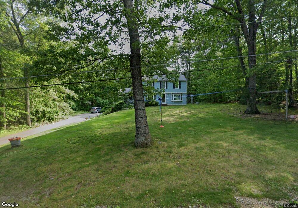
5 Hutchins Path Hampstead, NH 03841
Estimated Value: $613,000 - $655,000
4
Beds
2
Baths
2,273
Sq Ft
$279/Sq Ft
Est. Value
About This Home
This home is located at 5 Hutchins Path, Hampstead, NH 03841 and is currently estimated at $635,090, approximately $279 per square foot. 5 Hutchins Path is a home located in Rockingham County with nearby schools including Hampstead Central School, Hampstead Middle School, and Pinkerton Academy.
Ownership History
Date
Name
Owned For
Owner Type
Purchase Details
Closed on
Feb 18, 2016
Sold by
Cotter Thomas
Bought by
Cotter Elizabeth
Current Estimated Value
Purchase Details
Closed on
May 18, 2001
Sold by
Pappas Cynthia J
Bought by
Cotter Thomas W and Cotter Elizabeth W
Home Financials for this Owner
Home Financials are based on the most recent Mortgage that was taken out on this home.
Original Mortgage
$149,000
Interest Rate
7.03%
Purchase Details
Closed on
Apr 3, 1996
Sold by
Rvkb Ann Marie Colotti
Bought by
Pappas Cynthia J
Home Financials for this Owner
Home Financials are based on the most recent Mortgage that was taken out on this home.
Original Mortgage
$95,000
Interest Rate
7.31%
Create a Home Valuation Report for This Property
The Home Valuation Report is an in-depth analysis detailing your home's value as well as a comparison with similar homes in the area
Home Values in the Area
Average Home Value in this Area
Purchase History
| Date | Buyer | Sale Price | Title Company |
|---|---|---|---|
| Cotter Elizabeth | -- | -- | |
| Cotter Thomas W | $170,000 | -- | |
| Pappas Cynthia J | $164,900 | -- |
Source: Public Records
Mortgage History
| Date | Status | Borrower | Loan Amount |
|---|---|---|---|
| Previous Owner | Pappas Cynthia J | $149,000 | |
| Previous Owner | Pappas Cynthia J | $95,000 |
Source: Public Records
Tax History Compared to Growth
Tax History
| Year | Tax Paid | Tax Assessment Tax Assessment Total Assessment is a certain percentage of the fair market value that is determined by local assessors to be the total taxable value of land and additions on the property. | Land | Improvement |
|---|---|---|---|---|
| 2024 | $10,310 | $556,100 | $223,300 | $332,800 |
| 2023 | $9,095 | $357,500 | $159,500 | $198,000 |
| 2022 | $8,466 | $357,500 | $159,500 | $198,000 |
| 2021 | $8,133 | $357,500 | $159,500 | $198,000 |
| 2020 | $7,704 | $357,500 | $159,500 | $198,000 |
| 2016 | $6,403 | $264,600 | $93,500 | $171,100 |
| 2015 | $5,935 | $264,600 | $93,500 | $171,100 |
| 2014 | $5,935 | $264,600 | $93,500 | $171,100 |
| 2006 | $5,563 | $307,000 | $132,000 | $175,000 |
Source: Public Records
Map
Nearby Homes
- 4 Hastings Dr
- 6 Johnson Meadow Rd Unit A & B
- 5 Johnson Meadow Rd Unit A & B
- 8 Ians Path
- 20 Johnson Meadow Rd Unit A & B
- 19 Johnson Meadow Rd Unit A & B
- 30 Johnson Meadow Rd Unit A & B
- 33 Johnson Meadow Rd Unit A & B
- 36 Johnson Meadow Rd Unit A & B
- 185 Buttrick Rd
- 32 Ells Rd
- 23 Stonegate Ln
- 3 Cameron Ct Unit 3
- 50 Page Ln
- 313 Main St
- 156 Little Mill Rd Unit A
- 10 Pinewood Dr
- 13 Autumn Ln
- 14 Meredith Dr
- 5 Grandview Terrace
- 7 Freedom Hill Rd
- 6 Hutchins Path
- 2 Hutchins Path
- 36 Wash Pond Rd
- 32 Wash Pond Rd
- 42 Wash Pond Rd
- 17 Freedom Hill Rd
- 16 Freedom Hill Rd
- 8 Freedom Hill Rd
- 12 Freedom Hill Rd
- 21 Freedom Hill Rd
- 5 Liberty Ln
- 2 Freedom Hill Rd
- 4 Freedom Hill Rd
- 35 Wash Pond Rd
- 43 Wash Pond Rd
- 20 Freedom Hill Rd
- 11 Liberty Ln
- 25 Freedom Hill Rd
- 22 Freedom Hill Rd