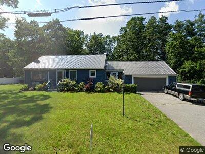
5 Laurel Ave Plaistow, NH 03865
Estimated Value: $440,000 - $539,000
2
Beds
1
Bath
1,248
Sq Ft
$383/Sq Ft
Est. Value
About This Home
This home is located at 5 Laurel Ave, Plaistow, NH 03865 and is currently estimated at $477,373, approximately $382 per square foot. 5 Laurel Ave is a home located in Rockingham County with nearby schools including Pollard Elementary School, Timberlane Regional Middle School, and Timberlane Regional High School.
Ownership History
Date
Name
Owned For
Owner Type
Purchase Details
Closed on
Jun 29, 2011
Sold by
Sullivan Patrick J and Sullivan Michelle L
Bought by
Donoughe Kevin William
Current Estimated Value
Home Financials for this Owner
Home Financials are based on the most recent Mortgage that was taken out on this home.
Original Mortgage
$222,694
Interest Rate
4.62%
Mortgage Type
Purchase Money Mortgage
Purchase Details
Closed on
Mar 31, 2003
Sold by
Stein Cindy Ann
Bought by
Sullivan Patrick J and Sullivan Michelle L
Home Financials for this Owner
Home Financials are based on the most recent Mortgage that was taken out on this home.
Original Mortgage
$224,228
Interest Rate
5.91%
Create a Home Valuation Report for This Property
The Home Valuation Report is an in-depth analysis detailing your home's value as well as a comparison with similar homes in the area
Home Values in the Area
Average Home Value in this Area
Purchase History
| Date | Buyer | Sale Price | Title Company |
|---|---|---|---|
| Donoughe Kevin William | $214,900 | -- | |
| Sullivan Patrick J | $226,000 | -- |
Source: Public Records
Mortgage History
| Date | Status | Borrower | Loan Amount |
|---|---|---|---|
| Open | Donoughe Kevin W | $95,000 | |
| Open | Donoughe Kevin W | $256,001 | |
| Closed | Donoughe Kevin W | $233,100 | |
| Closed | Donoughe Kevin W | $227,000 | |
| Closed | Sullivan Patrick J | $222,694 | |
| Previous Owner | Sullivan Patrick J | $25,000 | |
| Previous Owner | Sullivan Patrick J | $224,228 |
Source: Public Records
Tax History Compared to Growth
Tax History
| Year | Tax Paid | Tax Assessment Tax Assessment Total Assessment is a certain percentage of the fair market value that is determined by local assessors to be the total taxable value of land and additions on the property. | Land | Improvement |
|---|---|---|---|---|
| 2024 | $6,226 | $300,500 | $136,500 | $164,000 |
| 2023 | $6,713 | $300,500 | $136,500 | $164,000 |
| 2022 | $5,713 | $300,500 | $136,500 | $164,000 |
| 2021 | $5,697 | $300,500 | $136,500 | $164,000 |
| 2020 | $3,753 | $271,820 | $113,020 | $158,800 |
| 2019 | $10,552 | $271,820 | $113,020 | $158,800 |
| 2018 | $5,371 | $218,420 | $95,920 | $122,500 |
| 2017 | $3,608 | $218,420 | $95,920 | $122,500 |
| 2016 | $4,914 | $218,420 | $95,920 | $122,500 |
| 2015 | $5,517 | $228,350 | $117,050 | $111,300 |
| 2014 | $4,811 | $191,430 | $98,630 | $92,800 |
| 2011 | $4,730 | $191,430 | $98,630 | $92,800 |
Source: Public Records
Map
Nearby Homes
- 3 Overlook Dr
- 2 Overlook Dr
- 13 Beechwood Ct
- 108 Main St Unit B
- 24 W Pine St
- 3 Elm St
- 8 Davis Park
- 7 Elm St
- 10 Davis Park
- 8 Wildbrook Dr
- 8 Main St
- 44 Stephen C Savage Way Unit 10
- 44 Stephen C Savage Way Unit 12
- 44 Stephen C Savage Way Unit 14
- Lot 1 Luke's Way
- 42 Plaistow Rd
- 9 Auburn St
- 10 Tulip Cir Unit 12
- 27 Seaver Brook Ln
- 12 Angie Ave