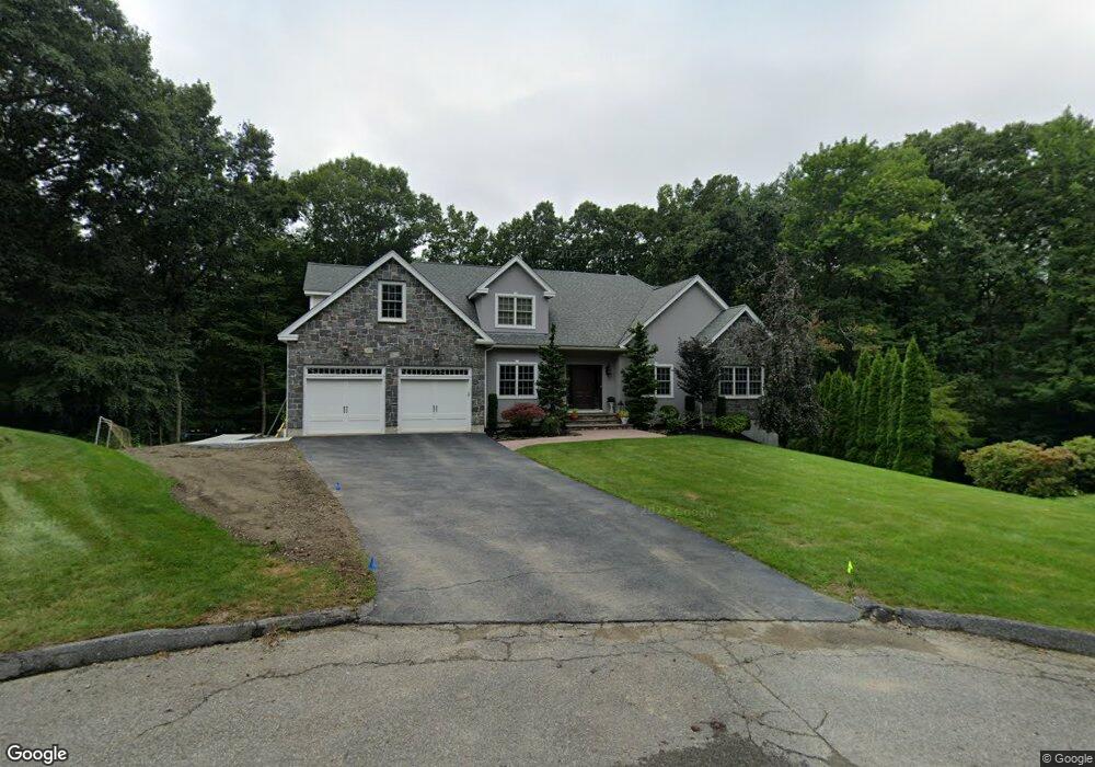
5 Mary Jane Cir Worcester, MA 01609
Forest Grove NeighborhoodEstimated Value: $809,000 - $942,000
4
Beds
3
Baths
3,300
Sq Ft
$267/Sq Ft
Est. Value
About This Home
This home is located at 5 Mary Jane Cir, Worcester, MA 01609 and is currently estimated at $879,519, approximately $266 per square foot. 5 Mary Jane Cir is a home located in Worcester County with nearby schools including Nelson Place Elementary School, Jacob Hiatt Magnet School, and Chandler Magnet.
Ownership History
Date
Name
Owned For
Owner Type
Purchase Details
Closed on
Jan 11, 2008
Sold by
C&S Constr Co Inc
Bought by
Paleologos Nicholas M and Paleologos Zoe D
Current Estimated Value
Home Financials for this Owner
Home Financials are based on the most recent Mortgage that was taken out on this home.
Original Mortgage
$59,000
Outstanding Balance
$37,339
Interest Rate
6.21%
Mortgage Type
Purchase Money Mortgage
Estimated Equity
$842,180
Create a Home Valuation Report for This Property
The Home Valuation Report is an in-depth analysis detailing your home's value as well as a comparison with similar homes in the area
Home Values in the Area
Average Home Value in this Area
Purchase History
| Date | Buyer | Sale Price | Title Company |
|---|---|---|---|
| Paleologos Nicholas M | $608,000 | -- | |
| C&S Constr Co Inc | -- | -- |
Source: Public Records
Mortgage History
| Date | Status | Borrower | Loan Amount |
|---|---|---|---|
| Open | C&S Constr Co Inc | $59,000 | |
| Open | Paleologos Nicholas M | $476,000 |
Source: Public Records
Tax History Compared to Growth
Tax History
| Year | Tax Paid | Tax Assessment Tax Assessment Total Assessment is a certain percentage of the fair market value that is determined by local assessors to be the total taxable value of land and additions on the property. | Land | Improvement |
|---|---|---|---|---|
| 2025 | $10,745 | $814,600 | $124,400 | $690,200 |
| 2024 | $10,490 | $762,900 | $124,400 | $638,500 |
| 2023 | $10,288 | $717,400 | $107,100 | $610,300 |
| 2022 | $9,471 | $622,700 | $85,700 | $537,000 |
| 2021 | $9,509 | $584,100 | $68,600 | $515,500 |
| 2020 | $9,556 | $562,100 | $68,400 | $493,700 |
| 2019 | $9,592 | $532,900 | $66,200 | $466,700 |
| 2018 | $9,538 | $504,400 | $66,200 | $438,200 |
| 2017 | $9,445 | $491,400 | $66,200 | $425,200 |
| 2016 | $9,920 | $481,300 | $55,900 | $425,400 |
| 2015 | $9,660 | $481,300 | $55,900 | $425,400 |
| 2014 | $9,377 | $479,900 | $55,900 | $424,000 |
Source: Public Records
Map
Nearby Homes
- 40 Westwood Dr
- 8 Old Colony Rd
- 477 Salisbury St
- 5 Hazelwood Rd
- 3 Westwood Dr
- 577 Grove St
- 9 Dennison Rd
- 0 Grove St
- 612 Grove St
- 11 Holden St
- 4 Wheeler Ave
- 3 Old English Rd
- 32 Aylesbury Rd
- 32 Indian Lake Pkwy
- 12 Alexander Rd
- 33 Aylesbury Rd
- 7 Old Brook Dr
- 43 Huntington Ave
- 2 Baiting Brook Ln Unit 71
- 21 Baiting Brook Ln Unit 60
- 1 Mary Jane Cir
- 11 Mary Jane Cir
- 21 Kanes Crossing
- 24 Kanes Crossing
- 28 Kanes Crossing
- 30 Kanes Crossing
- 55 Hancock Hill Dr
- 20 Kanes Crossing
- 53 Hancock Hill Dr
- 25 Westwood Dr
- 56 Romola Rd
- 52 Romola Rd
- 27 Westwood Dr
- 48 Romola Rd
- 23 Westwood Dr
- 29 Westwood Dr
- 44 Romola Rd
- 51 Hancock Hill Dr
- 19 Monmouth Rd
- 52 Hancock Hill Dr