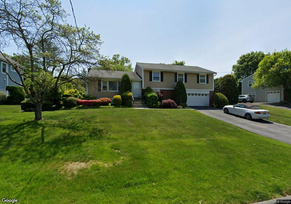
5 Whippoorwill Rd Rye Brook, NY 10573
Purchase NeighborhoodEstimated Value: $1,191,813 - $1,547,000
4
Beds
2
Baths
2,281
Sq Ft
$602/Sq Ft
Est. Value
About This Home
This home is located at 5 Whippoorwill Rd, Rye Brook, NY 10573 and is currently estimated at $1,372,703, approximately $601 per square foot. 5 Whippoorwill Rd is a home located in Westchester County with nearby schools including Bruno M. Ponterio Ridge Street School, Blind Brook Rye Middle School, and Blind Brook High School.
Ownership History
Date
Name
Owned For
Owner Type
Purchase Details
Closed on
Mar 14, 2002
Sold by
Dratler Morton and Dratler Libby
Bought by
Colotti Agostino and Colotti Maria
Current Estimated Value
Home Financials for this Owner
Home Financials are based on the most recent Mortgage that was taken out on this home.
Original Mortgage
$484,000
Interest Rate
7.15%
Mortgage Type
Purchase Money Mortgage
Create a Home Valuation Report for This Property
The Home Valuation Report is an in-depth analysis detailing your home's value as well as a comparison with similar homes in the area
Home Values in the Area
Average Home Value in this Area
Purchase History
| Date | Buyer | Sale Price | Title Company |
|---|---|---|---|
| Colotti Agostino | $605,000 | -- |
Source: Public Records
Mortgage History
| Date | Status | Borrower | Loan Amount |
|---|---|---|---|
| Previous Owner | Colotti Agostino | $484,000 |
Source: Public Records
Tax History Compared to Growth
Tax History
| Year | Tax Paid | Tax Assessment Tax Assessment Total Assessment is a certain percentage of the fair market value that is determined by local assessors to be the total taxable value of land and additions on the property. | Land | Improvement |
|---|---|---|---|---|
| 2024 | -- | $1,053,100 | $518,800 | $534,300 |
| 2023 | $26,140 | $1,012,600 | $494,100 | $518,500 |
| 2022 | $25,874 | $955,300 | $494,100 | $461,200 |
| 2021 | $25,599 | $884,500 | $494,100 | $390,400 |
| 2020 | $22,689 | $884,500 | $494,100 | $390,400 |
| 2019 | $42,423 | $886,900 | $426,900 | $460,000 |
| 2018 | $15,562 | $870,500 | $401,300 | $469,200 |
| 2017 | $3,588 | $871,800 | $406,900 | $464,900 |
| 2016 | $19,424 | $847,400 | $400,400 | $447,000 |
| 2015 | -- | $842,200 | $395,200 | $447,000 |
| 2014 | -- | $737,600 | $339,700 | $397,900 |
| 2013 | -- | $714,200 | $316,300 | $397,900 |
Source: Public Records
Map
Nearby Homes
- 53 Shady Ln
- 120 Brush Hollow Crescent
- 26 Shady Ln
- 37 Greenway Ln
- 7 Curt Terrace
- 10 Oriole Place
- 12 Glenville St Unit 108
- 22 Old Orchard Rd
- 21 Lincoln Ln
- 125 Bowman Dr
- 228 Pemberwick Rd
- 2 Churchill Rd
- 122 Lincoln Ave
- 14 Concord St
- 5 Bristol Ln
- 3 Loden Ln
- 4 Mark Dr
- 6 Loden Ln
- 139 Betsy Brown Rd
- 27 Lavender Ln
- 7 Whippoorwill Rd
- 3 Whippoorwill Rd
- 6 Country Ridge Dr N
- 6 Country Ridge Dr
- 4 Country Ridge Dr N
- 4 Country Ridge Dr
- 6 Whippoorwill Rd
- 1 Whippoorwill Rd
- 9 Whippoorwill Rd
- 8 Country Ridge Dr N
- 8 Whippoorwill Rd
- 2 Country Ridge Dr N
- 2 Country Ridge Dr
- 4 Whippoorwill Rd
- 10 Whippoorwill Rd
- 10 Country Ridge Dr N
- 5 Fairlawn Pkwy
- 2 Whippoorwill Rd
- 3 Fairlawn Pkwy
- 12 Whippoorwill Rd