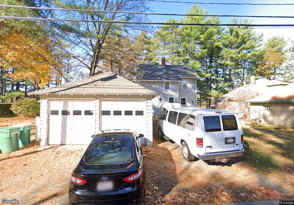
50 Lakeside Ave Hudson, MA 01749
Lake Boon NeighborhoodEstimated Value: $732,000 - $823,000
3
Beds
2
Baths
1,746
Sq Ft
$453/Sq Ft
Est. Value
About This Home
This home is located at 50 Lakeside Ave, Hudson, MA 01749 and is currently estimated at $791,122, approximately $453 per square foot. 50 Lakeside Ave is a home located in Middlesex County with nearby schools including David J. Quinn Middle School, Hudson High School, and Darnell School For Educational & Behavioral Service.
Ownership History
Date
Name
Owned For
Owner Type
Purchase Details
Closed on
Dec 21, 1993
Sold by
Picard Dennis J and Picard Dolores M
Bought by
Adams Robert D and Adams Donna L
Current Estimated Value
Home Financials for this Owner
Home Financials are based on the most recent Mortgage that was taken out on this home.
Original Mortgage
$110,000
Interest Rate
7.03%
Mortgage Type
Purchase Money Mortgage
Create a Home Valuation Report for This Property
The Home Valuation Report is an in-depth analysis detailing your home's value as well as a comparison with similar homes in the area
Home Values in the Area
Average Home Value in this Area
Purchase History
| Date | Buyer | Sale Price | Title Company |
|---|---|---|---|
| Adams Robert D | $185,000 | -- |
Source: Public Records
Mortgage History
| Date | Status | Borrower | Loan Amount |
|---|---|---|---|
| Open | Adams Robert D | $284,000 | |
| Closed | Adams Robert D | $165,000 | |
| Closed | Adams Robert D | $50,000 | |
| Closed | Adams Robert D | $110,000 |
Source: Public Records
Tax History Compared to Growth
Tax History
| Year | Tax Paid | Tax Assessment Tax Assessment Total Assessment is a certain percentage of the fair market value that is determined by local assessors to be the total taxable value of land and additions on the property. | Land | Improvement |
|---|---|---|---|---|
| 2025 | $11,563 | $833,100 | $403,400 | $429,700 |
| 2024 | $10,758 | $768,400 | $358,800 | $409,600 |
| 2023 | $10,330 | $707,500 | $345,200 | $362,300 |
| 2022 | $9,870 | $622,300 | $313,700 | $308,600 |
| 2021 | $9,669 | $582,800 | $298,900 | $283,900 |
| 2020 | $9,104 | $548,100 | $292,800 | $255,300 |
| 2019 | $9,303 | $546,300 | $292,800 | $253,500 |
| 2018 | $8,559 | $501,900 | $278,900 | $223,000 |
| 2017 | $8,185 | $467,700 | $265,600 | $202,100 |
| 2016 | $7,056 | $408,100 | $213,600 | $194,500 |
| 2015 | $7,044 | $407,900 | $213,600 | $194,300 |
| 2014 | $6,649 | $381,700 | $187,300 | $194,400 |
Source: Public Records
Map
Nearby Homes
- 4 Gately Ave
- 8 Town Line Rd Unit 4
- 10 Town Line Rd Unit 5
- 12 Town Line Rd Unit 6
- 1 Town Line Rd
- 1 Town Line Rd Unit 18
- Stockbridge South Shore Plan at Lakemont by Toll Brothers
- 51 Hale Rd
- 10 Old County Rd Unit 19
- 3 Shore Line Dr Unit 15
- 34 Hallock Point Rd
- 14 Old County Rd Unit 21
- 8 Shoreline Dr Unit 11
- 10 Shoreline Dr Unit 12
- 210 Barton Rd
- 786 Main St
- 788 Main St
- 618 Sudbury St
- 3 Stonehill Rd
- 168 Blanchette Dr
- 52 Lakeside Ave
- 48 Lakeside Ave
- 54 Lakeside Ave
- 46 Lakeside Ave
- 39 Lakeside Ave
- 35 Lakeside Ave
- 56 Lakeside Ave
- 42 Lakeside Ave
- 41 Lakeside Ave
- 3 Babick Lake Dr
- 58 Lakeside Ave
- 40 Lakeside Ave
- 40 Lakeside Ave Unit 1
- 43 Lakeside Ave
- 60 Lakeside Ave
- 37 Lakeside Ave
- 38 Lakeside Ave
- 31 Lakeside Ave
- 36 Lakeside Ave
- 20 Rock Ave