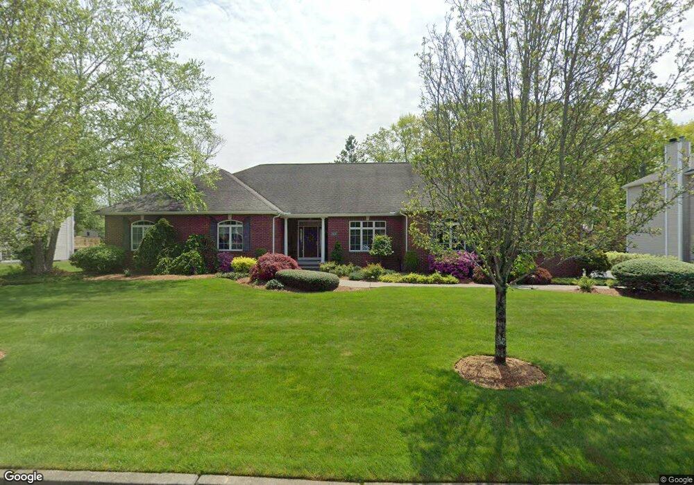
50 Lindsay Ln Cranston, RI 02921
Comstock Gardens NeighborhoodEstimated Value: $864,000 - $1,164,000
4
Beds
3
Baths
2,736
Sq Ft
$362/Sq Ft
Est. Value
About This Home
This home is located at 50 Lindsay Ln, Cranston, RI 02921 and is currently estimated at $990,552, approximately $362 per square foot. 50 Lindsay Ln is a home located in Providence County with nearby schools including Orchard Farms El. School, Western Hills Middle School, and Cranston High School West.
Ownership History
Date
Name
Owned For
Owner Type
Purchase Details
Closed on
Jul 12, 2020
Sold by
Marses Constantine E and Marses Tina F
Bought by
Marses Ft
Current Estimated Value
Purchase Details
Closed on
Nov 28, 2000
Sold by
Cranston Commons Llc
Bought by
Marses Constantine E and Marses Tina
Create a Home Valuation Report for This Property
The Home Valuation Report is an in-depth analysis detailing your home's value as well as a comparison with similar homes in the area
Home Values in the Area
Average Home Value in this Area
Purchase History
| Date | Buyer | Sale Price | Title Company |
|---|---|---|---|
| Marses Ft | -- | None Available | |
| Marses Constantine E | $90,000 | -- |
Source: Public Records
Mortgage History
| Date | Status | Borrower | Loan Amount |
|---|---|---|---|
| Previous Owner | Marses Constantine E | $99,000 | |
| Previous Owner | Marses Constantine E | $150,000 |
Source: Public Records
Tax History Compared to Growth
Tax History
| Year | Tax Paid | Tax Assessment Tax Assessment Total Assessment is a certain percentage of the fair market value that is determined by local assessors to be the total taxable value of land and additions on the property. | Land | Improvement |
|---|---|---|---|---|
| 2025 | $12,591 | $907,100 | $173,800 | $733,300 |
| 2024 | $12,346 | $907,100 | $173,800 | $733,300 |
| 2023 | $10,837 | $573,400 | $124,100 | $449,300 |
| 2022 | $10,614 | $573,400 | $124,100 | $449,300 |
| 2021 | $10,321 | $573,400 | $124,100 | $449,300 |
| 2020 | $10,138 | $488,100 | $145,400 | $342,700 |
| 2019 | $10,138 | $488,100 | $145,400 | $342,700 |
| 2018 | $9,904 | $488,100 | $145,400 | $342,700 |
| 2017 | $10,367 | $451,900 | $154,000 | $297,900 |
| 2016 | $10,145 | $451,900 | $154,000 | $297,900 |
| 2015 | $10,145 | $451,900 | $154,000 | $297,900 |
| 2014 | $8,942 | $391,500 | $128,300 | $263,200 |
Source: Public Records
Map
Nearby Homes
- 11 Raven Cir
- 0 W Bluebird Ln
- 130 Alpine Estates Dr
- 191 Pippin Orchard Rd
- 5 Braeburn Cir
- 2073 Plainfield Pike
- 02 Paula Ln
- 01 Paula Ln
- 9 Gray Coach E
- 7 Taylor Rd
- 12 Beechwood Dr
- 121 Ashbrook Dr
- 2202 Scituate Ave
- 79 Taylor Rd
- 0 Peck Hill Rd
- 129 Valerie Ct
- 53 Charcalee Dr
- 560 Seven Mile Rd
- 136 White Birch Cir
- 80 Tomahawk Trail