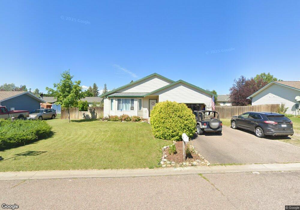
50 Martha Rd Columbia Falls, MT 59912
Estimated Value: $474,000 - $529,000
3
Beds
2
Baths
1,250
Sq Ft
$395/Sq Ft
Est. Value
About This Home
This home is located at 50 Martha Rd, Columbia Falls, MT 59912 and is currently estimated at $493,963, approximately $395 per square foot. 50 Martha Rd is a home located in Flathead County with nearby schools including Ruder Elementary School, Columbia Falls Junior High School (7-8), and Columbia Falls High School.
Ownership History
Date
Name
Owned For
Owner Type
Purchase Details
Closed on
Jan 9, 2009
Sold by
Emerson Laura C and Steward Laura C
Bought by
Emerson Jason and Emerson Laura C
Current Estimated Value
Home Financials for this Owner
Home Financials are based on the most recent Mortgage that was taken out on this home.
Original Mortgage
$199,733
Outstanding Balance
$129,052
Interest Rate
5.6%
Mortgage Type
FHA
Estimated Equity
$364,911
Purchase Details
Closed on
Aug 17, 2007
Sold by
Lake Kevin S and Lake Inga J
Bought by
Emerson Jason and Steward Laura C
Home Financials for this Owner
Home Financials are based on the most recent Mortgage that was taken out on this home.
Original Mortgage
$193,500
Interest Rate
6.62%
Mortgage Type
New Conventional
Create a Home Valuation Report for This Property
The Home Valuation Report is an in-depth analysis detailing your home's value as well as a comparison with similar homes in the area
Home Values in the Area
Average Home Value in this Area
Purchase History
| Date | Buyer | Sale Price | Title Company |
|---|---|---|---|
| Emerson Jason | -- | None Available | |
| Emerson Jason | -- | Citizens Title And Escrow Co |
Source: Public Records
Mortgage History
| Date | Status | Borrower | Loan Amount |
|---|---|---|---|
| Open | Emerson Jason | $199,733 | |
| Closed | Emerson Jason | $193,500 |
Source: Public Records
Tax History
| Year | Tax Paid | Tax Assessment Tax Assessment Total Assessment is a certain percentage of the fair market value that is determined by local assessors to be the total taxable value of land and additions on the property. | Land | Improvement |
|---|---|---|---|---|
| 2025 | $2,050 | $450,000 | $0 | $0 |
| 2024 | $2,639 | $374,700 | $0 | $0 |
| 2023 | $2,760 | $374,700 | $0 | $0 |
| 2022 | $2,731 | $259,100 | $0 | $0 |
| 2021 | $2,868 | $259,100 | $0 | $0 |
| 2020 | $2,540 | $214,200 | $0 | $0 |
| 2019 | $2,412 | $214,200 | $0 | $0 |
| 2018 | $2,149 | $181,700 | $0 | $0 |
| 2017 | $2,081 | $181,700 | $0 | $0 |
| 2016 | $1,857 | $158,000 | $0 | $0 |
| 2015 | $1,843 | $158,000 | $0 | $0 |
| 2014 | $1,912 | $99,162 | $0 | $0 |
Source: Public Records
Map
Nearby Homes
- 26 Martha Rd
- 25 Martha Rd
- 7 Grace Rd
- 24 Diane Rd Unit 171 A
- 22 Diane Rd Unit 172
- 10 Diane Rd
- 8786 U S 2
- 165 Veteran Dr
- 330 Meadow Lake Lot 2 Blvd
- 1265 Jellison Rd
- 1398 Waters Edge Way
- 2060 Rapids Ave
- 1306 Columbia Dr
- 929 9th St W
- 809 9th St W Unit 1
- 809 9th St W Unit 14
- 809 9th St W Unit 17
- 185 Kokanee Bend Dr
- 554 Evening Star Ln
- 57 Hidden Cedar Loop
Your Personal Tour Guide
Ask me questions while you tour the home.