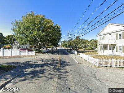
50 Quinlan Way Hyannis, MA 02601
Hyannis NeighborhoodEstimated Value: $941,000 - $2,344,449
5
Beds
3
Baths
3,271
Sq Ft
$496/Sq Ft
Est. Value
About This Home
This home is located at 50 Quinlan Way, Hyannis, MA 02601 and is currently estimated at $1,621,112, approximately $495 per square foot. 50 Quinlan Way is a home located in Barnstable County with nearby schools including Hyannis West Elementary School, Barnstable United Elementary School, and Barnstable Intermediate School.
Ownership History
Date
Name
Owned For
Owner Type
Purchase Details
Closed on
May 27, 2010
Sold by
Sample Charles F and Sample Julia
Bought by
Baxter Samuel T and Baxter Rebecca C
Current Estimated Value
Home Financials for this Owner
Home Financials are based on the most recent Mortgage that was taken out on this home.
Original Mortgage
$356,250
Interest Rate
5.13%
Mortgage Type
Purchase Money Mortgage
Purchase Details
Closed on
May 25, 2010
Sold by
Sample Charles F and Sample Julia
Bought by
Brunicardi David and Marooney Caryn
Home Financials for this Owner
Home Financials are based on the most recent Mortgage that was taken out on this home.
Original Mortgage
$356,250
Interest Rate
5.13%
Mortgage Type
Purchase Money Mortgage
Purchase Details
Closed on
Aug 24, 2009
Sold by
Brunicardi David and Marooney Caryn
Bought by
Sample Charles F and Sample Julia
Purchase Details
Closed on
Apr 9, 2001
Sold by
Jahm Rt and Sample
Bought by
Quail Edge Rt and Oneill
Purchase Details
Closed on
Aug 27, 1999
Sold by
Oneill J Brian and Oneill Miriam P
Bought by
Jahm Rt and Sample Charles
Home Financials for this Owner
Home Financials are based on the most recent Mortgage that was taken out on this home.
Original Mortgage
$50,000
Interest Rate
7.81%
Purchase Details
Closed on
Apr 30, 1998
Sold by
Mezger Bernard J and Mezger Carol M
Bought by
Sample Charles F and Sample Juli
Home Financials for this Owner
Home Financials are based on the most recent Mortgage that was taken out on this home.
Original Mortgage
$272,000
Interest Rate
7.04%
Mortgage Type
Purchase Money Mortgage
Purchase Details
Closed on
Dec 7, 1995
Sold by
Pilicy Mary G
Bought by
Mezger Bernard J and Mezger Carol M
Purchase Details
Closed on
Nov 25, 1991
Sold by
Pilicy Franklin G
Bought by
Pilicy Mary G
Create a Home Valuation Report for This Property
The Home Valuation Report is an in-depth analysis detailing your home's value as well as a comparison with similar homes in the area
Home Values in the Area
Average Home Value in this Area
Purchase History
| Date | Buyer | Sale Price | Title Company |
|---|---|---|---|
| Baxter Samuel T | $750,000 | -- | |
| Brunicardi David | -- | -- | |
| Sample Charles F | -- | -- | |
| Quail Edge Rt | $395,000 | -- | |
| Jahm Rt | $247,500 | -- | |
| Sample Charles F | $340,000 | -- | |
| Mezger Bernard J | $280,000 | -- | |
| Pilicy Mary G | $250,000 | -- |
Source: Public Records
Mortgage History
| Date | Status | Borrower | Loan Amount |
|---|---|---|---|
| Open | Baxter Samuel T | $400,000 | |
| Closed | Baxter Samuel T | $548,000 | |
| Closed | Baxter Samuel T | $685,000 | |
| Closed | Baxter Samuel T | $700,000 | |
| Closed | Baxter Samuel T | $397,000 | |
| Closed | Mezger Bernard J | $400,000 | |
| Closed | Baxter Samuel T | $356,250 | |
| Previous Owner | Sample Charles F | $714,800 | |
| Previous Owner | Sample Charles F | $375,000 | |
| Previous Owner | Sample Charles F | $50,000 | |
| Previous Owner | Mezger Bernard J | $222,500 | |
| Previous Owner | Sample Charles F | $272,000 |
Source: Public Records
Tax History Compared to Growth
Tax History
| Year | Tax Paid | Tax Assessment Tax Assessment Total Assessment is a certain percentage of the fair market value that is determined by local assessors to be the total taxable value of land and additions on the property. | Land | Improvement |
|---|---|---|---|---|
| 2025 | $18,046 | $1,946,700 | $1,111,000 | $835,700 |
| 2024 | $17,227 | $1,903,500 | $1,111,000 | $792,500 |
| 2023 | $16,291 | $1,702,300 | $996,600 | $705,700 |
| 2022 | $12,990 | $1,122,700 | $524,400 | $598,300 |
| 2021 | $12,425 | $1,043,200 | $524,400 | $518,800 |
| 2020 | $13,087 | $1,061,400 | $558,600 | $502,800 |
| 2019 | $12,415 | $986,900 | $533,300 | $453,600 |
| 2018 | $12,093 | $983,200 | $588,000 | $395,200 |
| 2017 | $11,334 | $945,300 | $588,000 | $357,300 |
| 2016 | $11,267 | $960,500 | $603,200 | $357,300 |
| 2015 | $10,401 | $899,000 | $562,100 | $336,900 |
Source: Public Records
Map
Nearby Homes
- 18 Mount Vernon Ave
- 106 Longwood Ave
- 35 Grayton Ave
- 27 & 54 Circle Dr
- 48 Smith St
- 113 Briarwood Ave
- 172 Irving Ave
- 34 Crocker Dr
- 27 Marchant Ave
- 86 Seabrook Rd
- 31 Arbor Way
- 230 Gosnold St Unit 11A-11B-11C
- 230 Gosnold St Unit 11ABC
- 187 Sea St
- 20 Sunset Terrace
- 133 Breakwater Shores Dr
- 48 Kennedy Cir
- 169 Gosnold St
- 39 Alden Way
- 307 W Main St Unit 7
