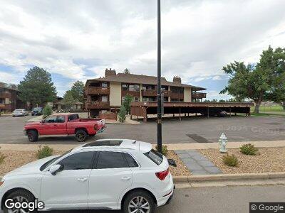
500 Manhattan Dr Unit C7 Boulder, CO 80303
Estimated Value: $417,000 - $473,000
2
Beds
2
Baths
1,092
Sq Ft
$407/Sq Ft
Est. Value
About This Home
This home is located at 500 Manhattan Dr Unit C7, Boulder, CO 80303 and is currently estimated at $444,675, approximately $407 per square foot. 500 Manhattan Dr Unit C7 is a home located in Boulder County with nearby schools including Eisenhower Elementary School, Manhattan Middle School of the Arts & Academics, and Fairview High School.
Ownership History
Date
Name
Owned For
Owner Type
Purchase Details
Closed on
Oct 5, 2016
Sold by
Powell Timothy and Powell Melissa
Bought by
Caraway Mary Bernice
Current Estimated Value
Home Financials for this Owner
Home Financials are based on the most recent Mortgage that was taken out on this home.
Original Mortgage
$241,500
Outstanding Balance
$198,564
Interest Rate
3.43%
Mortgage Type
New Conventional
Estimated Equity
$243,783
Purchase Details
Closed on
Sep 30, 2013
Sold by
Powell Timothy and Powell Melissa
Bought by
Powell Timothy
Home Financials for this Owner
Home Financials are based on the most recent Mortgage that was taken out on this home.
Original Mortgage
$153,700
Interest Rate
4.62%
Mortgage Type
New Conventional
Purchase Details
Closed on
Jun 29, 2006
Sold by
Kerr Kenneth C and Kerr Margaret P
Bought by
Powell Timothy and Powell Melissa
Home Financials for this Owner
Home Financials are based on the most recent Mortgage that was taken out on this home.
Original Mortgage
$165,300
Interest Rate
6.63%
Mortgage Type
Unknown
Purchase Details
Closed on
Oct 13, 2004
Sold by
Kerr Kenneth C and Kerr Margaret P
Bought by
Kerr Kenneth C
Home Financials for this Owner
Home Financials are based on the most recent Mortgage that was taken out on this home.
Original Mortgage
$110,000
Interest Rate
5%
Mortgage Type
Stand Alone Refi Refinance Of Original Loan
Purchase Details
Closed on
Apr 24, 1997
Sold by
Queen Jimmie H and Little Ralph L
Bought by
Kerr Kenneth C
Home Financials for this Owner
Home Financials are based on the most recent Mortgage that was taken out on this home.
Original Mortgage
$108,646
Interest Rate
7.82%
Mortgage Type
FHA
Purchase Details
Closed on
Mar 17, 1994
Sold by
Chambers David L
Bought by
Queen Jimmie H
Home Financials for this Owner
Home Financials are based on the most recent Mortgage that was taken out on this home.
Original Mortgage
$68,500
Interest Rate
7.21%
Purchase Details
Closed on
Nov 8, 1983
Bought by
Caraway Mary Bernice and Caraway Paul Erik
Purchase Details
Closed on
Jun 7, 1978
Bought by
Caraway Mary Bernice and Caraway Paul Erik
Create a Home Valuation Report for This Property
The Home Valuation Report is an in-depth analysis detailing your home's value as well as a comparison with similar homes in the area
Home Values in the Area
Average Home Value in this Area
Purchase History
| Date | Buyer | Sale Price | Title Company |
|---|---|---|---|
| Caraway Mary Bernice | $345,000 | Land Title Guarantee Co | |
| Powell Timothy | -- | Fidelity National Title Insu | |
| Powell Timothy | $174,000 | Land Title Guarantee Company | |
| Kerr Kenneth C | -- | Lt | |
| Kerr Kenneth C | $112,000 | -- | |
| Queen Jimmie H | $97,000 | -- | |
| Caraway Mary Bernice | $65,000 | -- | |
| Caraway Mary Bernice | $46,500 | -- |
Source: Public Records
Mortgage History
| Date | Status | Borrower | Loan Amount |
|---|---|---|---|
| Open | Caraway Mary Bernice | $241,500 | |
| Previous Owner | Powell Timothy | $153,700 | |
| Previous Owner | Powell Timothy | $165,300 | |
| Previous Owner | Kerr Kenneth C | $110,000 | |
| Previous Owner | Kerr Kenneth C | $108,350 | |
| Previous Owner | Kerr Kenneth C | $108,646 | |
| Previous Owner | Queen Jimmie H | $68,500 |
Source: Public Records
Tax History Compared to Growth
Tax History
| Year | Tax Paid | Tax Assessment Tax Assessment Total Assessment is a certain percentage of the fair market value that is determined by local assessors to be the total taxable value of land and additions on the property. | Land | Improvement |
|---|---|---|---|---|
| 2024 | $2,179 | $25,232 | -- | $25,232 |
| 2023 | $2,179 | $25,232 | -- | $28,917 |
| 2022 | $2,436 | $26,229 | $0 | $26,229 |
| 2021 | $2,323 | $26,984 | $0 | $26,984 |
| 2020 | $2,272 | $26,105 | $0 | $26,105 |
| 2019 | $2,238 | $26,105 | $0 | $26,105 |
| 2018 | $1,923 | $22,183 | $0 | $22,183 |
| 2017 | $1,863 | $24,525 | $0 | $24,525 |
| 2016 | $1,621 | $18,722 | $0 | $18,722 |
| 2015 | $1,535 | $15,801 | $0 | $15,801 |
| 2014 | $1,359 | $15,801 | $0 | $15,801 |
Source: Public Records
Map
Nearby Homes
- 595 Manhattan Dr Unit 203
- 501 Manhattan Dr Unit 202
- 625 Manhattan Place Unit 308
- 586 Aztec Dr
- 665 Manhattan Dr Unit 5
- 645 Manhattan Place Unit 106
- 590 Yuma Cir
- 695 Manhattan Dr Unit 22
- 695 Manhattan Dr Unit 5
- 695 Manhattan Dr Unit 213
- 695 Manhattan Dr Unit 216
- 5420 Baseline Rd
- 700 Brooklawn Dr
- 550 Mohawk Dr Unit 67
- 560 Mohawk Dr Unit 35
- 803 Laurel Ave
- 5540 Stonewall Place Unit 16
- 5520 Stonewall Place Unit 31
- 500 Mohawk Dr Unit 207
- 500 Mohawk Dr Unit 510
- 500 Manhattan Dr Unit D14
- 500 Manhattan Dr Unit D13
- 500 Manhattan Dr Unit D12
- 500 Manhattan Dr Unit D11
- 500 Manhattan Dr Unit D10
- 500 Manhattan Dr Unit D8
- 500 Manhattan Dr Unit D7
- 500 Manhattan Dr Unit D6
- 500 Manhattan Dr Unit D5
- 500 Manhattan Dr Unit D4
- 500 Manhattan Dr Unit D3
- 500 Manhattan Dr Unit D2
- 500 Manhattan Dr Unit D1
- 500 Manhattan Dr Unit C12
- 500 Manhattan Dr Unit C11
- 500 Manhattan Dr Unit C10
- 500 Manhattan Dr Unit C9
- 500 Manhattan Dr Unit C8
- 500 Manhattan Dr Unit C7
- 500 Manhattan Dr Unit C6