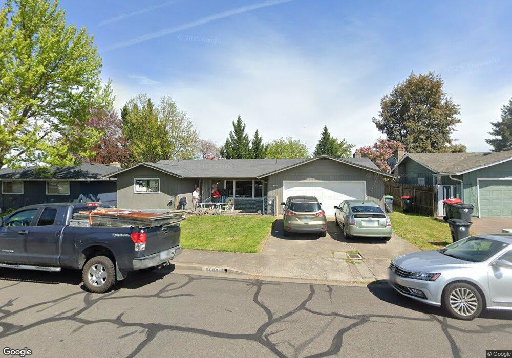
5000 Rock Way Central Point, OR 97502
Estimated Value: $377,542 - $421,000
3
Beds
2
Baths
1,807
Sq Ft
$218/Sq Ft
Est. Value
About This Home
This home is located at 5000 Rock Way, Central Point, OR 97502 and is currently estimated at $393,636, approximately $217 per square foot. 5000 Rock Way is a home located in Jackson County with nearby schools including Jewett Elementary School, Scenic Middle School, and Crater High School.
Ownership History
Date
Name
Owned For
Owner Type
Purchase Details
Closed on
Jul 14, 2020
Sold by
Knight Rick David and Knight Questa
Bought by
Knight Rick David and Knight Questa
Current Estimated Value
Purchase Details
Closed on
Jan 22, 2018
Sold by
Knight Shirley L and Knight Rick David
Bought by
Robert W Knight And Shirley L Knight Revocabl and Knight
Purchase Details
Closed on
Jul 30, 2014
Sold by
Knight Robert W and Knight Shirley L
Bought by
The Robert W Knight & Shirley L Knight R
Create a Home Valuation Report for This Property
The Home Valuation Report is an in-depth analysis detailing your home's value as well as a comparison with similar homes in the area
Home Values in the Area
Average Home Value in this Area
Purchase History
| Date | Buyer | Sale Price | Title Company |
|---|---|---|---|
| Knight Rick David | -- | None Available | |
| Robert W Knight And Shirley L Knight Revocabl | -- | None Listed On Document | |
| The Robert W Knight & Shirley L Knight R | -- | None Available |
Source: Public Records
Tax History Compared to Growth
Tax History
| Year | Tax Paid | Tax Assessment Tax Assessment Total Assessment is a certain percentage of the fair market value that is determined by local assessors to be the total taxable value of land and additions on the property. | Land | Improvement |
|---|---|---|---|---|
| 2025 | $3,362 | $246,010 | $93,100 | $152,910 |
| 2024 | $3,362 | $196,330 | $90,380 | $105,950 |
| 2023 | $3,254 | $190,620 | $87,750 | $102,870 |
| 2022 | $3,178 | $190,620 | $87,750 | $102,870 |
| 2021 | $3,087 | $185,070 | $85,190 | $99,880 |
| 2020 | $2,997 | $179,680 | $82,710 | $96,970 |
| 2019 | $2,923 | $169,370 | $77,970 | $91,400 |
| 2018 | $2,834 | $164,440 | $75,700 | $88,740 |
| 2017 | $2,763 | $164,440 | $75,700 | $88,740 |
| 2016 | $2,682 | $155,010 | $71,360 | $83,650 |
| 2015 | $2,570 | $155,010 | $71,360 | $83,650 |
| 2014 | $2,505 | $146,120 | $67,260 | $78,860 |
Source: Public Records
Map
Nearby Homes
- 4035 Rock Way
- 335 Applewood Dr
- 356 Marian Ave Unit 40
- 4626 N Pacific Hwy
- 1010 N 3rd St
- 327 Brookhaven Dr
- 920 N 10th St
- 905 Comet Ave
- 426 Bridge Creek Dr
- 0 Peninger Rd
- 413 Sand Pointe Dr
- 1167 Boulder Ridge St
- 741 Hazel St
- 422 Castle Rock Dr
- 833 Hazel St
- 55 Crater Ln
- 405 N 9th St
- 526 Stone Pointe Dr
- 342 Hazel St
- 431 N 5th St
- 4090 Rock Way
- 5010 Rock Way
- 2580 Parkwood Ave
- 2606 Parkwood Ave
- 4093 Old Upton Rd
- 4093 Upton Rd
- 4080 Rock Way
- 5005 Rock Way
- 4095 Old Upton Rd
- 4091 Old Upton Rd
- 5020 Rock Way
- 5015 Rock Way
- 4070 Rock Way
- 1934 Parkwood Ave
- 1933 Parkwood Ave
- 5030 Rock Way
- 5025 Rock Way
- 4897 Old Upton Rd
- 1931 Parkwood Ave
- 5040 Rock Way