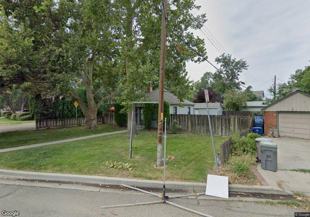
501 Avenue D Boise, ID 83712
East End NeighborhoodEstimated Value: $468,000 - $570,085
2
Beds
1
Bath
537
Sq Ft
$995/Sq Ft
Est. Value
About This Home
This home is located at 501 Avenue D, Boise, ID 83712 and is currently estimated at $534,271, approximately $994 per square foot. 501 Avenue D is a home located in Ada County with nearby schools including Roosevelt Elementary School, North Junior High School, and Boise Senior High School.
Ownership History
Date
Name
Owned For
Owner Type
Purchase Details
Closed on
Dec 6, 2013
Sold by
Jennings Benjamin C and Jennings Rhonda S
Bought by
B & R Jennings Llc
Current Estimated Value
Purchase Details
Closed on
Dec 3, 2012
Sold by
Lonning Rob and Lonning Jeffrey Elizabeth
Bought by
Lonning Robert A and Lonning Jeffrey Elizabeth
Purchase Details
Closed on
Mar 18, 2011
Sold by
Mccarthy Janet M
Bought by
Lonning Rob and Lonning Jeffrey Elizabeth
Purchase Details
Closed on
Dec 22, 2000
Sold by
Jennings Timothy B and Jennings Katherine Y
Bought by
Jennings Benjamin C and Jennings Rhonda
Create a Home Valuation Report for This Property
The Home Valuation Report is an in-depth analysis detailing your home's value as well as a comparison with similar homes in the area
Home Values in the Area
Average Home Value in this Area
Purchase History
We collect this data history from publicly available records. To have your information removed, we recommend requesting removal directly through your county’s website.
| Date | Buyer | Sale Price | Title Company |
|---|---|---|---|
| B & R Jennings Llc | -- | None Available | |
| Lonning Robert A | -- | None Available | |
| Lonning Rob | -- | Pioneer Title Company Of Ada | |
| Jennings Benjamin C | -- | Pioneer Title Company |
Source: Public Records
Tax History
| Year | Tax Paid | Tax Assessment Tax Assessment Total Assessment is a certain percentage of the fair market value that is determined by local assessors to be the total taxable value of land and additions on the property. | Land | Improvement |
|---|---|---|---|---|
| 2025 | $4,646 | $504,100 | -- | -- |
| 2024 | $3,987 | $470,000 | -- | -- |
| 2023 | $3,987 | $417,500 | $0 | $0 |
| 2022 | $3,955 | $456,100 | $0 | $0 |
| 2021 | $4,035 | $369,200 | $0 | $0 |
| 2020 | $3,818 | $321,600 | $0 | $0 |
| 2019 | $4,214 | $310,600 | $0 | $0 |
| 2018 | $4,257 | $280,400 | $0 | $0 |
| 2017 | $3,920 | $245,300 | $0 | $0 |
| 2016 | $3,683 | $224,900 | $0 | $0 |
| 2015 | $3,200 | $200,800 | $0 | $0 |
| 2012 | -- | $169,200 | $0 | $0 |
Source: Public Records
Map
Nearby Homes
- 630 N Avenue H
- 916 E Mckinley St
- 323 W Jefferson St Unit 103
- 323 W Jefferson St
- 323 W Jefferson St Unit 601
- TBD E Shaw Mountain Rd
- 1014 E Franklin St
- 1115 E Jefferson St
- 974 E Strawberry Ln
- 705 W Franklin St
- 709 W Franklin St
- 1224 E Hays St
- 199 N Capitol Blvd Unit 706
- 1312 E Franklin St
- 411 W Union St
- 255 S Capitol Blvd Unit 1403
- 919 N 6th St
- 1424 E Warm Springs Ave
- 1110 N 6th St
- 1417 E Shenandoah Ct
Your Personal Tour Guide
Ask me questions while you tour the home.