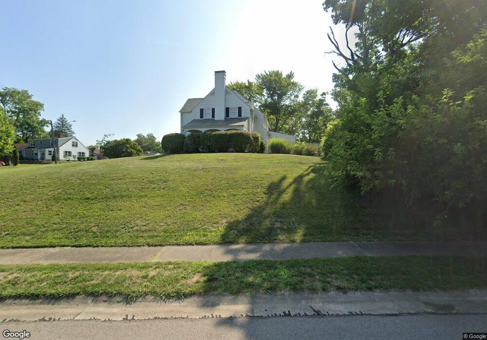
501 Euclid St Middletown, OH 45044
Highlands NeighborhoodEstimated Value: $283,000 - $309,000
3
Beds
2
Baths
2,010
Sq Ft
$146/Sq Ft
Est. Value
About This Home
This home is located at 501 Euclid St, Middletown, OH 45044 and is currently estimated at $293,976, approximately $146 per square foot. 501 Euclid St is a home located in Butler County with nearby schools including Mayfield Elementary School, Highview 6th Grade Center, and Middletown Middle School.
Ownership History
Date
Name
Owned For
Owner Type
Purchase Details
Closed on
Jul 14, 2021
Sold by
Goforth Kent Boyd and Goforth Lura Lucinda
Bought by
Brooks Robert W and Brooks Lauren M
Current Estimated Value
Home Financials for this Owner
Home Financials are based on the most recent Mortgage that was taken out on this home.
Original Mortgage
$188,000
Outstanding Balance
$170,581
Interest Rate
2.9%
Mortgage Type
Purchase Money Mortgage
Estimated Equity
$123,395
Purchase Details
Closed on
Mar 1, 1985
Bought by
Goforth Kent Boyd
Create a Home Valuation Report for This Property
The Home Valuation Report is an in-depth analysis detailing your home's value as well as a comparison with similar homes in the area
Home Values in the Area
Average Home Value in this Area
Purchase History
| Date | Buyer | Sale Price | Title Company |
|---|---|---|---|
| Brooks Robert W | $235,000 | None Available | |
| Goforth Kent Boyd | $97,500 | -- |
Source: Public Records
Mortgage History
| Date | Status | Borrower | Loan Amount |
|---|---|---|---|
| Open | Brooks Robert W | $188,000 |
Source: Public Records
Tax History Compared to Growth
Tax History
| Year | Tax Paid | Tax Assessment Tax Assessment Total Assessment is a certain percentage of the fair market value that is determined by local assessors to be the total taxable value of land and additions on the property. | Land | Improvement |
|---|---|---|---|---|
| 2024 | $4,301 | $83,270 | $8,320 | $74,950 |
| 2023 | $4,276 | $83,270 | $8,320 | $74,950 |
| 2022 | $3,205 | $55,160 | $8,320 | $46,840 |
| 2021 | $3,164 | $55,160 | $8,320 | $46,840 |
| 2020 | $3,296 | $55,160 | $8,320 | $46,840 |
| 2019 | $3,091 | $42,640 | $8,770 | $33,870 |
| 2018 | $2,761 | $42,640 | $8,770 | $33,870 |
| 2017 | $2,766 | $42,640 | $8,770 | $33,870 |
| 2016 | $2,687 | $39,670 | $8,770 | $30,900 |
| 2015 | $2,649 | $39,670 | $8,770 | $30,900 |
| 2014 | $2,149 | $39,670 | $8,770 | $30,900 |
| 2013 | $2,149 | $34,980 | $9,230 | $25,750 |
Source: Public Records
Map
Nearby Homes
- 500 Dorset Dr
- 3205 Grand Ave
- 800 Orchard St
- 20 Sycamore Terrace
- 723 Jackson Ln
- 609 Gladys Dr
- 304 S Highview Rd
- 3227 Barbara Dr
- 615 Highland St
- 3305 Poinciana Rd
- 1308 Orchard St
- 1012 Jackson Ln
- 1030 Jackson Ln
- 3700 Fiesta Way
- 503 Ross St
- 3106 Sheldon Rd
- 2619 Central Ave
- 3002 Goldman Ave
- 3724 Fiesta Way
- 808 The Alameda