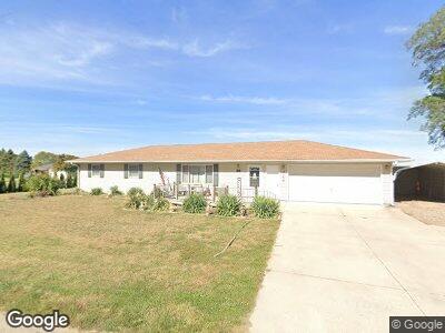
501 Webster St Farragut, IA 51639
Estimated Value: $203,000 - $210,000
3
Beds
2
Baths
2,152
Sq Ft
$96/Sq Ft
Est. Value
About This Home
This home is located at 501 Webster St, Farragut, IA 51639 and is currently estimated at $206,696, approximately $96 per square foot. 501 Webster St is a home located in Fremont County with nearby schools including Shenandoah Elementary School, Shenandoah Middle School, and Shenandoah High School.
Ownership History
Date
Name
Owned For
Owner Type
Purchase Details
Closed on
Mar 6, 2024
Sold by
Dollison Matthew John and Dollison Amanda Jean
Bought by
Jordan Randi Marie
Current Estimated Value
Purchase Details
Closed on
Apr 22, 2019
Sold by
Nebel Gary J and Neel Pamela S
Bought by
Dollison Matthew J and Dollison Amanda J
Home Financials for this Owner
Home Financials are based on the most recent Mortgage that was taken out on this home.
Original Mortgage
$60,000
Interest Rate
4%
Mortgage Type
Stand Alone Refi Refinance Of Original Loan
Create a Home Valuation Report for This Property
The Home Valuation Report is an in-depth analysis detailing your home's value as well as a comparison with similar homes in the area
Home Values in the Area
Average Home Value in this Area
Purchase History
| Date | Buyer | Sale Price | Title Company |
|---|---|---|---|
| Jordan Randi Marie | $195,000 | None Listed On Document | |
| Dollison Matthew J | $120,000 | -- |
Source: Public Records
Mortgage History
| Date | Status | Borrower | Loan Amount |
|---|---|---|---|
| Previous Owner | Dollison Matthew J | $60,000 |
Source: Public Records
Tax History Compared to Growth
Tax History
| Year | Tax Paid | Tax Assessment Tax Assessment Total Assessment is a certain percentage of the fair market value that is determined by local assessors to be the total taxable value of land and additions on the property. | Land | Improvement |
|---|---|---|---|---|
| 2024 | $3,118 | $191,790 | $9,450 | $182,340 |
| 2023 | $3,228 | $191,790 | $9,450 | $182,340 |
| 2022 | $3,108 | $182,740 | $12,110 | $170,630 |
| 2021 | $3,108 | $170,460 | $11,300 | $159,160 |
| 2020 | $3,056 | $151,730 | $11,300 | $140,430 |
| 2019 | $3,262 | $149,680 | $0 | $0 |
| 2018 | $3,206 | $149,680 | $0 | $0 |
| 2017 | $3,206 | $134,850 | $0 | $0 |
| 2016 | $2,872 | $134,850 | $0 | $0 |
| 2015 | $2,872 | $134,850 | $0 | $0 |
| 2014 | $2,886 | $134,200 | $0 | $0 |
Source: Public Records
Map
Nearby Homes
- 1009 Jackson Ave
- 1110 New Orleans Ave
- 00 200 St
- 2410 400th Ave
- 2474 400th Ave
- 602 Alice Ave
- 27 W Ridge Dr
- 509 Kearney Ave
- 2528 U S 59
- 1102 Cherry Hills Dr
- 0 280 St
- 14 Country Club Ln
- 2 Country Club Ln
- 1601 S Elm St
- 1410 S Elm St
- 1305 Maple St
- 814 South Ave
- 1405 S Elm St
- 811 W Summit Ave
- 9 Country Club Ln
- 501 Webster St
- 1110 Tecumseh Ave
- 411 Webster St
- 1108 Tecumseh Ave
- 1111 Tecumseh Ave
- 1109 St Phillips Ave
- 505 Webster St
- 1109 Tecumseh Ave
- 1109 Tecumseh Ave
- 1100 Tecumseh Ave
- 1101 Tecumseh Ave
- 511 Clay St
- 1109 St Phillip Ave
- 401 Webster St
- 404 Webster St
- 603 Webster St
- 1108 St Phillips Ave
- 1010 Tecumseh Ave
- 1009 Tecumseh Ave
- 605 Webster St