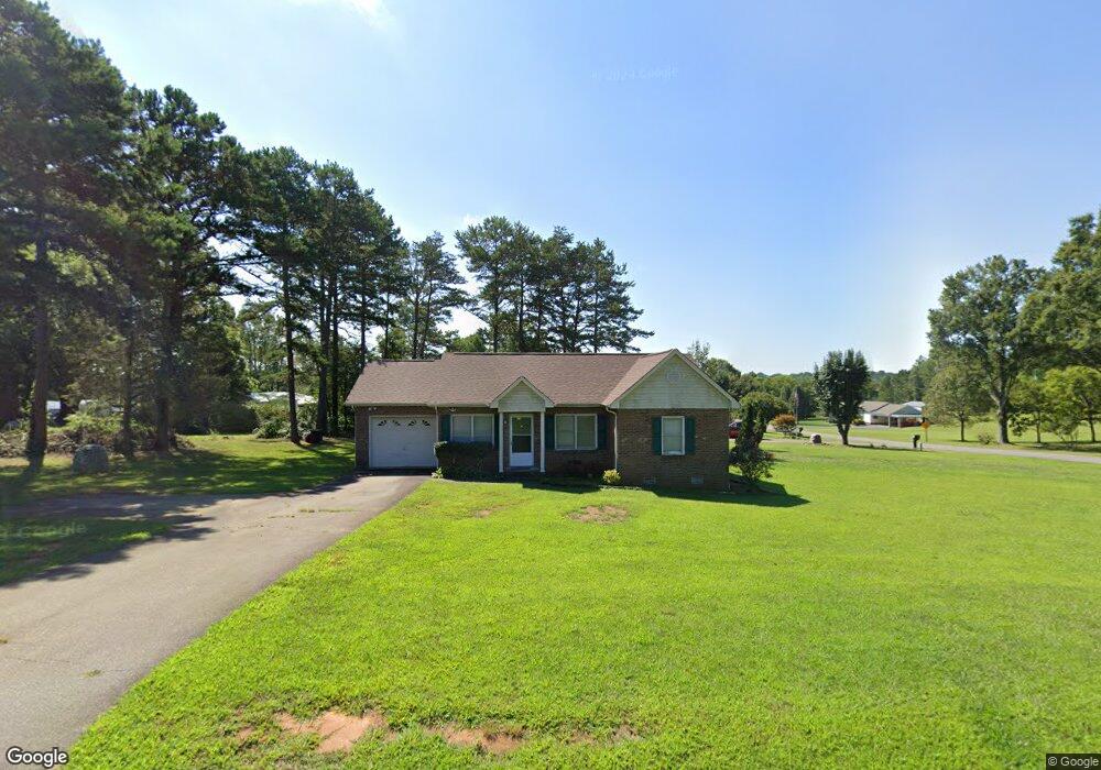
5013 Rifle Range Rd Conover, NC 28613
Estimated Value: $233,339 - $262,000
3
Beds
2
Baths
1,083
Sq Ft
$230/Sq Ft
Est. Value
About This Home
This home is located at 5013 Rifle Range Rd, Conover, NC 28613 and is currently estimated at $249,085, approximately $229 per square foot. 5013 Rifle Range Rd is a home located in Catawba County with nearby schools including Lyle Creek Elementary School, River Bend Middle School, and Bunker Hill High School.
Ownership History
Date
Name
Owned For
Owner Type
Purchase Details
Closed on
Oct 2, 2025
Sold by
Moran Jose Hernandez and Olivares Amada Hernandez
Bought by
Haven Rental Holdings Llc
Current Estimated Value
Purchase Details
Closed on
Jul 22, 2025
Sold by
Vue Lee Richie and Vue Pakou Lee
Bought by
Moran Jose Hernandez
Home Financials for this Owner
Home Financials are based on the most recent Mortgage that was taken out on this home.
Original Mortgage
$180,000
Interest Rate
6.85%
Mortgage Type
New Conventional
Purchase Details
Closed on
Sep 29, 2005
Sold by
Chang Kou and Chang Mao V
Bought by
Lee Vu and Yang Pa Kou
Home Financials for this Owner
Home Financials are based on the most recent Mortgage that was taken out on this home.
Original Mortgage
$107,100
Interest Rate
5.72%
Mortgage Type
Unknown
Purchase Details
Closed on
Jun 1, 1998
Create a Home Valuation Report for This Property
The Home Valuation Report is an in-depth analysis detailing your home's value as well as a comparison with similar homes in the area
Home Values in the Area
Average Home Value in this Area
Purchase History
| Date | Buyer | Sale Price | Title Company |
|---|---|---|---|
| Haven Rental Holdings Llc | -- | None Listed On Document | |
| Moran Jose Hernandez | $240,000 | Team Title Services | |
| Moran Jose Hernandez | $240,000 | Team Title Services | |
| Lee Vu | $105,000 | None Available | |
| -- | $83,000 | -- |
Source: Public Records
Mortgage History
| Date | Status | Borrower | Loan Amount |
|---|---|---|---|
| Previous Owner | Moran Jose Hernandez | $180,000 | |
| Previous Owner | Lee Vu | $107,100 |
Source: Public Records
Tax History
| Year | Tax Paid | Tax Assessment Tax Assessment Total Assessment is a certain percentage of the fair market value that is determined by local assessors to be the total taxable value of land and additions on the property. | Land | Improvement |
|---|---|---|---|---|
| 2025 | $1,046 | $200,200 | $12,400 | $187,800 |
| 2024 | $1,046 | $200,200 | $12,400 | $187,800 |
| 2023 | $1,006 | $133,000 | $12,400 | $120,600 |
| 2022 | $924 | $133,000 | $12,400 | $120,600 |
| 2021 | $924 | $133,000 | $12,400 | $120,600 |
| 2020 | $924 | $133,000 | $12,400 | $120,600 |
| 2019 | $924 | $133,000 | $0 | $0 |
| 2018 | $716 | $103,000 | $12,400 | $90,600 |
| 2017 | $714 | $0 | $0 | $0 |
| 2016 | $714 | $0 | $0 | $0 |
| 2015 | $566 | $102,670 | $12,100 | $90,570 |
| 2014 | $566 | $94,400 | $12,100 | $82,300 |
Source: Public Records
Map
Nearby Homes
- 5164 Lavern St Unit 1
- 4484 Springs Rd
- 5309 Hall St
- 4531 Springs Rd
- 5217 Canterbury Dr
- 5069 W Piedmont Cir
- 4687 Ransom Dr
- 1158 Sunset Ct
- 1252 Houston Mill Rd
- 1113 Pecan St
- 3951 Springs Rd
- 4874 Stone Dr Unit 125
- 4829 County Home Rd
- 5505 Creek Point Dr
- 1371 Millrace Dr
- 3785 Pinecrest Dr NE Unit 155
- 3779 Pinecrest Dr NE Unit 154
- 4029 Pinecrest Dr NE Unit 166
- 4125 Hideaway Ct NE
- 4932 Sandstone Dr
- 4964 Tumbling Creek Rd
- 4993 Rifle Range Rd
- 4952 Tumbling Creek Rd
- 5033 Rifle Range Rd
- 4977 Rifle Range Rd
- 5020 Rifle Range Rd
- 4944 Tumbling Creek Rd
- 4936 Tumbling Creek Rd
- 5057 Rifle Range Rd
- 4931 Tumbling Creek Rd
- 4928 Tumbling Creek Rd
- 4920 Tumbling Creek Rd
- 4908 Tumbling Creek Rd
- 4948 Rifle Range Rd
- 4915 Rifle Range Rd
- 4900 Tumbling Creek Rd
- 4944 Rifle Range Rd
- 4913 Tumbling Creek Rd
- 4894 Tumbling Creek Rd
- 4972 Drumnorth Dr
Your Personal Tour Guide
Ask me questions while you tour the home.