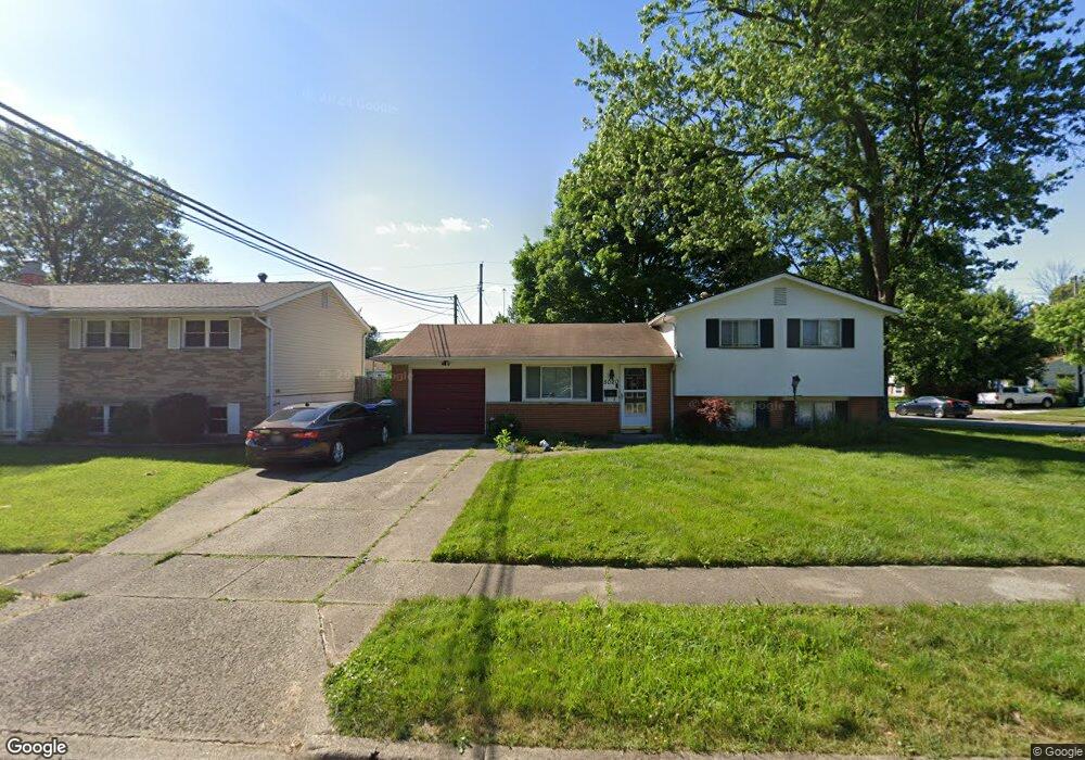
5020 Comstock Dr Columbus, OH 43232
Walnut Heights NeighborhoodEstimated Value: $181,252 - $249,000
3
Beds
1
Bath
956
Sq Ft
$221/Sq Ft
Est. Value
About This Home
This home is located at 5020 Comstock Dr, Columbus, OH 43232 and is currently estimated at $211,563, approximately $221 per square foot. 5020 Comstock Dr is a home located in Franklin County with nearby schools including Liberty Elementary School, Yorktown Middle School, and Independence High School.
Ownership History
Date
Name
Owned For
Owner Type
Purchase Details
Closed on
Nov 17, 2022
Sold by
Cr Funding Llc
Bought by
Onsri Properties Llc
Current Estimated Value
Purchase Details
Closed on
Nov 7, 2022
Sold by
Cr Funding Llc
Bought by
Onsri Properties Llc
Purchase Details
Closed on
Aug 31, 2022
Sold by
Wolford Wendall L
Bought by
Cr Funding Llc
Purchase Details
Closed on
Apr 29, 1991
Bought by
Wolford Wendall L and Wolford Jamie
Create a Home Valuation Report for This Property
The Home Valuation Report is an in-depth analysis detailing your home's value as well as a comparison with similar homes in the area
Home Values in the Area
Average Home Value in this Area
Purchase History
| Date | Buyer | Sale Price | Title Company |
|---|---|---|---|
| Onsri Properties Llc | -- | Valley Title & Escrow | |
| Onsri Properties Llc | -- | Valley Title & Escrow | |
| Cr Funding Llc | $75,000 | New Title Company Name | |
| Wolford Wendall L | $69,000 | -- |
Source: Public Records
Tax History
| Year | Tax Paid | Tax Assessment Tax Assessment Total Assessment is a certain percentage of the fair market value that is determined by local assessors to be the total taxable value of land and additions on the property. | Land | Improvement |
|---|---|---|---|---|
| 2025 | $4,715 | $62,930 | $18,760 | $44,170 |
| 2024 | $4,715 | $62,930 | $18,760 | $44,170 |
| 2023 | $3,002 | $62,930 | $18,760 | $44,170 |
| 2022 | $1,857 | $35,810 | $7,460 | $28,350 |
| 2021 | $1,861 | $35,810 | $7,460 | $28,350 |
| 2020 | $1,863 | $35,810 | $7,460 | $28,350 |
| 2019 | $1,830 | $30,170 | $6,230 | $23,940 |
| 2018 | $1,634 | $30,170 | $6,230 | $23,940 |
| 2017 | $1,829 | $30,170 | $6,230 | $23,940 |
| 2016 | $1,589 | $23,980 | $4,900 | $19,080 |
| 2015 | $1,442 | $23,980 | $4,900 | $19,080 |
| 2014 | $1,446 | $23,980 | $4,900 | $19,080 |
| 2013 | $792 | $26,635 | $5,425 | $21,210 |
Source: Public Records
Map
Nearby Homes
- 5123 Jameson Dr
- 5144 Botsford Dr
- 5114 Carbondale Dr
- 0 Noe Bixby Rd
- 2608 Hubbell Rd
- 2336 Noe Bixby Rd
- 2348 Noe Bixby Rd
- 2342 Noe Bixby Rd
- 2360 Noe Bixby Rd
- 2354 Noe Bixby Rd
- 2651 Brownfield Rd
- 5137 Holbrook Dr
- 0 Colvin Rd
- 1945 Riverdale Rd
- 5207 Kornwal Dr
- 2706 Moundcrest St
- 4942 Talbert Dr
- 2700 Raphael Dr
- 2730 Raphael Dr
- 2900 Gentry Ln
- 5010 Comstock Dr
- 2377 Lisbon Dr
- 5000 Comstock Dr
- 5019 Comstock Dr
- 2390 Lisbon Dr
- 4995 Botsford Dr
- 2378 Lisbon Dr
- 2400 Lisbon Dr
- 5009 Comstock Dr
- 4985 Botsford Dr
- 4996 Comstock Dr
- 2409 Lisbon Dr
- 5025 Botsford Dr
- 5003 Comstock Dr
- 2406 Lisbon Dr
- 4981 Botsford Dr
- 4999 Comstock Dr
- 5055 Jameson Dr
- 5029 Botsford Dr
- 2410 Lisbon Dr
Your Personal Tour Guide
Ask me questions while you tour the home.