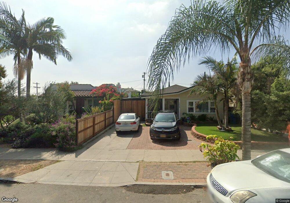
5028 Range View Ave Los Angeles, CA 90042
Highland Park NeighborhoodEstimated Value: $1,043,752 - $1,405,000
3
Beds
2
Baths
1,180
Sq Ft
$1,016/Sq Ft
Est. Value
About This Home
This home is located at 5028 Range View Ave, Los Angeles, CA 90042 and is currently estimated at $1,198,938, approximately $1,016 per square foot. 5028 Range View Ave is a home located in Los Angeles County with nearby schools including Buchanan Street Elementary and Franklin Middle School & High School.
Ownership History
Date
Name
Owned For
Owner Type
Purchase Details
Closed on
May 22, 2023
Sold by
Riopelle Silvia
Bought by
Tello Ana L
Current Estimated Value
Purchase Details
Closed on
Jun 20, 2012
Sold by
Cuervo William A
Bought by
Tello Ana L and Riopelle Silvia
Home Financials for this Owner
Home Financials are based on the most recent Mortgage that was taken out on this home.
Original Mortgage
$255,000
Interest Rate
3.74%
Mortgage Type
New Conventional
Purchase Details
Closed on
Feb 22, 2006
Sold by
Tello Ana L
Bought by
Cuervo William A and Tello Ana L
Purchase Details
Closed on
Dec 14, 2000
Sold by
Chapman William
Bought by
Tello Ana L and Riopelle Silvia
Home Financials for this Owner
Home Financials are based on the most recent Mortgage that was taken out on this home.
Original Mortgage
$180,172
Interest Rate
7.41%
Mortgage Type
FHA
Create a Home Valuation Report for This Property
The Home Valuation Report is an in-depth analysis detailing your home's value as well as a comparison with similar homes in the area
Home Values in the Area
Average Home Value in this Area
Purchase History
| Date | Buyer | Sale Price | Title Company |
|---|---|---|---|
| Tello Ana L | -- | None Listed On Document | |
| Tello Ana L | -- | Investors Title Company | |
| Cuervo William A | -- | None Available | |
| Tello Ana L | $183,000 | Commonwealth Title |
Source: Public Records
Mortgage History
| Date | Status | Borrower | Loan Amount |
|---|---|---|---|
| Previous Owner | Tello Ana L | $255,000 | |
| Previous Owner | Tello Ana L | $180,172 |
Source: Public Records
Tax History
| Year | Tax Paid | Tax Assessment Tax Assessment Total Assessment is a certain percentage of the fair market value that is determined by local assessors to be the total taxable value of land and additions on the property. | Land | Improvement |
|---|---|---|---|---|
| 2025 | $3,231 | $260,161 | $169,322 | $90,839 |
| 2024 | $3,231 | $255,060 | $166,002 | $89,058 |
| 2023 | $3,170 | $250,060 | $162,748 | $87,312 |
| 2022 | $3,025 | $245,157 | $159,557 | $85,600 |
| 2021 | $2,983 | $240,351 | $156,429 | $83,922 |
| 2019 | $2,894 | $233,225 | $151,791 | $81,434 |
| 2018 | $2,796 | $228,653 | $148,815 | $79,838 |
| 2017 | $2,732 | $224,171 | $145,898 | $78,273 |
| 2016 | $2,659 | $219,777 | $143,038 | $76,739 |
| 2015 | $2,620 | $216,477 | $140,890 | $75,587 |
| 2014 | $2,635 | $212,238 | $138,131 | $74,107 |
Source: Public Records
Map
Nearby Homes
- 5007 Almaden Dr
- 4920 Stratford Rd
- 5132 Range View Ave
- 4816 Stratford Rd
- 5001 Buchanan St
- 5144 Buchanan St
- 5240 Barker Dr
- 1932 Phillips Way
- 1411 Armadale Ave
- 1048 Dexter St
- 1942 Phillips Way
- 1938 Phillips Way
- 5055 Hub St
- 1817 N Avenue 55
- 5330 Lincoln Ave
- 5118 Hub St
- 917 N Avenue 51
- 4666 York Blvd
- 829 N Avenue 53
- 5349 Baltimore St
- 5032 Range View Ave
- 5024 Range View Ave
- 5038 Range View Ave
- 5022 Range View Ave
- 5042 Range View Ave
- 5016 Range View Ave
- 5027 Stratford Rd
- 5025 Stratford Rd
- 5021 Stratford Rd
- 5023 Stratford Rd
- 5044 Range View Ave
- 5012 Range View Ave
- 5017 Stratford Rd
- 5041 Stratford Rd
- 5047 Stratford Rd
- 5037 Range View Ave
- 5041 Range View Ave
- 5031 Range View Ave
- 5045 Range View Ave
- 5029 Range View Ave
Your Personal Tour Guide
Ask me questions while you tour the home.