Estimated Value: $373,000 - $492,000
4
Beds
4
Baths
3,750
Sq Ft
$117/Sq Ft
Est. Value
About This Home
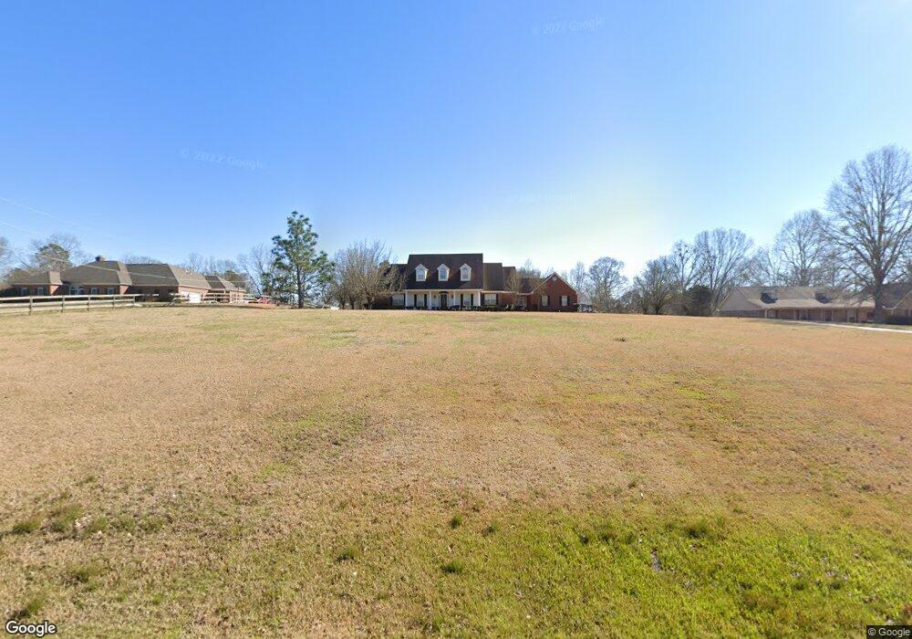
This home is located at 5031 Kay Brook Dr, Byram, MS 39272 and is currently estimated at $438,743, approximately $116 per square foot. 5031 Kay Brook Dr is a home located in Hinds County with nearby schools including Gary Road Elementary School, Gary Road Intermediate School, and Byram Middle School.
Ownership History
Date
Name
Owned For
Owner Type
Purchase Details
Closed on
Apr 20, 2011
Sold by
Canterbury Ricky D and Canterbury Eugenia Waller
Bought by
Perkins Christopher L and Perkins Sandra
Current Estimated Value
Purchase Details
Closed on
Sep 14, 2009
Sold by
Waller Jeannie W Canterbury
Bought by
Canterbury Ricky D
Create a Home Valuation Report for This Property
The Home Valuation Report is an in-depth analysis detailing your home's value as well as a comparison with similar homes in the area
Home Values in the Area
Average Home Value in this Area
Purchase History
| Date | Buyer | Sale Price | Title Company |
|---|---|---|---|
| Perkins Christopher L | -- | -- | |
| Canterbury Ricky D | -- | -- |
Source: Public Records
Mortgage History
| Date | Status | Borrower | Loan Amount |
|---|---|---|---|
| Open | Perkins Christopher L | $50,000 |
Source: Public Records
Tax History Compared to Growth
Tax History
| Year | Tax Paid | Tax Assessment Tax Assessment Total Assessment is a certain percentage of the fair market value that is determined by local assessors to be the total taxable value of land and additions on the property. | Land | Improvement |
|---|---|---|---|---|
| 2025 | $4,369 | $29,843 | $3,945 | $25,898 |
| 2024 | $4,369 | $29,843 | $3,945 | $25,898 |
| 2023 | $4,369 | $29,843 | $3,945 | $25,898 |
| 2022 | $4,591 | $29,843 | $3,945 | $25,898 |
| 2021 | $4,231 | $29,843 | $3,945 | $25,898 |
| 2020 | $4,105 | $29,395 | $3,945 | $25,450 |
| 2019 | $4,083 | $29,395 | $3,945 | $25,450 |
| 2018 | $4,083 | $29,395 | $3,945 | $25,450 |
| 2017 | $4,002 | $29,395 | $3,945 | $25,450 |
| 2016 | $4,002 | $29,395 | $3,945 | $25,450 |
| 2015 | $4,068 | $29,845 | $3,945 | $25,900 |
| 2014 | $4,007 | $29,845 | $3,945 | $25,900 |
Source: Public Records
Map
Nearby Homes
- 1460 Marwood Rd
- 120 Gun Hill Cove
- 221 Raulston Dr
- 213 Raulston Dr
- 0 Henderson Rd Unit 4126215
- 212 Raulston Dr
- 229 Raulston Dr
- Alston Plan at Barrington
- Cairn Plan at Barrington
- Booth Plan at Barrington
- 624 Lexington Cove
- 834 Creston Dr
- 737 Forest Woods Dr Unit 48
- 0 S Siwell Rd Unit 24872982
- 00 S Siwell Rd
- 0 S Siwell Rd Unit 4088750
- 0 Crossbridge Blvd Unit 4097429
- 108 Forest Lake Dr
- 00 Crossbridge Blvd
- 26 Old Bridge Cove
- 5035 Kay Brook Dr
- 5027 Kay Brook Dr
- 5039 Kaybrook Dr
- 5039 Kay Brook Dr
- 5023 Kay Brook Dr
- 5034 Kay Brook Dr
- 5043 Kay Brook Dr
- 5019 Kay Brook Dr
- 5019 Kay Brook Dr Unit 4
- 5019 Kay Brook Dr
- 5019 Kaybrook Dr Unit 4
- 5019 Kaybrook Dr
- 5038 Kaybrook Dr
- 5038 Kay Brook Dr
- 5030 Kay Brook Dr
- 5015 Kay Brook Dr
- 1434 Marwood Rd
- 5047 Kay Brook Dr
- 5026 Kay Brook Dr
- 5050 Kay Brook Dr