Estimated Value: $311,000 - $345,000
3
Beds
2
Baths
1,601
Sq Ft
$202/Sq Ft
Est. Value
About This Home
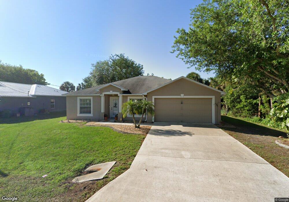
This home is located at 5045 Market St, Cocoa, FL 32927 and is currently estimated at $324,176, approximately $202 per square foot. 5045 Market St is a home located in Brevard County with nearby schools including Atlantis Elementary School, Space Coast Junior/Senior High School, and Sculptor Charter School.
Ownership History
Date
Name
Owned For
Owner Type
Purchase Details
Closed on
Oct 9, 2019
Sold by
Legge Deborha H
Bought by
Bowman Jennifer L
Current Estimated Value
Purchase Details
Closed on
Jun 11, 2001
Sold by
Spare Mark E
Bought by
Legge Deborah H
Purchase Details
Closed on
Oct 22, 1999
Sold by
Holiday Bldr Inc
Bought by
Spare Mark E
Home Financials for this Owner
Home Financials are based on the most recent Mortgage that was taken out on this home.
Original Mortgage
$85,200
Interest Rate
7.81%
Purchase Details
Closed on
Jun 23, 1999
Sold by
Atlantic Gulf Com Corp
Bought by
Holiday Bldr Inc
Create a Home Valuation Report for This Property
The Home Valuation Report is an in-depth analysis detailing your home's value as well as a comparison with similar homes in the area
Home Values in the Area
Average Home Value in this Area
Purchase History
| Date | Buyer | Sale Price | Title Company |
|---|---|---|---|
| Bowman Jennifer L | -- | Attorney | |
| Legge Deborah H | $95,000 | -- | |
| Spare Mark E | $85,300 | -- | |
| Holiday Bldr Inc | $9,000 | -- |
Source: Public Records
Mortgage History
| Date | Status | Borrower | Loan Amount |
|---|---|---|---|
| Previous Owner | Spare Mark E | $85,200 |
Source: Public Records
Tax History Compared to Growth
Tax History
| Year | Tax Paid | Tax Assessment Tax Assessment Total Assessment is a certain percentage of the fair market value that is determined by local assessors to be the total taxable value of land and additions on the property. | Land | Improvement |
|---|---|---|---|---|
| 2025 | $1,356 | $98,210 | -- | -- |
| 2024 | $1,319 | $95,450 | -- | -- |
| 2023 | $1,319 | $92,670 | $0 | $0 |
| 2022 | $1,229 | $89,980 | $0 | $0 |
| 2021 | $1,222 | $87,360 | $0 | $0 |
| 2020 | $1,158 | $86,160 | $0 | $0 |
| 2019 | $1,093 | $84,230 | $0 | $0 |
| 2018 | $1,084 | $82,660 | $0 | $0 |
| 2017 | $1,073 | $80,960 | $0 | $0 |
| 2016 | $1,071 | $79,300 | $18,000 | $61,300 |
| 2015 | $664 | $78,750 | $15,000 | $63,750 |
| 2014 | $664 | $78,130 | $11,000 | $67,130 |
Source: Public Records
Map
Nearby Homes
- 5090 Market St
- 6840 Anecia Ave
- 5155 Mayflower St
- 6735 Grissom Pkwy
- 7155 Export Ave
- 4859 Horton St
- 4760 Ivan St
- 5149 Arlington Rd Unit 104
- 7275 Durban Ave
- 7065 Hundred Acre Dr
- 7035 Jasmine Ave
- 0000 Grissom Pkwy
- 00 Unknown
- 5170 Everett St
- 7302 Bumelia Dr
- 6615 Dock Ave
- 7310 Joshua Place
- 7230 Venus Ave
- 6390 Depot Ave
- 6375 Cable Ave