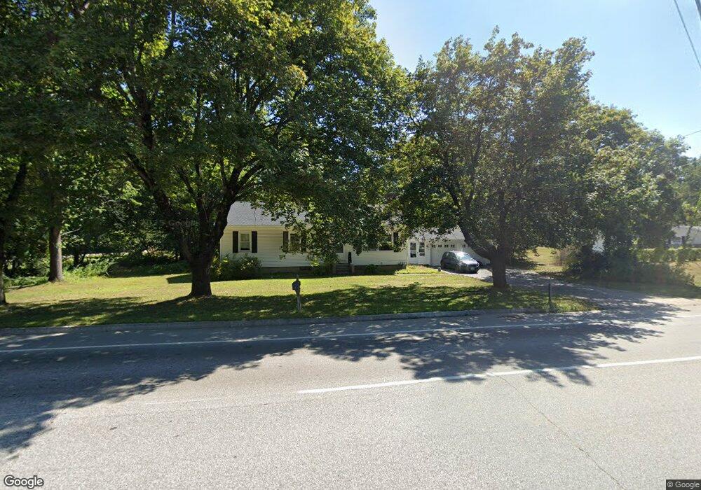
505 Charles Bancroft Hwy Litchfield, NH 03052
Estimated Value: $456,785 - $535,000
4
Beds
3
Baths
1,980
Sq Ft
$253/Sq Ft
Est. Value
About This Home
This home is located at 505 Charles Bancroft Hwy, Litchfield, NH 03052 and is currently estimated at $501,196, approximately $253 per square foot. 505 Charles Bancroft Hwy is a home with nearby schools including Griffin Memorial School and St. Francis of Assisi School.
Ownership History
Date
Name
Owned For
Owner Type
Purchase Details
Closed on
Jan 25, 2001
Sold by
Est Sophia Mary Adams
Bought by
Warren W Adams Lt
Current Estimated Value
Home Financials for this Owner
Home Financials are based on the most recent Mortgage that was taken out on this home.
Original Mortgage
$87,700
Outstanding Balance
$32,413
Interest Rate
7.39%
Estimated Equity
$468,783
Create a Home Valuation Report for This Property
The Home Valuation Report is an in-depth analysis detailing your home's value as well as a comparison with similar homes in the area
Home Values in the Area
Average Home Value in this Area
Purchase History
| Date | Buyer | Sale Price | Title Company |
|---|---|---|---|
| Warren W Adams Lt | $80,000 | -- |
Source: Public Records
Mortgage History
| Date | Status | Borrower | Loan Amount |
|---|---|---|---|
| Open | Warren W Adams Lt | $87,700 |
Source: Public Records
Tax History Compared to Growth
Tax History
| Year | Tax Paid | Tax Assessment Tax Assessment Total Assessment is a certain percentage of the fair market value that is determined by local assessors to be the total taxable value of land and additions on the property. | Land | Improvement |
|---|---|---|---|---|
| 2024 | $6,240 | $300,300 | $148,300 | $152,000 |
| 2023 | $6,288 | $300,300 | $148,300 | $152,000 |
| 2022 | $5,684 | $298,700 | $148,300 | $150,400 |
| 2021 | $5,508 | $298,700 | $148,300 | $150,400 |
| 2020 | $5,550 | $298,700 | $148,300 | $150,400 |
| 2019 | $5,645 | $238,700 | $118,400 | $120,300 |
| 2017 | $5,357 | $238,200 | $118,400 | $119,800 |
| 2016 | $5,145 | $238,200 | $118,400 | $119,800 |
| 2015 | $4,855 | $238,200 | $118,400 | $119,800 |
| 2014 | $4,796 | $231,700 | $116,100 | $115,600 |
| 2013 | $4,766 | $231,700 | $116,100 | $115,600 |
Source: Public Records
Map
Nearby Homes
- 490 Charles Bancroft Hwy
- 3-C Mustang Dr Unit MODEL
- 9 Mustang Dr Unit C
- 9 Mustang Dr Unit B
- 7 Mustang Dr Unit C
- 7 Mustang Dr Unit END UNIT-A
- 25 Chatfield Dr
- 22 Kimberly Dr
- 29 Watts Landing Unit 24
- 31 Garden Dr
- 15 Tamarack Ct
- 1 Pleasant St
- 67 Pullman St
- 1 Tallarico St Unit 14
- 8 Iroquois Cir
- 0 Tallarico St Unit 3 5032471
- 0 Tallarico St Unit 5 5032751
- 0 Tallarico St Unit 26
- 0 Tallarico St Unit 10 5044310
- 0 Tallarico St Unit 12 5033131
- 503 Charles Bancroft Hwy
- 4 A Adams Way
- 3b Adams Way
- 506 Charles Bancroft Hwy
- 510 Charles Bancroft Hwy
- 507 Charles Bancroft Hwy
- 504 Charles Bancroft Hwy
- 512 Charles Bancroft Hwy
- 501 Charles Bancroft Hwy
- 509 Charles Bancroft Hwy
- 500 Charles Bancroft Hwy
- 514 Charles Bancroft Hwy
- 498 Charles Bancroft Hwy
- 519 Charles Bancroft Hwy
- 496 Charles Bancroft Hwy
- 494 Charles Bancroft Hwy
- 493 Charles Bancroft Hwy
- 492 Charles Bancroft Hwy
- 3 Brook Rd
- 1 Forest Ln