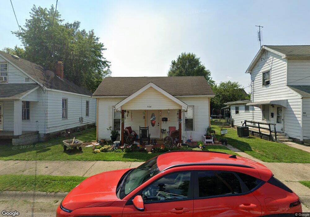
506 Moore St Middletown, OH 45044
Sherman NeighborhoodEstimated Value: $75,710 - $135,000
2
Beds
1
Bath
752
Sq Ft
$131/Sq Ft
Est. Value
About This Home
This home is located at 506 Moore St, Middletown, OH 45044 and is currently estimated at $98,178, approximately $130 per square foot. 506 Moore St is a home located in Butler County with nearby schools including Amanda Elementary School, Highview 6th Grade Center, and Middletown Middle School.
Ownership History
Date
Name
Owned For
Owner Type
Purchase Details
Closed on
Sep 9, 2013
Sold by
Walters Aineta and Davis Lillie M
Bought by
Sallie Diana
Current Estimated Value
Purchase Details
Closed on
Jul 30, 1997
Sold by
Earls Alma
Bought by
Davis Jim and Davis Lillie
Home Financials for this Owner
Home Financials are based on the most recent Mortgage that was taken out on this home.
Original Mortgage
$20,700
Interest Rate
9.95%
Mortgage Type
New Conventional
Create a Home Valuation Report for This Property
The Home Valuation Report is an in-depth analysis detailing your home's value as well as a comparison with similar homes in the area
Home Values in the Area
Average Home Value in this Area
Purchase History
We collect this data history from publicly available records. To have your information removed, we recommend requesting removal directly through your county’s website.
| Date | Buyer | Sale Price | Title Company |
|---|---|---|---|
| Sallie Diana | $18,000 | None Available | |
| Davis Jim | $23,000 | -- |
Source: Public Records
Mortgage History
We collect this data history from publicly available records. To have your information removed, we recommend requesting removal directly through your county’s website.
| Date | Status | Borrower | Loan Amount |
|---|---|---|---|
| Previous Owner | Davis Jim | $20,700 |
Source: Public Records
Tax History
| Year | Tax Paid | Tax Assessment Tax Assessment Total Assessment is a certain percentage of the fair market value that is determined by local assessors to be the total taxable value of land and additions on the property. | Land | Improvement |
|---|---|---|---|---|
| 2025 | $255 | $14,710 | $4,400 | $10,310 |
| 2024 | $255 | $14,710 | $4,400 | $10,310 |
| 2023 | $285 | $13,160 | $4,400 | $8,760 |
| 2022 | $667 | $11,510 | $4,400 | $7,110 |
| 2021 | $643 | $11,510 | $4,400 | $7,110 |
| 2020 | $670 | $11,510 | $4,400 | $7,110 |
| 2019 | $541 | $7,470 | $4,170 | $3,300 |
| 2018 | $471 | $7,470 | $4,170 | $3,300 |
| 2017 | $472 | $7,470 | $4,170 | $3,300 |
| 2016 | $449 | $6,810 | $4,170 | $2,640 |
| 2015 | $443 | $6,810 | $4,170 | $2,640 |
| 2014 | $457 | $6,810 | $4,170 | $2,640 |
| 2013 | $457 | $7,440 | $4,170 | $3,270 |
Source: Public Records
Map
Nearby Homes
- 2001 Woodlawn Ave
- 409 Crawford St
- 325 Moore St
- 319 Crawford St
- 1816 Sherman Ave
- 705 Crawford St
- 707 Moore St
- 2020 Grand Ave
- 2039 Howard Ave
- 615 Cleveland St
- 313 S Sutphin St
- 2204 Superior Ave
- 1907 Hill Ave
- 2005 Hill Ave
- 40 Crawford St
- 902 Crawford St
- 2210 Arlington Ave
- 2208 Linden Ave
- 500 Garfield St
- 2119 Central Ave
Your Personal Tour Guide
Ask me questions while you tour the home.