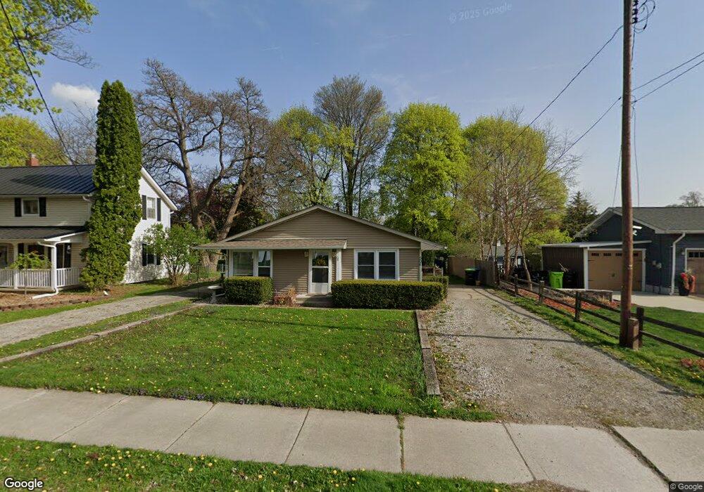
506 W High St Fenton, MI 48430
Estimated Value: $223,077 - $260,000
4
Beds
2
Baths
1,140
Sq Ft
$217/Sq Ft
Est. Value
About This Home
This home is located at 506 W High St, Fenton, MI 48430 and is currently estimated at $247,519, approximately $217 per square foot. 506 W High St is a home located in Genesee County with nearby schools including Fenton Senior High School and St. John the Evangelist Catholic School.
Ownership History
Date
Name
Owned For
Owner Type
Purchase Details
Closed on
Oct 17, 2017
Sold by
Borvis Holdings Llc
Bought by
506 High Llc
Current Estimated Value
Purchase Details
Closed on
Apr 12, 2011
Sold by
Damoth John W and Damoth Kathleen M
Bought by
Borvis Holdings Llc
Purchase Details
Closed on
Dec 10, 1999
Sold by
Hering Mark W and Hering Elizabeth
Bought by
Damoth John W
Create a Home Valuation Report for This Property
The Home Valuation Report is an in-depth analysis detailing your home's value as well as a comparison with similar homes in the area
Home Values in the Area
Average Home Value in this Area
Purchase History
| Date | Buyer | Sale Price | Title Company |
|---|---|---|---|
| 506 High Llc | -- | None Available | |
| Borvis Holdings Llc | -- | None Available | |
| Damoth John W | -- | None Available | |
| Damoth John W | $90,000 | Lawyers Title Insurance Corp |
Source: Public Records
Mortgage History
| Date | Status | Borrower | Loan Amount |
|---|---|---|---|
| Closed | 506 High Llc | $0 |
Source: Public Records
Tax History Compared to Growth
Tax History
| Year | Tax Paid | Tax Assessment Tax Assessment Total Assessment is a certain percentage of the fair market value that is determined by local assessors to be the total taxable value of land and additions on the property. | Land | Improvement |
|---|---|---|---|---|
| 2025 | $3,459 | $95,800 | $0 | $0 |
| 2024 | $2,681 | $95,800 | $0 | $0 |
| 2023 | $2,556 | $85,300 | $0 | $0 |
| 2022 | $3,153 | $69,200 | $0 | $0 |
| 2021 | $2,892 | $55,200 | $0 | $0 |
| 2020 | $2,187 | $53,300 | $0 | $0 |
| 2019 | $2,159 | $49,300 | $0 | $0 |
| 2018 | $2,749 | $45,200 | $0 | $0 |
| 2017 | $1,877 | $42,900 | $0 | $0 |
| 2016 | $1,863 | $38,800 | $0 | $0 |
| 2015 | $1,889 | $34,600 | $0 | $0 |
| 2012 | -- | $30,600 | $30,600 | $0 |
Source: Public Records
Map
Nearby Homes
- 1012 State Rd
- 700 S Adelaide St
- 11577 Farmhill Dr
- 300 Union St
- 843 Whisperwood Trail Unit 31
- 11548 Farmhill Dr
- 305 Furlong Ct
- 211 Colfax St
- 1039 S East St
- 0 W Caroline St
- 407 E Elizabeth St
- 304 S Lemen St
- 11332 Denton Hill Rd
- 624 Hickory St
- 404 Main St
- 201 1st St
- 411 Jefferson St
- 872 W Silver Lake Rd
- 501 N Leroy St
- 507 Main St