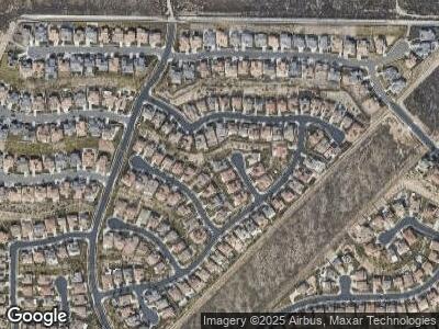
5060 Kent Ct Rancho Cucamonga, CA 91739
Etiwanda NeighborhoodEstimated Value: $1,469,000 - $1,549,000
6
Beds
5
Baths
4,220
Sq Ft
$357/Sq Ft
Est. Value
About This Home
This home is located at 5060 Kent Ct, Rancho Cucamonga, CA 91739 and is currently estimated at $1,508,531, approximately $357 per square foot. 5060 Kent Ct is a home located in San Bernardino County with nearby schools including John L. Golden Elementary, Day Creek Intermediate, and Los Osos High.
Ownership History
Date
Name
Owned For
Owner Type
Purchase Details
Closed on
Sep 23, 2008
Sold by
Rancho Estates At Etiwanda/Af 37 Llc
Bought by
Brown Damian M and Brown Kerri Ann
Current Estimated Value
Home Financials for this Owner
Home Financials are based on the most recent Mortgage that was taken out on this home.
Original Mortgage
$474,544
Interest Rate
6.31%
Mortgage Type
Purchase Money Mortgage
Create a Home Valuation Report for This Property
The Home Valuation Report is an in-depth analysis detailing your home's value as well as a comparison with similar homes in the area
Home Values in the Area
Average Home Value in this Area
Purchase History
| Date | Buyer | Sale Price | Title Company |
|---|---|---|---|
| Brown Damian M | $625,000 | Fidelity National Title |
Source: Public Records
Mortgage History
| Date | Status | Borrower | Loan Amount |
|---|---|---|---|
| Open | Brown Damian M | $612,000 | |
| Closed | Brown Damian M | $610,000 | |
| Closed | Brown Damian M | $145,000 | |
| Closed | Brown Damian M | $493,000 | |
| Closed | Brown Damian M | $470,000 | |
| Closed | Brown Damian M | $474,544 |
Source: Public Records
Tax History Compared to Growth
Tax History
| Year | Tax Paid | Tax Assessment Tax Assessment Total Assessment is a certain percentage of the fair market value that is determined by local assessors to be the total taxable value of land and additions on the property. | Land | Improvement |
|---|---|---|---|---|
| 2024 | $13,593 | $823,844 | $197,123 | $626,721 |
| 2023 | $13,375 | $807,690 | $193,258 | $614,432 |
| 2022 | $13,274 | $791,853 | $189,469 | $602,384 |
| 2021 | $13,127 | $776,327 | $185,754 | $590,573 |
| 2020 | $13,642 | $768,366 | $183,849 | $584,517 |
| 2019 | $13,408 | $753,300 | $180,244 | $573,056 |
| 2018 | $13,971 | $738,530 | $176,710 | $561,820 |
| 2017 | $13,595 | $724,049 | $173,245 | $550,804 |
| 2016 | $13,374 | $709,852 | $169,848 | $540,004 |
| 2015 | $13,322 | $699,190 | $167,297 | $531,893 |
| 2014 | $12,736 | $656,082 | $164,020 | $492,062 |
Source: Public Records
Map
Nearby Homes
- 12180 Casper Ct
- 5237 Flora Ct
- 12680 Encino Ct
- 12716 Freemont Ct
- 12750 Baltic Ct
- 4991 Union Ct
- 12798 N Rim Way
- 12861 Mediterranean Dr
- 5563 Las Brisas Dr
- 5548 Pacific Crest Place
- 12430 Altura Dr
- 5660 Stoneview Rd
- 12800 N Overlook Dr
- 5743 Kendall Ct
- 12430 Split Rein Dr
- 12719 E Rancho Estates Place
- 12590 Arena Dr
- 0 Decliff Dr
- 12414 Dapple Dr
- 12271 Oldenberg Ct
