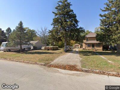
507 1st St NE Dayton, IA 50530
Estimated Value: $97,934 - $125,000
3
Beds
2
Baths
1,312
Sq Ft
$85/Sq Ft
Est. Value
About This Home
This home is located at 507 1st St NE, Dayton, IA 50530 and is currently estimated at $111,484, approximately $84 per square foot. 507 1st St NE is a home located in Webster County with nearby schools including Dayton Center and Southeast Webster-Grand Southeast Valley Middle School.
Ownership History
Date
Name
Owned For
Owner Type
Purchase Details
Closed on
Jun 9, 2018
Sold by
Regnold Juan W and Regnold Lucy D
Bought by
Dorothy Tina
Current Estimated Value
Home Financials for this Owner
Home Financials are based on the most recent Mortgage that was taken out on this home.
Original Mortgage
$13,600
Interest Rate
4.5%
Mortgage Type
New Conventional
Purchase Details
Closed on
May 24, 2018
Sold by
Regnold Erin M
Bought by
Dorothy Tina
Home Financials for this Owner
Home Financials are based on the most recent Mortgage that was taken out on this home.
Original Mortgage
$13,600
Interest Rate
4.5%
Mortgage Type
New Conventional
Create a Home Valuation Report for This Property
The Home Valuation Report is an in-depth analysis detailing your home's value as well as a comparison with similar homes in the area
Home Values in the Area
Average Home Value in this Area
Purchase History
| Date | Buyer | Sale Price | Title Company |
|---|---|---|---|
| Dorothy Tina | -- | -- | |
| Dorothy Tina | $17,000 | -- |
Source: Public Records
Mortgage History
| Date | Status | Borrower | Loan Amount |
|---|---|---|---|
| Closed | Dorothy Tina | $13,600 |
Source: Public Records
Tax History Compared to Growth
Tax History
| Year | Tax Paid | Tax Assessment Tax Assessment Total Assessment is a certain percentage of the fair market value that is determined by local assessors to be the total taxable value of land and additions on the property. | Land | Improvement |
|---|---|---|---|---|
| 2024 | $7 | $50,560 | $10,770 | $39,790 |
| 2023 | $518 | $50,560 | $10,770 | $39,790 |
| 2022 | $534 | $37,710 | $10,770 | $26,940 |
| 2021 | $728 | $37,710 | $10,770 | $26,940 |
| 2020 | $728 | $43,950 | $10,770 | $33,180 |
| 2019 | $656 | $37,510 | $9,480 | $28,030 |
| 2018 | $854 | $37,740 | $8,620 | $29,120 |
| 2017 | $912 | $38,910 | $0 | $0 |
| 2016 | $868 | $38,910 | $0 | $0 |
| 2015 | $868 | $38,910 | $0 | $0 |
| 2014 | $908 | $38,910 | $0 | $0 |
Source: Public Records
Map
Nearby Homes
- 24 4th Ave NE
- 102 5th Ave NW
- 502 3rd St NE
- 104 N Main St
- 1914251008 Parcel Nos 1914251008 and 1914251003
- 301 2nd Ave NE
- 308 3rd Ave SW
- 2929 Highway 175
- 3957 Quail Ave
- TBD Quail Ave
- 2205 350th St
- 2586 310th St
- 117 E 4th
- 3111 Taylor Ave
- 475 Bluff St
- 0 Racine Ave
- 000 Racine Ave
- 3331 380th St
- 3912 Lainson Ave
- 359 E Main St